Category:Old maps of cities in India
Jump to navigation
Jump to search
Subcategories
This category has the following 16 subcategories, out of 16 total.
A
- Old maps of Agra (6 F)
B
- Old maps of Bangalore (24 F)
C
- Old maps of Chennai (58 F)
D
- Old maps of Darjeeling (7 F)
H
- Old maps of Hyderabad, India (11 F)
K
- Old maps of Kolkata (42 F)
- Old maps of Kollam (24 F)
L
- Old maps of Lucknow (30 F)
M
- Old maps of Mumbai (98 F)
- Old maps of Mysore (12 F)
O
- Old maps of Tharangambadi (13 F)
- Old maps of Varanasi (9 F)
T
Media in category "Old maps of cities in India"
The following 15 files are in this category, out of 15 total.
-
1911 Map of Agra Uttar Pradesh India.jpg 1,308 × 1,754; 341 KB
-
1911 Map of Benares Varanasi Uttar Pradesh India.jpg 1,246 × 1,304; 207 KB
-
1911 Map of Nainital Uttarakhand India.jpg 1,718 × 1,326; 265 KB
-
Cranganor, Plan de la forteresse de Cranganor. 1709.jpg 4,363 × 2,981; 4.76 MB
-
Diu 2a.jpg 800 × 600; 150 KB
-
Dutch Tuticorin.jpg 535 × 430; 74 KB
-
Kalibangan-de.svg 518 × 583; 7 KB
-
Kalibangan-en.svg 518 × 583; 7 KB
-
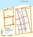
Kalibangan-fr.svg 518 × 583; 13 KB
-
Kalibangan.jpg 1,726 × 1,943; 159 KB
-
Map of Diu.jpg 906 × 740; 155 KB
-
Thanjavurtown1955.png 1,064 × 1,209; 1.65 MB
-
Tiruchirapalli1955 hicontrast.png 1,096 × 1,101; 410 KB
-
View of Mahe.jpg 720 × 868; 82 KB


