Category:Old maps of Yunlin
Jump to navigation
Jump to search
中文(臺灣):雲林縣的古地圖
Media in category "Old maps of Yunlin"
The following 11 files are in this category, out of 11 total.
-
 1684 台灣地理圖.jpg 1,466 × 1,161; 1.18 MB
-
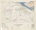
 Hokko 1 6000 1945.jpg 4,357 × 4,372; 4.05 MB
-
 Location map of schools in Tainan 1927.jpg 840 × 1,200; 209 KB
-
 Map of Kanan Irrigation System.jpg 3,332 × 2,768; 2.06 MB
-
 Map of Kobi-gun.jpg 2,208 × 1,604; 1.37 MB
-
 Seira 1 8000 1945.jpg 4,758 × 3,969; 4.67 MB
-
 Tainanshu Kannaizu.jpg 2,260 × 2,794; 676 KB
-
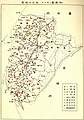
 斗六廳管內圖.jpg 4,175 × 2,109; 2.4 MB
-
 虎尾街市街地略圖.jpg 2,523 × 3,765; 5.34 MB
-
 虎尾街管內略圖.jpg 4,900 × 4,134; 11.66 MB
-
 虎尾郡地圖 1937.jpg 4,824 × 3,004; 5.41 MB


