Category:Old maps of Yugoslavia
Jump to navigation
Jump to search
Media in category "Old maps of Yugoslavia"
The following 18 files are in this category, out of 18 total.
-

-
 Review of reviews and world's work (1890) (14770311371).jpg 2,738 × 2,188; 916 KB
-
 1916 Diagrammatic Map of Slav Territories East of the Adriatic.jpg 5,000 × 4,671; 4.36 MB
-
 1940 German military map - Übersichtskarte Bulgarien-Griechenland.jpg 24,892 × 32,442; 132.82 MB
-
 1940 German military map - Übersichtskarte Rumänien-Bulgarien.jpg 24,996 × 31,562; 153.66 MB
-
 1942 German military map - Internationale Weltkarte - Sofia.jpg 7,784 × 7,496; 7.72 MB
-
 Admiralty Chart No 1561 Ports Anchorages and Channels in Yugoslavia, Published 1955.jpg 16,230 × 11,062; 41.17 MB
-
 Admiralty Chart No 3675 Ports and Anchorages in Yugoslavia, Published 1953.jpg 8,244 × 11,037; 22.9 MB
-
 Admiralty Chart No 3906 Krilo and Igrane to Otok Lastovo, Published 1963.jpg 11,056 × 16,228; 40.13 MB
-

-
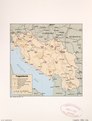
 Greece Physical Map 1880.jpg 5,652 × 4,798; 2.6 MB
-
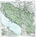 Jugo-slavia, 1919.png 3,286 × 3,424; 3.02 MB
-
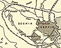 Serbian aspirations 1912.jpg 400 × 312; 59 KB
-

-
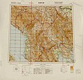
 Yugoslavia. LOC 2011587053.jpg 3,323 × 4,342; 1.61 MB
-
 Yugoslavia. LOC 2011587053.tif 3,323 × 4,342; 41.28 MB
-
 Yugoslavia. LOC 2011587054.jpg 3,322 × 4,317; 1.92 MB
-
 Yugoslavia. LOC 2011587054.tif 3,322 × 4,317; 41.03 MB
%27_(11175234535).jpg)
_(14770311371).jpg)


.jpg)


_(14781787722).jpg)

