Category:Old maps of West Bengal (U. S. Army Map Service)
Jump to navigation
Jump to search
Media in category "Old maps of West Bengal (U. S. Army Map Service)"
The following 12 files are in this category, out of 12 total.
-
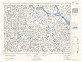
 Map India and Pakistan 1-250,000 Tile NF 45-11, Contai.jpg 5,000 × 3,770; 1.32 MB
-
 Map India and Pakistan 1-250,000 Tile NF 45-2 Purulia.jpg 5,000 × 3,786; 4.3 MB
-
 Map India and Pakistan 1-250,000 Tile NF 45-3 Burdwan.jpg 5,000 × 3,779; 3.87 MB
-
 Map India and Pakistan 1-250,000 Tile NF 45-4 Faridpur.jpg 5,000 × 3,791; 4.11 MB
-
-
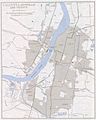
 Map India and Pakistan 1-250,000 Tile NF 45-7 Calcutta-Howrah and Vicinity (verso).jpg 5,000 × 3,763; 1.37 MB
-
 Map India and Pakistan 1-250,000 Tile NF 45-7 Calcutta.jpg 5,000 × 3,923; 4.58 MB
-
 Map India and Pakistan 1-250,000 Tile NF 45-8 Khula.jpg 5,000 × 3,779; 4.39 MB
-
 Map India and Pakistan 1-250,000 Tile NG 45-11 Katihar.jpg 5,000 × 3,874; 3.99 MB
-
 Map India and Pakistan 1-250,000 Tile NG 45-12 Dinajpur.jpg 5,000 × 3,810; 5 MB
-
 Map India and Pakistan 1-250,000 Tile NG 45-4 Phari Dzong.jpg 5,000 × 3,815; 6.06 MB
-


_(cropped).jpg)
.jpg)


.jpg)