Category:Old maps of Valparaíso
Jump to navigation
Jump to search
Subcategories
This category has only the following subcategory.
Media in category "Old maps of Valparaíso"
The following 41 files are in this category, out of 41 total.
-
 Valparaiso en 1646, vista general.jpg 1,751 × 2,867; 2.41 MB
-
 1646 Histórica Relación del Reyno de Chile Valparaiso Alonso de Ovalle.jpg 3,030 × 3,885; 1.44 MB
-

-
 Valparaiso en 1712, Plano de las fortificationes.jpg 2,723 × 1,881; 3.07 MB
-
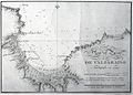
 1763 - Plan du Port de Valparaiso.jpg 1,600 × 1,232; 364 KB
-
 1790 - Plano del Puerto de Valparaiso Trabajado en 1790.jpg 1,494 × 1,066; 369 KB
-
 1826 - Harbor and Town of Valparaíso, with the Town of the Almendral.jpg 1,442 × 895; 160 KB
-
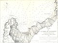
 1838 - Plano de la Bahía de Valparaíso.jpg 1,341 × 1,002; 176 KB
-
 1850 60 - Plano de la Ciudad y Puerto de Valparaíso.jpg 1,457 × 1,070; 317 KB
-
 1853 - Plan der Stadt und des Hafens von Valparaiso..jpg 1,388 × 1,024; 215 KB
-

-
 1868 69 - Plano Jeneral de los Nuevos Almacenes Fiscales de Valparaiso.jpg 1,493 × 472; 113 KB
-
 1871 - Plano de la Ciudad de Valparaíso.jpg 1,291 × 860; 224 KB
-
 1879 - Plano de Valparaiso.jpg 1,563 × 1,266; 429 KB
-
 1880 - Agua Potable de Valparaíso.jpg 1,497 × 492; 133 KB
-

-
 Valparaiso-MC0007482.pdf 3,281 × 2,597; 3.6 MB
-
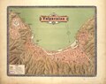
 1895 - Plano de Valparaíso.jpg 1,772 × 1,405; 869 KB
-
 1905 - Plano de Valparaiso con el Proyecto Kraus..jpg 1,491 × 777; 196 KB
-
 1909 - Barrio del Almendral.jpg 1,539 × 1,071; 268 KB
-
 Valparaiso, Pergamon World Atlas 1967.jpg 480 × 317; 35 KB
-

-

-
 Bombardeo 02.jpg 2,771 × 3,323; 7.96 MB
-

-
 Joris van Spilbergen in the bay of Valparaiso 1615.png 728 × 518; 307 KB
-
 Meyers b16 s0043 b1.png 368 × 238; 62 KB
-
 NSRW Valparaiso.png 690 × 448; 238 KB
-
 Plan de la ville et port de Valparaiso - btv1b53122140t.jpg 5,320 × 4,162; 2.33 MB
-

-

-

-
 Plano de Valparaíso-Terremoto 1906.jpg 3,608 × 2,388; 2.33 MB
-
 Plano del Puerto de Valparaiso del Reino de Chile (1744) - AHG.jpg 8,265 × 5,565; 5.21 MB
-
 Plano Genral de los Nuevos Almacenes Fiscales.jpg 2,506 × 1,827; 3.92 MB
-
 Planovalpo1838.jpg 1,425 × 1,060; 397 KB
-
 Proyecto de Ampliación del Puerto en el Almendral.jpg 847 × 655; 128 KB
-
 Proyecto de Puerto de 1906.jpg 881 × 652; 104 KB
-
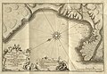 Relacion historica del viage a la America meridional (37770760345).jpg 4,203 × 2,910; 2.37 MB
-
 Situationsplan von Valparaíso.jpg 349 × 222; 25 KB
-
 Valparaiso - P.L. Feuillée Mathem. et bot. Reg. del. - btv1b8596604c.jpg 5,380 × 3,363; 3.05 MB


.jpg)


.jpg)
.jpg)


.jpg)
.jpg)


_-_AHG.jpg)


.jpg)

