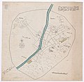
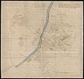
Category:Old maps of Turku
Jump to navigation
Jump to search
Use the appropriate category for maps showing all or a large part of Turku. See subcategories for smaller areas:
| If the map shows | Category to use |
|---|---|
| Turku on a recently created map | Category:Maps of Turku or its subcategories |
| Turku on a map created more than 70 years ago | Category:Old maps of Turku or its subcategories |
| the history of Turku on a recently created map | Category:Maps of the history of Turku or its subcategories |
| the history of Turku on a map created more than 70 years ago | Category:Old maps of the history of Turku or its subcategories |
Subcategories
This category has the following 3 subcategories, out of 3 total.
Media in category "Old maps of Turku"
The following 14 files are in this category, out of 14 total.
-
Plan af Åbo Stad (1837).jpg 3,700 × 2,800; 2.04 MB
-
Situationsplan af Åbo ca 1920 (Nordisk familjebok sid 913-914).png 1,203 × 790; 122 KB
-
210 of 'Описаніе Финляндской войны ... въ 1808 и 1809 годахъ' (11018548265).jpg 1,519 × 2,513; 633 KB
-
Charta öfver Åbo stad och slott med slotts fältet 1.jpg 6,027 × 4,670; 4.82 MB
-
Gangius - Turku 1634 1.jpg 7,782 × 7,683; 7.12 MB
-
Gangius - Turku 1634 2.jpg 7,507 × 7,098; 5.88 MB
-
Plan af Åbo stad utgifven 1837 af C. W. Gyldén.jpg 3,436 × 2,614; 1.74 MB
-
Senaatin kartasto Turku IX 16 out RealESRGAN x2plus.jpg 28,860 × 29,132; 190.22 MB
-
Senaatin kartasto Turku IX 16 out RealESRGAN x4plus anime.jpg 28,860 × 29,132; 144.05 MB
-
Senaatin kartasto Turku IX 16 out RealESRGAN x4plus.jpg 28,860 × 29,132; 184.24 MB
-
Senate Atlas, 1870–1907. Sheet IX 16 Turku.jpg 7,215 × 7,283; 7.95 MB
-
Senate Atlas, 1870–1907. Sheet VIII 16 Kakskerta.jpg 7,128 × 7,169; 7.31 MB
-
Turku map 1634.jpg 1,470 × 1,798; 177 KB


