Category:Old maps of Troy, New York
Jump to navigation
Jump to search
Subcategories
This category has only the following subcategory.
Media in category "Old maps of Troy, New York"
The following 19 files are in this category, out of 19 total.
-
Clement's Art and Frame Shop (35629235315).jpg 4,074 × 2,988; 2.4 MB
-
Damage by the Great Fire of Troy.jpg 294 × 300; 31 KB
-
Fire 1820 Unrestored.png 2,634 × 3,418; 36.01 MB
-
Fire 1820.png 2,066 × 2,645; 15.9 MB
-
Fire 1854 Restored.png 831 × 1,877; 4.84 MB
-
Fire 1854.png 1,018 × 2,015; 8.53 MB
-
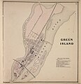
Green Island 1866.jpg 2,478 × 2,560; 758 KB
-
Index Map City of Troy, N.Y. NYPL1584731.tiff 5,428 × 6,818; 105.88 MB
-
Old map of Rensselaer County, NY 4.jpeg 10,076 × 6,370; 10.29 MB
-
Old map of Rensselaer County, NY 6.jpeg 9,917 × 6,252; 10.3 MB
-
Road map of the Albany-Troy district (10139232154).jpg 800 × 752; 200 KB
-
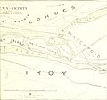
The city of Troy and its vicinity in 1886, cityoftroyitsvic00weis 0 0012.jpg 1,149 × 1,621; 427 KB
-
Troy NY map - 1877 - Bailey and Hazen.png 9,944 × 5,816; 83.85 MB
-
Troy, N.Y. (2675049007).jpg 2,000 × 1,170; 2.01 MB
-
Troy, N.Y. 1881. LOC 75694855.jpg 11,798 × 8,770; 17.41 MB
-
Troy, N.Y. 1881. LOC 75694855.tif 11,798 × 8,770; 296.03 MB
-
Troyandarea1881 (cropped for Union Station and Green Island Bridge).jpg 966 × 676; 206 KB
-
Troyandarea1881.jpg 2,950 × 2,193; 1.43 MB


