Category:Old maps of Seattle
Jump to navigation
Jump to search
Subcategories
This category has the following 6 subcategories, out of 6 total.
M
Media in category "Old maps of Seattle"
The following 136 files are in this category, out of 136 total.
-
"Negro Population Seattle 1960" map (53167019351).jpg 2,367 × 3,361; 1.81 MB
-
Sea Gull's View of Seattle map, 1927 (MOHAI 13255).jpg 839 × 1,200; 306 KB
-
Denny Regrade District, Seattle, 1928 (MOHAI 13446).jpg 843 × 1,200; 249 KB
-
1960 map of what became Seattle Center.jpg 2,556 × 3,228; 3.29 MB
-
Active-survey-of-Seattle-1854.jpg 8,192 × 5,222; 5.87 MB
-
Admiralty Chart No 1427 Harbours in Puget Sound - Seattle Harbour - Tacoma Harbour, Published 1890.jpg 16,180 × 11,668; 43.77 MB
-
Anderson Map Co's Official Map of Greater Seattle, 1909 (MOHAI 13247).jpg 980 × 1,200; 202 KB
-
Anderson's 1890 map - 'North Seattle' to Smith Cove.jpg 1,019 × 1,275; 372 KB
-
Anderson's 1890 map - mudflats south of King Street.jpg 820 × 1,475; 348 KB
-
Anderson's 1890 map - West Seattle shore of Elliott Bay.jpg 1,407 × 1,839; 554 KB
-
Anderson's 1896 Street and Guide Map of the City of Seattle (MOHAI 13261).jpg 822 × 1,200; 150 KB
-
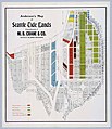
Anderson's Map of Seattle Tide Lands, circa 1907 (MOHAI 13438).jpg 1,035 × 1,200; 218 KB
-
Anderson's New Guide Map of the City of Seattle & Environs, July 1890 (MOHAI 13402).jpg 1,025 × 1,200; 190 KB
-
Anderson's new guide map of the city of Seattle and environs, Washington. LOC 98687165.jpg 8,819 × 10,125; 15.72 MB
-
Anderson's new guide map of the city of Seattle and environs, Washington. LOC 98687165.tif 8,819 × 10,125; 255.47 MB
-
Andersons New Guide Map of the City of Seattle and Environs, 1890.jpg 8,413 × 10,050; 4.7 MB
-
Ballard's Addition to Gilman Park, Seattle, March 11, 1890 (MOHAI 14540).jpg 807 × 1,000; 138 KB
-
Battle of Seattle map, January 1, 1856 - DPLA - ff9b8afdece6380426ca0e3d238eb7d0.jpg 4,989 × 6,334; 1.94 MB
-
Battle of Seattle, January 28, 1856 - DPLA - c9eb2629ae67034ed6e622aa45ecd01f.jpg 2,481 × 3,096; 929 KB
-
Bell's 5th Addition to the City of Seattle, March 30, 1882 (MOHAI 13331).jpg 1,200 × 480; 58 KB
-
Bird's Eye Map of Seattle 1889 (5276164889).jpg 7,294 × 4,594; 13.6 MB
-
Bird's Eye View, City of Seattle and vicinity, 1904 (MAPS 63).jpg 8,397 × 5,292; 15.4 MB
-
Bird's-eye view of Seattle, 1908 (MOHAI 1390).jpg 640 × 454; 72 KB
-
Bird's-eye View of Seattle, Washington Territory.jpg 873 × 639; 156 KB
-
Birds Eye View of Seattle, 1889 (MOHAI 13218).jpg 1,000 × 642; 134 KB
-
Birds-eye-view of Seattle and environs King County, Wash., 1891. LOC 75696663.jpg 15,389 × 10,416; 42.8 MB
-
Birdseye view of Seattle 1908.jpg 2,817 × 1,788; 1.74 MB
-
Central Seattle. 1914.jpg 476 × 381; 106 KB
-
Christmas Ship map, 1950 (50747940467).jpg 2,550 × 3,300; 1.14 MB
-
City of Seattle map, 1874 (MOHAI 12708).jpg 834 × 1,000; 141 KB
-
Contour map of Seattle, 1938 (54036050014).jpg 746 × 1,013; 222 KB
-
Daily pedestrian traffic map, Seattle, April 1921 (MOHAI 12716).jpg 1,000 × 759; 122 KB
-
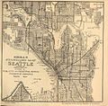
FMIB 41445 Kroll's standard map of Seattle.jpeg 1,481 × 1,455; 861 KB
-
Foot traffic in Seattle, Washington, Wednesday, April 26th, 1922. LOC 98687155.jpg 6,518 × 3,517; 3.5 MB
-
GLO map of Interbay and Magnolia claims - 1863.jpg 795 × 522; 67 KB
-
Guide map to Seattle bicycle paths, probably 1900 (SEATTLE 5895).jpg 768 × 613; 86 KB
-
James Street cable line, Seattle, 1904 (MOHAI 13395).jpg 1,200 × 506; 53 KB
-
Kroll's Seattle 1920 plate 31W - A - raw.jpg 2,592 × 1,944; 746 KB
-
Kroll's Seattle 1920 plate 35W - A - raw.jpg 2,592 × 1,944; 864 KB
-
Latona Addition to the City of Seattle, October 28, 1889 (MOHAI 14548).jpg 779 × 1,000; 156 KB
-
Main business district periscopic Seattle. LOC 75696665.jpg 6,904 × 6,088; 7.64 MB
-
Main business district periscopic Seattle. LOC 75696665.tif 6,904 × 6,088; 120.25 MB
-
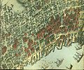
Map detail showing piers and wharves on the pre-Fire Seattle Waterfront (c. 1889).jpg 1,137 × 1,146; 328 KB
-
Map of Camp Long, Seattle, 1969 (53155402850).jpg 3,105 × 2,345; 925 KB
-
Map of housing conditions, Seattle, 1960 (49465003892).jpg 1,287 × 1,971; 228 KB
-
Map of Seattle 1914.jpg 1,938 × 2,628; 2.14 MB
-
Map of Seattle Harbor, 1913.jpg 8,352 × 5,156; 3.13 MB
-
Map of Seattle Harbor, circa 1971 (52409434495).jpg 1,624 × 3,788; 1.16 MB
-
Map of Seattle in 1856.JPG 260 × 378; 45 KB
-
Map of Seattle, 1934 (51127890592).jpg 6,423 × 9,923; 42.23 MB
-
Map of Seattle, ca 1912 (MOHAI 1845).jpg 640 × 415; 74 KB
-
McKee's Correct Road Map of Seattle and Vicinity, 1894 (MOHAI 13401).jpg 870 × 1,200; 153 KB
-
North Canal section drawings, Seattle, circa 1911 (MOHAI 14556).jpg 1,000 × 422; 41 KB
-
Pedestrian fatality map, 1944 (27629295984).jpg 2,550 × 3,300; 2.53 MB
-
Pettit's Historical Map of Seattle, 1913 (MOHAI 14551).jpg 1,000 × 628; 79 KB
-
Plan for Denny Park, Seattle, 1884 (46984533815).jpg 2,459 × 3,019; 1.41 MB
-
Plan of city during Battle of Seattle, 1856 (MOHAI 1791).jpg 640 × 978; 101 KB
-
Plan of Seattle 1855-6.jpg 600 × 802; 125 KB
-
Plan of Seattle, 1855-6 (SEATTLE 328).jpg 600 × 931; 137 KB
-
Plat of the Second Addition, City of Seattle, December 1876 (MOHAI 14545).jpg 1,000 × 624; 142 KB
-
Political map of Seattle, 1910 (53362717124).jpg 5,104 × 5,024; 10.39 MB
-
Port of Seattle General Map Seattle Harbor, May 1915 (MOHAI 13249).jpg 1,200 × 691; 133 KB
-
Port of Seattle map circa 1919 - enhanced.jpg 2,250 × 1,034; 854 KB
-
Port of Seattle map circa 1919.jpg 2,250 × 1,034; 841 KB
-
Port of Seattle map, 1918.jpg 10,000 × 6,728; 3.88 MB
-
Seattle - Denny Park topographical map, circa 1893 (49070435227).jpg 700 × 1,148; 101 KB
-
Seattle - Fremont Cut and Salmon Bay map, 1918.jpg 1,371 × 862; 296 KB
-
Seattle - map - Armory Way northwest of Lenora Street 1920.jpg 1,947 × 1,487; 959 KB
-
Seattle - map - Pike Place Market and vicinity 1920.jpg 1,754 × 2,607; 1.44 MB
-
Seattle - Map of major roads, 1929 (51747999747).jpg 5,750 × 3,965; 8.16 MB
-
Seattle - Map of The Uplands, circa 1925 (49584839983).jpg 1,608 × 1,408; 449 KB
-
Seattle - Morningside Heights locator map, 1923.jpg 751 × 1,109; 216 KB
-
Seattle - North Lake Union 1911 map.jpg 540 × 495; 283 KB
-
Seattle - Proposed street directional designation changes, 1960 (50195875081).jpg 1,405 × 3,750; 691 KB
-
Seattle - West Spokane Street interchanges, 1961.jpg 956 × 601; 727 KB
-
Seattle - Yesler-Atlantic T, 1967 (50196137647).jpg 1,689 × 1,362; 450 KB
-
Seattle 1902 engineering proposals.jpg 406 × 677; 69 KB
-
Seattle 1909 harbor improvements proposal on topo.jpg 984 × 1,548; 344 KB
-
Seattle birdseye view of portion of city and vicinity. LOC 75696666.jpg 16,998 × 9,854; 23.2 MB
-
Seattle Central Waterfront 1903.jpg 5,129 × 1,528; 1.35 MB
-
Seattle City Light line service dispatcher, 1960 (52243650606).jpg 1,775 × 2,231; 1.2 MB
-
Seattle harbor at time of 1908 fleet visit.jpg 1,617 × 2,349; 825 KB
-
Seattle Map 1914 (5855306176).jpg 5,837 × 7,555; 10.73 MB
-
Seattle map showing water supply pipes, 1899.jpg 8,500 × 5,592; 3.31 MB
-
Seattle map, 1878 (SEATTLE 445).jpg 768 × 477; 66 KB
-
Seattle map, 1884 (SEATTLE 1600).jpg 761 × 512; 51 KB
-
Seattle map, 1889 (SEATTLE 150).jpg 768 × 554; 139 KB
-
Seattle map, 1891 (SEATTLE 803).jpg 768 × 527; 112 KB
-
Seattle map, 1904 (SEATTLE 1191).jpg 768 × 498; 125 KB
-
Seattle sewer districts, 1894.jpg 7,783 × 8,311; 3.25 MB
-
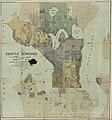
Seattle Sewerage Skeleton Map, July 1891 (MOHAI 13444).jpg 1,132 × 1,200; 219 KB
-
Seattle Tide Lands, Volume Two, index, 1894-1896 (MOHAI 13416).jpg 1,200 × 926; 201 KB
-
Seattle Tide Lands, Volume Two, page 28, March 15, 1895 (MOHAI 13415).jpg 1,200 × 802; 150 KB
-
Seattle topo map showing old route of Duwamish River.jpg 984 × 1,531; 308 KB
-
Seattle ward and precinct map, 1891.jpg 8,295 × 10,000; 4.01 MB
-
Seattle's coming retail and apartment-house district - 1917.jpg 667 × 350; 59 KB
-
Seattle, Maps and Charts, 1841 (SEATTLE 837).jpg 336 × 512; 22 KB
-
Seattle-1911-map-Industrial-District.jpg 815 × 751; 315 KB
-
Seattle-1911-map.jpg 1,896 × 2,511; 4.11 MB
-
Seward Park preliminary plan, 1912 (51615389979).jpg 2,925 × 1,975; 4.22 MB
-
The City of Seattle Harbor Department Map of Central Waterfront District, February 1918.png 6,000 × 3,649; 44.67 MB
-
Township No 24 North Range No 4 East, 1864 (MOHAI 14539).jpg 846 × 1,000; 101 KB
-
West Seattle shore from Duwamish head to the mill and grain elevator, 1918.png 1,139 × 982; 1.77 MB
-
Yesler Way at Railroad Avenue map, Seattle, 1896 (MOHAI 13411).jpg 1,200 × 323; 56 KB


