Category:Old maps of Roman Hispania
Jump to navigation
Jump to search
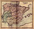
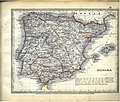
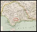
This category is for old maps showing all or a large part of Roman Hispania. See subcategories for smaller areas.
- "Old maps" means maps made over seventy (70) years ago.
| Where to categorize or find maps of Roman Hispania made in the last 70 years: |
|---|
| Category:Maps of Roman Hispania or its subcategories |
Subcategories
This category has the following 2 subcategories, out of 2 total.
P
- Ptolemy's 2nd European Map (56 F)
Media in category "Old maps of Roman Hispania"
The following 58 files are in this category, out of 58 total.
-
Hispaniae antiquae tabulae - authore N. Sanson - btv1b59637724.jpg 6,688 × 5,032; 4.54 MB
-
Map of ancient Spain, 1683.jpg 698 × 993; 251 KB
-
Pars orientalis antiquae Hispaniae - btv1b59637880.jpg 2,184 × 2,680; 771 KB
-
Hispaniae antiquae tabula - authore N. Sanson... - btv1b8446519v.jpg 9,732 × 7,716; 10.42 MB
-
L'Espagne pour l'histoire Romaine de Mr. Rollin - par le Sr d'Anville... - btv1b8490263r.jpg 4,810 × 3,910; 3.13 MB
-
Hispania Antiqua... - Autore N. Sanson... - btv1b5973198k.jpg 6,573 × 5,259; 4.42 MB
-
Ancient hispania 1849.jpg 925 × 768; 269 KB
-
Meyer‘s Zeitungsatlas 074 – Hispania.jpg 7,111 × 6,070; 19.18 MB
-
Hispania Karte.jpg 4,442 × 3,285; 6.84 MB
-
Map of Baetica, Lusitania and Tarraconensis.jpg 2,827 × 2,190; 1.42 MB
-
Roman province of Hispania.jpg 2,769 × 2,213; 1.5 MB
-
Conventus juridici in Hispania valeira.jpg 1,003 × 778; 211 KB
-
Part 2 of Roman Hispania 218-215 aC.jpg 1,024 × 1,024; 638 KB
-
Part of Roman Hispania 218-215 aC.jpg 695 × 716; 229 KB
-
Conventus juridici in Hispania.jpg 1,003 × 778; 808 KB
-
Hispania Baetica - Munda.jpg 991 × 865; 379 KB
-
Hispania Baetica.jpg 991 × 865; 377 KB
-
Hispania.jpg 2,888 × 2,313; 837 KB
-
Part 3 of Roman Hispania 218-215 aC.jpg 800 × 800; 486 KB
-
Part 4 of Roman Hispania 218-215 aC (Baetica).jpg 960 × 720; 611 KB
-
Part of Roman Hispania 218-215 aC - Dertosa.jpg 582 × 600; 174 KB
-
Typus Hispaniae veteris - btv1b53226974j (1 of 2).jpg 2,226 × 1,452; 441 KB
-
Heinrich Kiepert. Hispania, Mauretania et Africa.jpg 8,499 × 5,638; 8.15 MB
-
Nr. 28. Spanien.png 4,157 × 3,322; 39.54 MB
-
Nr. 29. Neun Karten zur Geschichte von Spanien.png 4,128 × 3,343; 39.51 MB
-
Karte aus dem Buch Römische Provinzen von Theodor Mommsen 1921 09.jpg 4,488 × 2,220; 12.1 MB
-
Karte aus dem Buch Römische Provinzen von Theodor Mommsen 1921 10.jpg 1,996 × 1,540; 3.93 MB
-
Antiquarum Hispaniae episcopatuum geographica descriptio - btv1b53194448d (2 of 3).jpg 5,883 × 4,402; 5.8 MB
-
Atlas of ancient and classical geography (1909) (14782365265).jpg 2,950 × 2,346; 1.93 MB
-
Aug Emerita.png 1,503 × 1,016; 887 KB
-
MapaRomano-Golfo de Cádis.jpg 466 × 593; 99 KB


