Category:Old maps of Peterborough
Jump to navigation
Jump to search
Media in category "Old maps of Peterborough"
The following 5 files are in this category, out of 5 total.
-

-
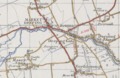 Historical map showing Deeping Gate.PNG 581 × 380; 455 KB
-
 Map of Cambridgeshire OS Map name 009-SE, Ordnance Survey, 1884-1892.jpg 5,398 × 3,590; 4.32 MB
-
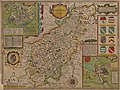
 Peterborough c. 1610 - Project Gutenberg.jpg 1,086 × 1,025; 213 KB
-
 Speed Northampton.jpg 6,240 × 4,680; 24.29 MB
.jpg)


