Category:Old maps of Newfoundland
Jump to navigation
Jump to search
Subcategories
This category has the following 2 subcategories, out of 2 total.
Media in category "Old maps of Newfoundland"
The following 167 files are in this category, out of 167 total.
-
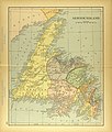
Purchas Map of New England.jpg 609 × 463; 182 KB
-
Atlante Veneto Volume 2 124.jpg 10,371 × 7,230; 7.74 MB
-
A chart of the South-East part of Newfoundland - btv1b5970486g (1 of 2).jpg 9,168 × 6,936; 7.78 MB
-
A Chart of the gulf of St Laurence - R. Sayer - btv1b53089612c (1 of 2).jpg 6,640 × 8,992; 7.5 MB
-
A chart of the banks of New Foundland - btv1b59704926 (1 of 2).jpg 8,912 × 6,656; 7.01 MB
-
ROSSER(1869) p0694 TREPASSEY BAY.jpg 2,899 × 1,693; 2.53 MB
-
1925 Air Routes of Newfoundland and Nova Scotia.jpg 591 × 857; 242 KB
-
232 of '(The Geological Observer.)' (11040667044).jpg 1,328 × 1,992; 343 KB
-
King George's Sound - btv1b530895338 (1 of 2).jpg 5,656 × 7,448; 4.13 MB
-
A chart od Iland of NEW FOUND LAND with paticular harbors atlarge NYPL1640629.tiff 7,230 × 5,428; 112.28 MB
-
A chart of part of the coast of Newfoundland (cape Spear-cape Bonavista) - btv1b59703686.jpg 8,064 × 10,248; 9.04 MB
-
A chart of the banks of Newfoundland (3045499021).jpg 2,000 × 1,307; 2.58 MB
-
A chart of the bay of Placentia - btv1b59705202.jpg 8,176 × 9,992; 8.37 MB
-
A chart of the island of Fogo - btv1b5970454h.jpg 9,824 × 7,344; 6.82 MB
-
A chart of the streights of Bell Isle (3046379564).jpg 2,000 × 1,640; 3.16 MB
-
A chart of the West coast of Newfoundland - btv1b59705009.jpg 545 × 173; 21 KB
-
A chart of the West coast of Newfoundland - btv1b5970501q.jpg 554 × 212; 21 KB
-
A chart of the west coast of Newfoundland - by James Cook - btv1b53052938p.jpg 21,613 × 6,462; 15.12 MB
-
A correct chart of the banks and harbours of New Foundland - btv1b5970378k.jpg 8,664 × 6,720; 6.85 MB
-
A general chart of the island of Newfoundland - btv1b5970332k.jpg 7,600 × 6,960; 6.7 MB
-
A general chart of the island of Newfoundland with the rocks & soundings (5960816713).jpg 2,000 × 1,469; 2.44 MB
-
A new map of the only useful and frequented part of New Found Land (4231158345).jpg 2,000 × 1,468; 3.02 MB
-
Admiralty Chart No 1209 Bonne Bay, Published 1897.jpg 16,271 × 11,201; 32.61 MB
-
Admiralty Chart No 1839 Trepassy Harbour, Published 1847.jpg 7,882 × 8,667; 8.24 MB
-
Admiralty Chart No 2141 Richards Harbour to Ramea Island, Published 1894.jpg 19,312 × 11,291; 38.29 MB
-
Admiralty Chart No 2143 Indian Harbour to Cape Ray, Published 1894.jpg 18,441 × 11,310; 29.22 MB
-
Admiralty Chart No 227 Deer and St Jones Harbours, Published 1867.jpg 7,993 × 6,125; 7.02 MB
-
Admiralty Chart No 232a Newfoudland Southern Portion, Published 1870.jpg 14,957 × 8,175; 16.78 MB
-
Admiralty Chart No 232a Newfoundland - Southern Portion, Published 1870.jpg 14,725 × 7,957; 16.58 MB
-
Admiralty Chart No 232b Newfoundland - Northern Portion, Published 1870.jpg 14,763 × 7,986; 14.88 MB
-
Admiralty Chart No 232b Newfoundland Northern Portion, Published 1870.jpg 14,904 × 8,481; 12.55 MB
-
Admiralty Chart No 2649 Bull Arm, Published 1859.jpg 6,104 × 8,348; 14.72 MB
-
Admiralty Chart No 2666 St Johns Newfoundland to Halifax with the Outer Banks, Published 1861.jpg 11,911 × 8,074; 12.46 MB
-
Admiralty Chart No 271 Cape Onion to Hare Bay, Published 1872.jpg 8,091 × 11,977; 13.45 MB
-
Admiralty Chart No 278 Croque Harbour Newfoundland, Published 1816.jpg 2,984 × 4,034; 2.5 MB
-
Admiralty Chart No 280 Fogo Island to Point Partridge, Published 1828.jpg 8,956 × 8,353; 9.22 MB
-
Admiralty Chart No 280 Notre Dame Bay, Published 1881.jpg 16,387 × 11,253; 30.86 MB
-
Admiralty Chart No 2828 Port aux Basques, Published 1952.jpg 8,211 × 11,255; 17.02 MB
-
Admiralty Chart No 2829 Placentia Harbour, Published 1861.jpg 8,150 × 5,890; 6.03 MB
-
Admiralty Chart No 283 Codroy Road to Cow Head Harbour, Published 1884.jpg 11,318 × 16,414; 23.05 MB
-
Admiralty Chart No 2915 Bay Bulls to Placentia, Published 1864.jpg 11,990 × 8,152; 9.6 MB
-
Admiralty Chart No 2917 Good Bay & St. John Harbour, Published 1865.jpg 7,926 × 6,047; 6.08 MB
-
Admiralty Chart No 293 Fogo Island to Cape Bonavista, Puublished 1873.jpg 9,697 × 14,974; 16.15 MB
-
Admiralty Chart No 295 Barrow Harbour, Broomclose, and Sailors Harbour, Published 1873.jpg 8,206 × 5,935; 5.46 MB
-
Admiralty Chart No 296 Cape Bonavista to Bay Bulls, Published 1868.jpg 8,230 × 12,016; 10.98 MB
-
Admiralty Chart No 297 Harbour Grace, Published 1825.jpg 10,636 × 7,750; 8.2 MB
-
Admiralty Chart No 298 St John's Harbour, Published 1864.jpg 10,892 × 16,140; 23.95 MB
-
Admiralty Chart No 302 Knife Bay to Cape Anguille, Published 1865.jpg 8,194 × 6,114; 6.82 MB
-
Admiralty Chart No 303 St Pierre Island & Miquelon Road, Published 1862.jpg 8,196 × 11,966; 9.15 MB
-
Admiralty Chart No 376 Broyle Harbour to Renewse Harbour, Published 1864.jpg 8,048 × 10,598; 8.4 MB
-
Admiralty Chart No 489 Catalina Harbour, Published 1863.jpg 7,828 × 5,763; 3.56 MB
-
Admiralty Chart No 520 Trinity Harbour, Published 1865.jpg 7,904 × 6,092; 6.16 MB
-
Admiralty Chart No 743 St George Harbour, Published 1866.jpg 8,018 × 10,896; 10.45 MB
-
Admiralty Chart No 893 Birin Harbour to Devil Bay, Published 1883.jpg 11,263 × 16,396; 28.3 MB
-
Allison Crowe - Newfoundland Vinyl (album back-cover).jpg 1,400 × 1,400; 1.58 MB
-
AnnotatedChartOfStJohns1798.jpg 3,360 × 2,289; 4.03 MB
-
British Provinces.jpg 3,119 × 1,690; 6.05 MB
-
Cattalina Harbor (9495451572).jpg 517 × 800; 74 KB
-
Cooks Karte von Neufundland.jpg 1,500 × 1,462; 521 KB
-
Dominion of Canada and Newfoundland (13997469874).jpg 2,500 × 1,632; 1.94 MB
-
FMIB 35557 -Hood and Harp Seal Distribution in Newfoundland-.jpeg 685 × 1,007; 157 KB
-
French Shore arrangement, 1885.png 904 × 727; 1.33 MB
-
Harbor Grace (9492652993).jpg 524 × 799; 74 KB
-
HARBOR GRACE part of New -Found-land; BAY BULLS part of Newfound-land NYPL1640626.tiff 7,230 × 5,428; 112.28 MB
-
James Cook NF Belle Isle.jpg 1,766 × 962; 312 KB
-
James Cook NF Placentia.jpg 1,000 × 876; 178 KB
-
James Cook NF South coast.jpg 1,279 × 1,304; 247 KB
-
James Cook NF St marys.jpg 816 × 1,000; 134 KB
-
James Cook NF Trepassey.jpg 1,597 × 1,049; 285 KB
-
James Cook NF West coast.jpg 1,368 × 1,199; 348 KB
-
James Cook York harbour labrador.jpg 1,534 × 1,062; 279 KB
-
James Yonge's map of Ferryland, ca. 1663..jpg 580 × 446; 65 KB
-
Le Tour du monde-07-p404.jpg 1,048 × 1,219; 477 KB
-
Map of Newfoundland, 1685.jpg 631 × 900; 462 KB
-
Map of Newfoundland.jpg 2,934 × 3,447; 2.26 MB
-
Maps of Bermuda, Iceland, Jan Mayen Island, and Newfoundland WDL2575.jpg 12,648 × 8,911; 13.28 MB
-
Maps of Bermuda, Iceland, Jan Mayen Island, and Newfoundland WDL2575.png 1,453 × 1,024; 2.62 MB
-
Newfoundland South Coast Placentia Harbour (IA McGillLibrary-rbsc map bayfield-020-18900).pdf 4,072 × 2,943; 11.37 MB
-
N5970379 JPEG 1 1DM.jpg 1,023 × 1,542; 293 KB
-
N6700079 JPEG 1 1DM.jpg 1,536 × 1,178; 573 KB
-
N6700100 JPEG 1 1DM.jpg 5,578 × 4,237; 3.8 MB
-
Nautical Chart Belle Isle Cook 1766 nla.obj-231254777.jpg 9,410 × 7,168; 7.48 MB
-
New France, New Englande, New Scotlande, and New Foundlande (2675734090).jpg 2,000 × 1,696; 2.69 MB
-
Newfoundland Bank 1787 chart.jpg 17,941 × 13,507; 152.79 MB
-
Newfoundland Coronelli.jpg 6,324 × 4,455; 3.28 MB
-
Newfoundland, Nova Scotia, etc - btv1b530575059.jpg 7,576 × 6,096; 6.06 MB
-
Newfoundland1744.jpg 1,284 × 776; 559 KB
-
Newfoundland1744Annotated.jpg 1,284 × 776; 554 KB
-
NL-HaNA 4.MCAL 2134A.jpg 12,498 × 9,010; 20.29 MB
-
NorthernNewfoundland.jpg 492 × 805; 265 KB
-
Nova Scotia and Newfoundland (13407302013).jpg 2,500 × 1,913; 2.03 MB
-
NSRW Dominion of Canada and Newfoundland.jpg 2,607 × 1,909; 2.23 MB
-
A map of Newfoundland (NYPL b14115138-1567517).jpg 5,428 × 6,598; 4.58 MB
-
P3023-NF86-1908.jpg 306 × 372; 31 KB
-
Pierre Bertius map excerpt 1606 including Y de Fogo.jpg 1,261 × 838; 964 KB
-
Port Bonavista (9495451698).jpg 520 × 800; 72 KB
-
Shipping Routes Around NewFoundLand.jpg 3,093 × 4,637; 2.97 MB
-
Terre-Neuve - btv1b59703278.jpg 6,960 × 7,880; 5.4 MB
-
Terre-Neuve - btv1b5970334d.jpg 7,624 × 11,112; 11.55 MB
-
Terre-Neuve, cap Bonavista-cap St-Jean - btv1b5970357d.jpg 11,968 × 8,208; 9.69 MB
-
Terre-Neuve, cap Bonavista-cap St-Jean - btv1b5970358t.jpg 11,936 × 8,208; 9.66 MB
-
Terre-Neuve, cap Bonavista-cap St-Jean - btv1b59703597.jpg 9,304 × 6,672; 7.22 MB
-
Terre-Neuve, cap Bonavista-cap St-Jean - btv1b5970360w.jpg 12,080 × 8,344; 9.76 MB
-
Terre-Neuve, cap Bonavista-cap St-Jean - btv1b59703619.jpg 11,928 × 8,128; 10.56 MB
-
Terre-Neuve, cap Bonavista-cap St-Jean - btv1b5970362q.jpg 11,904 × 8,112; 9.27 MB
-
Terre-Neuve, cap Bonavista-cap St-Jean - btv1b59703634.jpg 6,944 × 10,464; 6.53 MB
-
Terre-Neuve, cap Bonavista-cap St-Jean - btv1b5970364j.jpg 3,888 × 3,912; 1.61 MB
-
Terre-Neuve, cap Daim-rivière de Randon - btv1b59703560.jpg 2,648 × 1,952; 505 KB
-
Terre-Neuve, Ouest - btv1b5970496v.jpg 4,864 × 6,752; 3.39 MB
-
This map of the province of Nova-Scotia and parts adjacent. LOC 73695745.jpg 4,630 × 3,429; 3.1 MB


