Category:Old maps of New York City
Jump to navigation
Jump to search
Subcategories
This category has the following 21 subcategories, out of 21 total.
Media in category "Old maps of New York City"
The following 200 files are in this category, out of 273 total.
(previous page) (next page)-
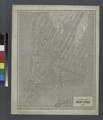
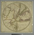
(New York Island. Military; unfinished. LOC gm71002309.tif 3,341 × 5,066; 48.42 MB
-
(Plan de New-York et les environs. LOC gm71000992.jpg 6,419 × 4,992; 4.03 MB
-
(Plan de New-York et les environs. LOC gm71000992.tif 6,419 × 4,992; 91.68 MB
-
Plan of New York or New Amsterdam (as in Sept 1661), 1664 - BL.jpg 1,645 × 1,312; 951 KB
-
Forts Washington Tryon Cockhill.jpg 1,356 × 1,798; 1.13 MB
-
1820 Map of Manhattan.jpg 2,261 × 1,626; 498 KB
-
1862 Johnson Map of New York City and Brooklyn - Geographicus - NYC-johnson-1862.jpg 5,000 × 3,198; 5.79 MB
-
1863 McCloskey Pocket Map of Brooklyn, New York - Geographicus - Brooklyn-mccloskey-1863.jpg 5,000 × 4,149; 4.16 MB
-
1864 Mitchell Map of New York City, New York - Geographicus - NewYorkCity-mitchell-1864.jpg 3,000 × 3,695; 2.75 MB
-
New York and Vicinity as Proposed to be Remodeled crop.png 766 × 472; 897 KB
-
1865 Johnson Map of New York City and Brooklyn - Geographicus - NewYorkCity-johnson-1865.jpg 4,000 × 2,573; 3.29 MB
-
1866 Johnson Map of New York City and Brooklyn - Geographicus - NewYorkCity-johnson-1866.jpg 3,620 × 5,000; 6.72 MB
-
1867 Mitchell Map of New York City, New York - Geographicus - NewYorkCity-mitchell-1870.jpg 5,000 × 3,291; 5.13 MB
-
1869 Kitchen - Shannon Map of New York City - Geographicus - NewYorkKitchin-mcny-1869.jpg 2,457 × 3,028; 1.05 MB
-
New York City NYPL1575777.tiff 5,122 × 6,412; 93.96 MB
-
1873 Central Park Map Harlem Meer.jpg 4,320 × 5,372; 10.25 MB
-
1882 Mitchell Map of New York City, New York - Geographicus - NewYorkCity-mitchell-1882.jpg 4,000 × 2,611; 3.46 MB
-
(King1893NYC) pg012 DUTCH MAP OF NEW YORK, 1656.jpg 1,245 × 1,981; 1.32 MB
-
(King1893NYC) pg021 THOMAS KITCHIN (SENIOR'S) NEW YORK IN 1778, FROM THE LONDON MAGAZINE.jpg 1,285 × 1,714; 1.37 MB
-
1895 Bien Map of New York City (w- Queens ^ the Bronx) - Geographicus - NYC-bien-1895.jpg 3,532 × 5,000; 3.73 MB
-
1910 NYC map.jpg 1,694 × 2,288; 1.46 MB
-
Greatest New York (panoramic view) - H. Wellge, sk. NYPL1691404.tiff 7,230 × 4,118; 85.18 MB
-
PSM V88 D089 Plan to enlarge new york city.png 2,041 × 2,871; 1.44 MB
-
A Plan of New York - btv1b53089681t.jpg 7,584 × 5,400; 3.6 MB
-
A plan of New York Island... (2675109076).jpg 1,290 × 2,000; 1.99 MB
-
A plan of the city of New York from an actual survey, anno Domini, M(D)CC,LV LOC 73691802.tif 8,396 × 4,538; 109.01 MB
-
A plan of the harbour of New York - I. Carwitham sculp. - btv1b530115948.jpg 3,300 × 4,718; 2.1 MB
-
A plan of the harbour of New York - I. Carwitham sculp. - btv1b8596008z.jpg 3,696 × 5,171; 3.09 MB
-
Admiralty Chart No 2491 New York Harbour, Published 1857.jpg 11,307 × 8,029; 15.4 MB
-
African Burial Ground - African Burial Ground National Monument, New York LOC 2011587283.jpg 10,305 × 4,934; 7.5 MB
-
African Burial Ground - African Burial Ground National Monument, New York LOC 2011587283.tif 10,305 × 4,934; 145.47 MB
-
African Burial Ground - African Burial Ground National Monument, New York LOC 2012585155.jpg 10,289 × 4,866; 6.88 MB
-
African Burial Ground - African Burial Ground National Monument, New York LOC 2012585155.tif 10,289 × 4,866; 143.24 MB
-
AmCyc New York City and Vicinity.jpg 1,546 × 2,437; 1.49 MB
-
Annual report of the New York Zoological Society" (1897-) (18742531524).jpg 1,426 × 2,622; 571 KB
-
Area District Map Section No. 6 NYPL1637938.tiff 7,230 × 5,428; 112.28 MB
-
Attaque de l'armée des Provinciaux dans Long Island - Le Rouge - btv1b53089690s.jpg 4,232 × 4,648; 2.4 MB
-
Bay and harbor of New York. NYPL1692341.tiff 7,050 × 9,300; 187.61 MB
-
Birds eye view New York City crop.jpeg 682 × 450; 83 KB
-
Birds eye view New York City.jpeg 5,662 × 4,066; 5.57 MB
-
Birds-eye view of New York City (2675842338).jpg 2,000 × 1,370; 2.24 MB
-
Britannica New York City.png 2,169 × 3,088; 560 KB
-
Bronx1867.jpg 1,000 × 1,195; 265 KB
-
BrooklynMap1766 Wallabout Bay.jpg 1,822 × 1,570; 1.56 MB
-
BrooklynMap1766.jpg 1,882 × 1,629; 3.11 MB
-
City of New York, 1843. NYPL433767.tiff 4,840 × 5,627; 77.94 MB
-
City of New York. Board of Estimate and Apportionment. Area District Map. NYPL1637932.tiff 7,230 × 5,428; 112.28 MB
-
City of New York. Board of Estimate and Apportionment. Height District Map. NYPL1637894.tiff 7,230 × 5,428; 112.28 MB
-
City of New York. Board of Estimate and Apportionment. Use District Map. NYPL1637969.tiff 7,230 × 5,428; 112.28 MB
-
City of New-York - by David H. Burr. NYPL1253197.tiff 4,557 × 5,094; 66.42 MB
-
City of New-York - by David H. Burr. NYPL434685.tiff 4,944 × 5,835; 82.54 MB
-
City of New-York - by David H. Burr. NYPL434686.tiff 4,784 × 5,915; 80.97 MB
-
City of New-York - W. Kemble. NYPL434105.tiff 4,127 × 5,033; 59.43 MB
-
City of New-York LOC 2005626401.jpg 5,604 × 6,905; 7.28 MB
-
City of New-York LOC 2005626401.tif 5,604 × 6,905; 110.71 MB
-
City of New-York. LOC 75692381.jpg 4,738 × 5,720; 3.91 MB
-
City of New-York. LOC 75692381.tif 4,738 × 5,720; 77.54 MB
-
Classified Business Directory of New York (1) NYPL1575811.tiff 5,142 × 6,444; 94.8 MB
-
Classified Business Directory of New York (10) NYPL1575820.tiff 5,068 × 6,326; 91.73 MB
-
Classified Business Directory of New York (11) NYPL1575821.tiff 5,100 × 6,482; 94.58 MB
-
Classified Business Directory of New York (12) NYPL1575822.tiff 5,162 × 6,326; 93.43 MB
-
Classified Business Directory of New York (13) NYPL1575763.tiff 5,134 × 6,490; 95.33 MB
-
Classified Business Directory of New York (2) NYPL1575812.tiff 4,998 × 6,334; 90.57 MB
-
Classified Business Directory of New York (3) NYPL1575813.tiff 5,134 × 6,506; 95.57 MB
-
Classified Business Directory of New York (4) NYPL1575814.tiff 5,006 × 6,318; 90.49 MB
-
Classified Business Directory of New York (5) NYPL1575815.tiff 5,166 × 6,514; 96.28 MB
-
Classified Business Directory of New York (6) NYPL1575816.tiff 5,030 × 6,350; 91.38 MB
-
Classified Business Directory of New York (7) NYPL1575817.tiff 5,134 × 6,404; 94.07 MB
-
Classified Business Directory of New York (8) NYPL1575818.tiff 5,022 × 6,342; 91.12 MB
-
Classified Business Directory of New York (9) NYPL1575819.tiff 5,120 × 6,466; 94.72 MB
-
Colton's New York City - Brooklyn, Jersey City, Hoboken, etc. LOC 00557441.jpg 5,186 × 7,519; 6.98 MB
-
Deep sea fishing grounds (1915) (20223273974).jpg 2,992 × 1,854; 940 KB
-
Deep sea fishing grounds (1915) (20853022211).jpg 2,992 × 1,884; 1.49 MB
-
Detail of Battle Of Fort Washington Map By Sauthier.jpg 1,018 × 841; 443 KB
-
Disegno della struttura delle vie di Garden city.png 277 × 381; 188 KB
-
District map of the Archdeaconry of New York. LOC 76692291.jpg 17,416 × 4,770; 14.09 MB
-
District map of the Archdeaconry of New York. LOC 76692291.tif 17,416 × 4,770; 237.68 MB
-
Eldridge Street in A Plan of the City of New York (1776).jpg 1,900 × 1,499; 899 KB
-
Entrée de l'Hudson - btv1b530895103.jpg 4,280 × 7,928; 3.36 MB
-
Environs de New York - btv1b53089509q.jpg 7,448 × 5,776; 5.77 MB
-
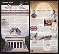
General Grant National Memorial, New York LOC 2010588606.jpg 5,277 × 4,879; 3.65 MB
-
General Grant National Memorial, New York LOC 2010588606.tif 5,277 × 4,879; 73.66 MB
-
Governors Island National Monument, New York LOC 2008620938.jpg 5,246 × 4,859; 3.84 MB
-
Gray's aero view of the port of New York LOC 2010587908.jpg 5,084 × 8,456; 5.83 MB
-
Gray's aero view of the port of New York LOC 2010587908.tif 5,084 × 8,456; 123 MB
-
Guide leaflet (1901) (14579642887).jpg 2,040 × 1,780; 344 KB
-
Hammond's new guide map of Manhattan and the Bronx. LOC 79695063.jpg 10,597 × 11,271; 24.18 MB
-
Hammond's new guide map of Manhattan and the Bronx. LOC 79695063.tif 10,597 × 11,271; 341.72 MB
-
Historic lower Manhattan LOC 79690008.jpg 5,368 × 6,891; 3.96 MB
-
Historic lower Manhattan LOC 79690008.tif 5,368 × 6,891; 105.83 MB
-
History of the city of New York- its origin, rise and progress (1896) (14760892714).jpg 1,758 × 3,338; 1.71 MB
-
John Randel Map Detail of Kings Bridge.jpg 3,494 × 2,329; 4.48 MB
-
Joseph Hutchins Colton - City of New York - 1897 - 001.jpg 5,000 × 2,786; 7.79 MB
-
Long Island 1842.jpg 701 × 313; 212 KB
-
Maerschalck Map-Negros Burial Ground-1755.jpg 554 × 767; 127 KB
-
Manhattan1781.jpg 864 × 1,680; 893 KB
-
Map of Kings and part of Queens counties, Long Island N.Y. LOC 2013593245.jpg 16,957 × 16,034; 44.92 MB
-
Map of Kings and part of Queens counties, Long Island N.Y. LOC 2013593245.tif 16,957 × 16,034; 777.88 MB
-
Map of New York and Adjacent Cities NYPL1691419.tiff 7,230 × 5,428; 112.28 MB
-
Map of New York and vicinity. LOC 2015591056.jpg 7,068 × 11,369; 11.67 MB
-
Map of New York and vicinity. LOC 2015591056.tif 7,068 × 11,369; 229.9 MB
-
Map of New York City. LOC 77693691.jpg 5,136 × 15,597; 12.71 MB
-
Map of New York City. LOC 77693691.tif 5,136 × 15,597; 229.19 MB
-
Map of New York WDL9593.png 1,368 × 1,024; 2.32 MB
-
Map of New York's Collect Pond, and adjoining streets, 1796.png 1,280 × 800; 508 KB
-
Map of New York, Brooklyn, Jersey City etc NYPL1691418.tiff 7,230 × 5,428; 112.28 MB
-
Map of New-York City LOC 80695174.jpg 9,802 × 7,753; 11.12 MB
-
Map of the city of New York. LOC 2011593667.jpg 3,262 × 4,709; 2.93 MB
-
Map of the city of New York. LOC 2011593667.tif 3,262 × 4,709; 43.95 MB
-
Meyers b12 s0121a.jpg 1,638 × 2,048; 773 KB
-
Miller's new map of the city of New-York. LOC 2015591066.jpg 8,883 × 5,141; 7.56 MB
-
Miller's new map of the city of New-York. LOC 2015591066.tif 8,883 × 5,141; 130.66 MB
-
Minuit Chart.tif 4,284 × 2,951; 37.26 MB
-
New york 1840.jpg 6,336 × 5,202; 3.88 MB
-
New York 1901.jpg 5,416 × 9,675; 6.62 MB
-
New York and adjacent country. NYPL433876.tiff 2,320 × 2,802; 18.6 MB
-
New York and Perthamboy Harbours. NYPL434637.tiff 4,746 × 5,580; 75.79 MB
-
New York and vicinity. NYPL433766.tiff 4,880 × 5,475; 76.46 MB
-
New York City 1846.jpg 4,784 × 5,797; 4.25 MB
-
New York City Business Notices - List of Attorneys, Bankers etc NYPL1517299.tiff 6,299 × 4,592; 83.41 MB
-
New York med trakten däromkring. NYPL1030055.tiff 2,093 × 2,826; 16.95 MB
-
New york retreat 1776 (2).jpg 413 × 607; 121 KB
-
New york retreat 1776.jpg 893 × 1,250; 162 KB
-
New York und Umgebungen. NYPL1030054.tiff 2,850 × 2,033; 16.58 MB
-
New York1890.jpg 5,930 × 9,245; 6.61 MB
-
Noort Rivier in Niew Neerlandt. LOC 2003623406.jpg 7,051 × 5,104; 5.54 MB
-
NSRW New York City - environs.jpg 1,204 × 1,026; 699 KB
-
NYC1776 crop.jpg 2,706 × 2,545; 4.65 MB
-
NYC1776 labelled.jpg 4,360 × 3,360; 7.88 MB
-
NYC1885-1.jpg 3,015 × 4,307; 8.78 MB
-
A Plan of the city and environs of New York in North America (NYPL b14923636-434407).jpg 7,117 × 5,472; 7.59 MB
-
A Plan of the city and environs of New York in North America (NYPL b14923636-434407).tiff 7,117 × 5,472; 111.43 MB
-
This map of the city of New York and island of Manhattan... (NYPL Hades-118166-54929).tiff 12,697 × 4,378; 159.04 MB
-
Ville de Manathe ou Nouvelle-Yorc (NYPL Hades-1783180-1650618).tiff 5,428 × 7,230; 112.28 MB


