Category:Old maps of Miaoli
Jump to navigation
Jump to search
中文(臺灣):苗栗縣的古地圖
Media in category "Old maps of Miaoli"
The following 11 files are in this category, out of 11 total.
-
1684 台灣地理圖.jpg 1,466 × 1,161; 1.18 MB
-
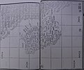
01淡水廳志稿淡廳境圖.jpg 3,955 × 2,888; 4.51 MB
-
01淡水廳全圖.jpg 3,664 × 2,918; 3.21 MB
-
04淡水廳分圖三.jpg 3,440 × 2,859; 2.59 MB
-
05淡水廳分圖四.jpg 3,529 × 2,947; 2.83 MB
-
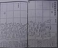
06淡水廳沿山各隘圖一.jpg 3,441 × 2,868; 2.71 MB
-
08淡水廳沿海礁砂形勢圖一.jpg 3,542 × 2,940; 2.86 MB
-
1935 Hsinchu-Taichung earthquake location map.png 600 × 899; 951 KB
-
Chikunan 1 8000 1944.jpg 3,972 × 3,992; 3.13 MB
-
新竹廳管內圖.jpg 4,450 × 3,411; 8.42 MB
-
竹南郡管內圖.jpg 4,681 × 3,226; 6.3 MB


