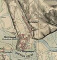
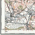
Category:Old maps of Mariampil (Galicia)
Jump to navigation
Jump to search
Media in category "Old maps of Mariampil (Galicia)"
The following 16 files are in this category, out of 16 total.
-
1772 Halicz Jezupol Wołczkow Mariampol Uście.jpg 481 × 290; 61 KB
-
1799 Mariampol.jpg 551 × 332; 67 KB
-
Mariampol plan (1812).jpg 1,652 × 2,138; 779 KB
-
Deliow Tumierz Lany Wodniki Wolskow Maryampol.jpg 362 × 309; 55 KB
-
1824 Jezupol Maryampol Wolskow.jpg 1,052 × 631; 312 KB
-
1824 klucz marjampolski.jpg 1,306 × 808; 444 KB
-
1869-1887 Habsburg Empire Third Military Survey 1 25000 Maryampol.jpg 992 × 681; 139 KB
-
1914 Wołczków Woronica Świdowa 1 75 000.jpg 438 × 557; 102 KB
-
1914 ZONE 9 KOL XXXII MONASTERZYSKA.jpg 13,020 × 10,162; 25.85 MB
-
1959 Marinopol Volchkov.jpg 399 × 576; 100 KB
-
Plan Mariampola (1812).jpg 432 × 706; 117 KB
-
Wolczek (Wołczków) 1670.jpg 688 × 327; 65 KB
-
Wołczków (Wolczek) XVII w.jpg 648 × 747; 156 KB
-
Wołczków Marjampol 1925.jpg 524 × 523; 143 KB


