Category:Old maps of Mantua
Jump to navigation
Jump to search
Subcategories
This category has only the following subcategory.
M
Media in category "Old maps of Mantua"
The following 40 files are in this category, out of 40 total.
-
Demarcacio de Mant-ua (BM 1849,1208.693).jpg 2,500 × 1,871; 1.14 MB
-
Mantua.png 3,725 × 4,244; 25.68 MB
-
Mantua (BM 1898,0725.8.1344).jpg 1,708 × 963; 454 KB
-
Mantua (BM 1992,U.71).jpg 2,161 × 1,610; 1.12 MB
-
The Situation of Mantua (BM M,36.55).jpg 2,500 × 2,009; 1.43 MB
-
130 of 'Napoléon et son temps ... Ouvrage illustré ... Neuvième mille' (11236265616).jpg 1,590 × 1,658; 782 KB
-
463 of 'Le cento città d'Italia. Descrizione storica, politica, etc' (11095301573).jpg 2,544 × 1,976; 1.58 MB
-
DUCATO DI MANTOVA , Maps K.Top.78.4, Date of publication 1662.jpg 4,000 × 2,910; 2.1 MB
-
Duchy of Mantua 1720.jpg 1,522 × 704; 684 KB
-
Italy- a handbook for travellers. First Part (Nothern Italy) (1893) (14594692230).jpg 1,850 × 2,678; 2.02 MB
-
Mantoua - btv1b84940068.jpg 8,513 × 6,734; 6.02 MB
-
Mantouan - btv1b53042572t.jpg 3,851 × 2,485; 1.36 MB
-
Mantoue - btv1b530429870.jpg 3,925 × 2,771; 1.98 MB
-
Mantoue - btv1b53083543m.jpg 6,448 × 9,262; 6.4 MB
-
Mantoue - btv1b530998184.jpg 10,337 × 8,275; 10.84 MB
-
Mantoue - par N. de Fer ; H. van Loon fec. - btv1b84954207.jpg 5,634 × 3,897; 3.86 MB
-
Mantoüe - btv1b84939151.jpg 6,817 × 5,389; 4.3 MB
-
Mantua map from 1869.jpg 1,268 × 1,700; 1,004 KB
-
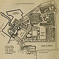
Map of Ducal Palace of Mantua (1870).jpg 1,796 × 1,792; 446 KB
-
Mappa della Città di Mantova.jpg 960 × 743; 226 KB
-
Mappa di Mantova (1858).jpg 2,634 × 3,810; 2.65 MB
-
Meyer‘s Zeitungsatlas 008 – Österreich- Lombardisch-Venetisches Königreich.jpg 7,344 × 6,224; 16.82 MB
-
Représentation de la belle ville de Mantoue en Italie - btv1b84450318.jpg 5,280 × 3,257; 3.21 MB
-
Sacco di mantova nel 1630.JPG 1,988 × 1,415; 1.31 MB
-
Viaggio da Mantova a Bologna (1771).jpg 600 × 453; 362 KB
-
– Neu-eröffnetes Italien, 1703 – BEIC 6138553 Mantova.jpg 644 × 401; 366 KB


