Category:Old maps of Manchester and Salford
Jump to navigation
Jump to search
Subcategories
This category has the following 2 subcategories, out of 2 total.
Media in category "Old maps of Manchester and Salford"
The following 72 files are in this category, out of 72 total.
-
Map of Manchester 1550.jpg 960 × 620; 123 KB
-
Map of manchester circa 1650.jpg 1,472 × 952; 434 KB
-
10 of 'Manchester. (A history of the town.)' (11186976154).jpg 1,952 × 1,264; 779 KB
-
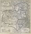
Robert Owen Jones (1885) Salford Parliamentary Borough.png 673 × 743; 876 KB
-
223 of 'Manchester. (A history of the town.)' (11191099184).jpg 3,250 × 2,052; 1.31 MB
-
Map of Manchester 1801.PNG 1,059 × 919; 2.06 MB
-
Plan von Manchster und Saalfort 1809 9110.jpg 3,206 × 2,720; 2.15 MB
-
Roscoe GJR(1839) p176 - Map of Manchester.jpg 1,455 × 2,268; 868 KB
-
Manchester 1843 map.jpg 2,000 × 1,572; 4.6 MB
-
BRADSHAW(1854) p182 MAP OF MANCHESTER AND SALFORD.jpg 5,331 × 4,804; 13.88 MB
-
EW(1884) p.350 - Manchester and Salford (left) - A + C Black (pub).jpg 1,225 × 1,902; 710 KB
-
EW(1884) p.351 - Manchester and Salford (right) - A + C Black (pub).jpg 1,225 × 1,902; 787 KB
-
Belle vue zoological gardens plan 1892.jpg 3,872 × 2,747; 3.65 MB
-
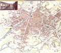
Manchester central 1894.jpg 700 × 504; 199 KB
-
183 of '(Our own country. Descriptive, historical, pictorial.)' (11248083866).jpg 1,892 × 1,748; 1.12 MB
-
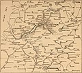
197 of 'The International Geography. ... Edited by H. R. Mill' (11289702613).jpg 1,222 × 944; 499 KB
-
Didsbury 1905.jpg 800 × 494; 102 KB
-
Manchester RJD 47.JPG 2,861 × 1,916; 768 KB
-
1910 cheshire odinance survey map showing Edgley Park.jpg 2,959 × 4,096; 3.14 MB
-
1910 Cheshire ordnance survey map showing Edgeley Park (cropped).jpg 2,282 × 2,782; 1.53 MB
-
Britannica Manchester 1911.png 1,071 × 913; 2.31 MB
-
Railway Clayton Br Park1911 edited-2.jpg 1,600 × 1,133; 722 KB
-
Manchestermap 1924.jpg 3,504 × 2,544; 2.81 MB
-
Salford docks 1924.jpg 1,257 × 871; 419 KB
-
Wilbraham road railway station 1937 OS Map.jpg 800 × 500; 138 KB
-
30 of 'John Heywood's Illustrated Manchester Ship Canal Route Guide' (11227968893).jpg 1,318 × 1,538; 637 KB
-
34 of 'Observation on improvements of the town of Manchester, etc' (11011962276).jpg 2,592 × 1,981; 1.09 MB
-
6 of 'Views of Old Manchester' (11181898414).jpg 2,240 × 1,441; 802 KB
-
A Map of the City of Manchester in the Year of its First Civic Week, A.D.1926.jpg 6,200 × 4,350; 5.96 MB
-
A new Plan of Manchester and Salford, with every recent alteration - btv1b8440513h.jpg 7,450 × 6,097; 8.31 MB
-
A Plan of Manchester and Salford, published by Rand W. Dean 1809 - btv1b8443186z.jpg 11,982 × 8,436; 19.11 MB
-
A Plan of Manchester and Salford, with the recent improvements, 1825 - btv1b53029240b.jpg 9,096 × 6,810; 12.61 MB
-
Bacon's Map of Manchester, corrected to the present time - btv1b8439018c.jpg 9,346 × 6,259; 11.56 MB
-
Bradshaw's Railway Timetables 1839 - Manchester.jpg 1,728 × 1,327; 897 KB
-
D379- N° 492. Slums de Manchester et Salford. - Liv4-Ch02.png 1,450 × 1,868; 476 KB
-
Dickenson Road Methodist Chapel OS map 1899.jpg 1,147 × 747; 388 KB
-
EB1911 - Manchester (UK) and Environs.jpg 1,078 × 917; 845 KB
-
Exchange Ward Manchester Adshead.jpg 1,536 × 1,159; 480 KB
-
Fallowfield Station OS map 1899.jpg 2,485 × 1,698; 1.59 MB
-
Manchester AFN Sectors.jpg 2,127 × 2,481; 4.39 MB
-
Manchester Exchange and Victoria stations map.png 1,312 × 874; 1.36 MB
-
Manchester Ship Canal Dock; General Key Plan (BL 149781).tiff 3,019 × 3,644; 31.47 MB
-
Nico ditch 1895 os map.png 1,680 × 331; 43 KB
-
North road os.jpg 500 × 250; 94 KB
-
North road os.png 500 × 250; 129 KB
-
Panama Canal traffic and tolls (1912) (14786239013).jpg 3,480 × 3,086; 1.06 MB
-
Panama Canal traffic and tolls (1912) (14786240413).jpg 5,108 × 2,066; 1.31 MB
-
Plan of Alexandra Park, Manchester.jpg 4,218 × 5,909; 8.65 MB
-
Ports and terminal facilities (1918) (14574751198).jpg 2,832 × 1,434; 451 KB
-
Robert Owen Jones (1885) Manchester - Divisions of extended borough.png 674 × 853; 1,002 KB
-
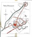
Roman Manchester (1900) by Charles Roeder, Illustration 15.jpg 1,064 × 770; 173 KB
-
Roman Manchester by Charles Roeder p149.jpg 1,323 × 1,734; 566 KB
-
Roman Manchester by Charles Roeder p83.jpg 1,417 × 1,632; 613 KB
-
Salford Twist Mill on Bancks and Co's Plan of Manchester, 1831.png 546 × 425; 499 KB
-
St Peter's Square, Manchester 1794 map.jpg 2,400 × 1,600; 2.79 MB
-
St Peter's Square, Manchester 1850 map.jpg 2,400 × 1,600; 2.03 MB
-
West Didsbury map 1911.jpg 1,076 × 827; 440 KB


