Category:Old maps of Leipzig
Jump to navigation
Jump to search
Subcategories
This category has the following 2 subcategories, out of 2 total.
1
D
- Details of old maps of Leipzig (119 F)
Media in category "Old maps of Leipzig"
The following 86 files are in this category, out of 86 total.
-
Braun-Lipsae-Insignis.png 1,683 × 1,301; 4.23 MB
-
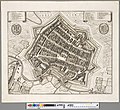
Leipzig (Merian).jpg 1,504 × 1,180; 596 KB
-
Leipzig um 1650.jpg 1,227 × 981; 502 KB
-
Leipzig-1650-Merian.jpg 3,176 × 2,517; 2.21 MB
-
Leipzigk (Merian).png 5,618 × 4,425; 38.3 MB
-
Leipzigk.jpg 4,821 × 4,410; 8.34 MB
-
Gezicht op Leipzig Die statt Leijptzig (titel op object), RP-P-2018-979.jpg 4,932 × 4,250; 4.6 MB
-
Antique map of Leipzig (8429631502).jpg 3,648 × 2,432; 13.04 MB
-
Leipzig um 1720.jpg 1,069 × 596; 464 KB
-
Lipsia. Leipzig.jpg 3,861 × 3,180; 3.96 MB
-
Elsterfloßgraben 2.JPG 666 × 667; 105 KB
-
Elsterfloßgraben.jpg 1,536 × 2,000; 1.82 MB
-
Leipzig 1749.jpg 1,470 × 1,388; 958 KB
-
Stadtplan Leipzig 1749.jpg 2,529 × 2,366; 2.12 MB
-
Breitkopf Leipzig Landkartensatz-Probe 1776.jpg 3,033 × 2,510; 3.94 MB
-
Grundris des Rosenthals bey Leipzig.jpg 4,016 × 3,372; 4.23 MB
-
Plan of Leipzig 18 century.jpg 4,492 × 4,613; 7.81 MB
-
Leipzig 1799.jpg 2,035 × 2,247; 1.42 MB
-
Meilenblatt B 15 Rackwitz.jpg 8,980 × 9,000; 23.27 MB
-
Meilenblatt B 20 Taucha.jpg 8,988 × 9,004; 24.14 MB
-
Meilenblatt B 29 Borsdorf.jpg 9,000 × 9,040; 23.68 MB
-
Meilenblatt B 14 Lindenthal.jpg 9,000 × 9,000; 22.82 MB
-
Meilenblatt B 19 Leipzig.jpg 9,141 × 9,126; 19.44 MB
-
Meilenblatt B 27 Markkleeberg.jpg 9,000 × 9,000; 25.12 MB
-
Meilenblatt B 28 Liebertwolkwitz.jpg 5,942 × 5,928; 12.94 MB
-
Meilenblatt F 7 Leipzig.jpg 7,250 × 7,230; 14.24 MB
-
Grundriss Leipzig 1803.jpg 5,315 × 7,738; 11.89 MB
-
Meilenblatt B 13 Rückmarsdorf.jpg 9,020 × 9,000; 23.74 MB
-
Meilenblatt B 17 Räpitz.jpg 9,000 × 9,000; 24.12 MB
-
Meilenblatt B 18 Leipzig-West.jpg 9,153 × 9,174; 18.79 MB
-
Meilenblatt F 6 Leipzig-West.jpg 7,240 × 7,250; 13.09 MB
-
Batailles de Leipzig, Livrées le 16, 18, 19 Octobre 1813 01.jpg 4,177 × 3,777; 4.26 MB
-
Batailles de Leipzig, Livrées le 16, 18, 19 Octobre 1813 02.jpg 4,108 × 3,689; 3.64 MB
-
Deutschland BV042513042 (cropped).jpg 1,779 × 2,790; 800 KB
-
Plan von Leipzig.jpg 2,943 × 2,210; 2.06 MB
-
Neuester Grundriss der Stadt Leipzig. Veranstaltet von Georg Voss. 1814.jpg 5,512 × 3,849; 6.34 MB
-
Leipzig 1823.jpg 2,624 × 2,306; 2.05 MB
-
BV042512946.tif 3,573 × 2,181; 12.94 MB
-
Deutschland BV042512946.jpg 3,573 × 2,181; 1.09 MB
-
Gerlach Situationsplan Leipzig 1829.jpg 8,583 × 9,380; 31.21 MB
-
Situations-Plan der Stadt Leipzig.jpg 8,064 × 9,987; 15.79 MB
-
Plan von Leipzig 1832 df dk 0000495 retouched.jpg 4,959 × 5,618; 18.08 MB
-
Grundriss von Leipzig.jpg 6,735 × 5,580; 11.97 MB
-
Oberreit Atlas Section 2 Leipzig 1839.jpg 8,004 × 6,827; 13.58 MB
-
Plan von Leipzig und Lauf der Eisenbahn 1841.jpg 4,609 × 3,652; 5.29 MB
-
BECHSTEIN(1844) p234 Plan von Leipzig.jpg 4,702 × 2,829; 6.9 MB
-
Map of Leipzig in 1857 from Wandkarte vom Königreiche Sachsen 09 (cropped).jpg 1,815 × 1,824; 1.63 MB
-
124 of 'Heimatskunde von Leipzig. Leitfaden für den Unterricht, etc' (11075020634).jpg 1,522 × 1,581; 425 KB
-
70 of 'Heimatskunde von Leipzig. Leitfaden für den Unterricht, etc' (11076394004).jpg 1,475 × 1,556; 404 KB
-
Topographische Karte 1868 Section 2 Leipzig.jpg 8,668 × 7,433; 20.99 MB
-
Leipzig-1871-df dk 0006110.jpg 9,783 × 8,389; 16.98 MB
-
Leipzig1876 c-m.png 1,200 × 880; 745 KB
-
Leipzig1876.png 1,200 × 880; 875 KB
-
Messtischblatt 4640 Leipzig von 1879 df dk 0000093.jpg 7,715 × 7,615; 14.55 MB
-
EB9 Leipsic.jpg 821 × 1,047; 608 KB
-
Plan von Leipzig 1884.jpg 6,587 × 7,811; 17.3 MB
-
Meyers b10 s0662a.jpg 2,048 × 1,598; 779 KB
-
RA05.01SN-7-L14.jpg 8,332 × 6,457; 5.36 MB
-
Brockhaus-14-Stadtplan-Leipzig.jpg 1,290 × 1,042; 360 KB
-
Df dk 0012803 0005 001.jpg 1,600 × 1,256; 538 KB
-
Leipzig Stadtplan mit Umgebung 1892-1898.jpg 2,523 × 3,150; 1.52 MB
-
Messtischblatt 4640 Leipzig von 1897 df dk 0000094.jpg 7,515 × 7,446; 10.39 MB
-
Messtischblatt 4640 Leipzig von 1908 df dk 0000095.jpg 7,677 × 7,554; 13.47 MB
-
Lissel Verkehrsplan Leipzig 1913.jpg 10,820 × 8,300; 22.22 MB
-
Leipzig plagwitz 1943.gif 5,000 × 1,683; 863 KB
-
Leipzig, Pergamon World Atlas 1967.jpg 686 × 624; 271 KB
-
31 of 'Kurfürst August von Sachsen als Geograph, etc. (With plates.)' (11246467513).jpg 1,801 × 1,846; 756 KB
-
647 of 'Neumanns Orts-Lexikon des Deutschen Reichs' (11229415515).jpg 1,756 × 2,725; 1.45 MB
-
68 of 'Heimatskunde von Leipzig. Leitfaden für den Unterricht, etc' (11076083935).jpg 2,578 × 1,232; 702 KB
-
84 of 'Heimatskunde von Leipzig. Leitfaden für den Unterricht, etc' (11075679895).jpg 1,385 × 2,578; 787 KB
-
Leipzig und Umgebung Meßtischblatt 1915 TK25 b.jpg 9,252 × 6,914; 106.22 MB
-
Leipzig und Umgebung Meßtischblatt 1915 TK25.jpg 9,449 × 7,095; 101.21 MB
-
Leipzig-Eventpalast-(Lageplan-1913).jpg 2,512 × 2,988; 4.19 MB
-
Map of Leipzig 1863 (Werl's neuester Plan von Leipzig und angrenzenden Ortschaften).jpg 9,624 × 7,659; 9.37 MB
-
Plan des Brühls, Leipzig, 1867.jpg 1,302 × 649; 145 KB
-
Topographische Karte der Umgegend - von Leipzig - btv1b53099563t.jpg 8,537 × 8,946; 14.8 MB
-
Topographische Karte der Umgegend von Leipzig (1854).jpg 10,597 × 12,750; 24.04 MB
-
Topographische Karte der Umgegend von Leipzig (1863).jpg 10,508 × 12,397; 26.9 MB
-
Fuhrer und Plan von Leipzig. 1889 (128315903).jpg 8,072 × 10,570; 12.75 MB


