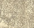
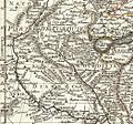
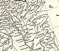
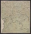
Category:Old maps of Kurdistan
Jump to navigation
Jump to search
Use the appropriate category for maps showing all or a large part of Category:Kurdistan. See subcategories for smaller areas:
| If the map shows | Category to use |
|---|---|
| Category:Kurdistan on a recently created map | Category:Maps of Kurdistan or its subcategories |
| Category:Kurdistan on a map created more than 70 years ago | Category:Old maps of Kurdistan or its subcategories |
| the history of Category:Kurdistan on a recently created map | Category:Maps of the history of Kurdistan or its subcategories |
| the history of Category:Kurdistan on a map created more than 70 years ago | Category:Old maps of the history of Kurdistan or its subcategories |
Media in category "Old maps of Kurdistan"
The following 75 files are in this category, out of 75 total.
-
"Turky in Asia" map circa 1790s.jpg 2,584 × 1,935; 964 KB
-
Daniel Keller. Asiae nova descriptio (Antwerpen, 1590).LU11.jpg 1,837 × 1,531; 503 KB
-
1684 Curdistan Diarbeck map.jpg 1,090 × 1,474; 1.47 MB
-
William Faden. Composite Mediterranean. 1785.D.jpg 1,660 × 1,076; 583 KB
-
William Faden. Composite Mediterranean. 1785.E.jpg 736 × 645; 148 KB
-
Rigobert Bonne. Perse. 1787 (I).jpg 548 × 519; 98 KB
-
Rigobert Bonne. Turquie d'Asie. 1791 (L).jpg 1,185 × 1,017; 358 KB
-
Anville, Jean Baptiste Bourguignon. Turkey in Asia. 1794 (EBA).jpg 1,180 × 897; 361 KB
-
Anville, Jean Baptiste Bourguignon. Turkey in Asia. 1794 (EC).jpg 1,020 × 961; 307 KB
-
Anville, Jean Baptiste Bourguignon. Turkey in Asia. 1794 (H).jpg 1,022 × 1,009; 305 KB
-
Osmanisches Reich BV044705374.jpg 8,165 × 8,822; 7.22 MB
-
Cary, John, ca Turkey in Asia 1801 (HD).jpg 931 × 842; 267 KB
-
Cedid Atlas (Kurdistan) 1803.jpg 2,524 × 2,490; 1.78 MB
-
Bowen, Frances. Turkey in Asia. 1810 (L).jpg 941 × 1,063; 134 KB
-
Bowen, Frances. Turkey in Asia. 1810 (M).jpg 853 × 807; 86 KB
-
Darton, William. Turkey in Asia. 1811 (I).jpg 990 × 977; 247 KB
-
Pinkerton, John. Turkey in Asia. 1813 (J).jpg 924 × 939; 296 KB
-
Lucas, Fielding Jr. Turkey in Asia. 1823 GA.jpg 805 × 747; 171 KB
-
Louis Vivien de Saint-Martin. Carte General de la Turquie d'Asie. 1824 (E).jpg 2,551 × 1,761; 1.13 MB
-
Louis Vivien de Saint-Martin. Carte General de la Turquie d'Asie. 1824 (I).jpg 1,823 × 1,594; 672 KB
-
Daniel Lizars. Turkey in Asia. 1831 (J).jpg 811 × 970; 214 KB
-
Johnston, Alexander Keith (1804-1871). Turkey in Asia, Transcaucasia. 1861 (E).jpg 1,636 × 1,218; 654 KB
-
Map of Northern Koordistan (1870).jpg 3,781 × 2,029; 4 MB
-
Persia(IRAN)1922 Azerbijan.jpg 910 × 725; 351 KB
-
1946 Kurdistan et groupements Kurdes isolés (detail of Iranian Kurdistan).jpg 2,786 × 4,139; 1.71 MB
-
1946 Kurdistan et groupements Kurdes isolés (detail of Iraqi Kurdistan).jpg 3,202 × 3,132; 1.45 MB
-
1946 Kurdistan et groupements Kurdes isolés (detail of Kurdistan).jpg 4,782 × 3,838; 2.71 MB
-
1946 Kurdistan et groupements Kurdes isolés (detail of Soviet Kurdistan).jpg 3,119 × 2,093; 1.01 MB
-
1946 Kurdistan et groupements Kurdes isolés (detail of Syrian Kurdistan).jpg 2,693 × 1,803; 753 KB
-
1946 Kurdistan et groupements Kurdes isolés (detail of the Iraq–Iran border).jpg 3,150 × 3,142; 1.49 MB
-
1946 Kurdistan et groupements Kurdes isolés (detail of the Mediterranean Sea coast).jpg 2,755 × 2,073; 806 KB
-
1946 Kurdistan et groupements Kurdes isolés (detail of the Persian Gulf coast).jpg 3,732 × 3,049; 1.41 MB
-
1946 Kurdistan et groupements Kurdes isolés (detail of the Syria–Iraq border).jpg 2,038 × 1,813; 582 KB
-
1946 Kurdistan et groupements Kurdes isolés (detail of the Turkey–Iran border).jpg 1,456 × 1,491; 450 KB
-
1946 Kurdistan et groupements Kurdes isolés (detail of Turkish Kurdistan).jpg 4,106 × 2,602; 1.6 MB
-
1946 Kurdistan et groupements Kurdes isolés (margins cropped).jpg 10,727 × 5,831; 7.39 MB
-
1946 Kurdistan et groupements Kurdes isolés.jpg 11,967 × 6,874; 10 MB
-
1948 Kurdistan by the CIA (margins cropped).jpg 4,037 × 2,945; 3.59 MB
-
Bohtan principality.png 749 × 444; 864 KB
-
Detail of Kurdistan from a map of "Turkey in Asia" by W. and A. K. Johnston.jpg 1,459 × 1,554; 2.96 MB
-
Ethnographic Eastern Turkey.jpg 726 × 785; 185 KB
-
Kurdish States 1902 -outlined.jpg 1,459 × 1,554; 2.96 MB
-
Kurdistan map 1892.jpg 953 × 960; 179 KB
-
Map of Kurdistan, Georgia, Armenia, Mesopotamia and Western Persia (1887) (margins cropped).png 4,509 × 5,037; 40.23 MB
-
Map of Kurdistan, Georgia, Armenia, Mesopotamia and Western Persia (1887).png 5,517 × 6,332; 51.33 MB
-
Old Kurdistan Map, Ibn Hawqal.png 468 × 605; 269 KB
-
Ottoman vilayet of Kurdistan.jpg 1,024 × 888; 548 KB
-
Ottoman vilayets of Van and Mossoul 1899.png 549 × 743; 768 KB
-
Western Kurdistan limit 1907 for Sir Mark Sykes.jpg 1,213 × 757; 183 KB

