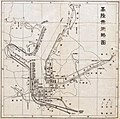
Category:Old maps of Keelung
Jump to navigation
Jump to search
中文(臺灣):基隆市的古地圖
Media in category "Old maps of Keelung"
The following 41 files are in this category, out of 41 total.
-
Map of the north of the island of Formosa 1626-1642.jpg 720 × 990; 118 KB
-
Map of the Spanish Port in Jilong, Taiwan, 1626.jpg 1,000 × 1,391; 554 KB
-
AMH-7131-NA Map of Spanish fort at Tamsui, later in hands of the VOC.jpg 9,167 × 6,437; 9.08 MB
-
NL-HaNA 4.VELH 141-groot.jpg 9,167 × 6,437; 31.88 MB
-
400px-04141-2.jpg 400 × 310; 27 KB
-
AMH-4602-NA Map of Tamsuy and Kelang.jpg 2,400 × 1,863; 1.1 MB
-
Dutch Tamsui Map 1654.png 1,305 × 869; 1.69 MB
-
Kaartje van Tamsuy en omleggende dorpen, zoo mede het eilandje Kelang.png 1,540 × 1,122; 6.6 MB
-
Map of Danshui and Surrounding Areas, Including the Island of Jilong, 1654.jpg 1,000 × 782; 447 KB
-
Old map of Taipei.jpg 500 × 387; 38 KB
-
《Kaartje van Tamsuy en omleggende dorpen, zoo mede het eilandje Kelang》.jpg 3,206 × 2,290; 1.91 MB
-
AMH-2521-NA Chart of the northern coast of the island of Formosa and Kelangh.jpg 2,400 × 1,686; 652 KB
-
17th century Keelung map.jpg 882 × 560; 81 KB
-
AMH-2520-NA Map of Fort Zeelandia.jpg 2,400 × 1,677; 477 KB
-
Navigation Charts of Jilong and the Bay of Tayouan..jpg 1,000 × 695; 232 KB
-
Zhuluo Qing map 1696.png 775 × 622; 135 KB
-
01淡水廳志稿淡廳境圖.jpg 3,955 × 2,888; 4.51 MB
-
01淡水廳全圖.jpg 3,664 × 2,918; 3.21 MB
-
02淡水廳分圖一.jpg 3,336 × 2,724; 2.74 MB
-
07淡水廳沿山各隘圖二.jpg 3,646 × 3,004; 2.93 MB
-
09淡水廳沿海礁砂形勢圖二.jpg 3,686 × 3,092; 3.2 MB
-
Keelung map 1933.jpg 3,806 × 2,961; 2.33 MB
-
Keelung map in 1935.jpg 1,390 × 1,380; 322 KB
-
Keelung-Garnot-Kelung-1894.jpg 717 × 768; 604 KB
-
Kiirun 1 10000 1945.jpg 3,996 × 5,138; 5.83 MB
-
Le yamen de Kelung.tif 6,778 × 4,023; 26.03 MB
-
Map of Formosa Coal Resources 美國人所繪福爾摩沙-臺灣基隆以東煤礦分布.jpg 861 × 541; 89 KB
-
Map of Kelung.jpg 1,310 × 1,536; 466 KB
-
Map of Kiirun(Keelung) City 01.jpg 1,024 × 675; 109 KB
-
Map of Kiirun(Keelung) City 02.jpg 1,024 × 676; 133 KB
-
Sititosho Map.jpg 717 × 447; 47 KB
-
Zenkan jidai Chōsenzu - Shōtei igo LOC 2011458821.jpg 9,346 × 7,710; 7.45 MB
-
Zenkan jidai Chōsenzu - Shōtei igo LOC 2011458821.tif 9,346 × 7,710; 206.16 MB
-
七堵庄管內圖.jpg 673 × 396; 200 KB
-
三爪子線圓窗嶺路段.png 1,616 × 920; 2.87 MB
-
古地圖展-台灣地圖a.jpg 1,920 × 1,206; 634 KB
-
基隆廳管內略圖.jpg 943 × 1,102; 745 KB
-
基隆水道水源地平面圖.jpg 3,084 × 2,362; 732 KB
-
臺北廳管內圖 1917.jpg 4,656 × 3,413; 6.53 MB


