Category:Old maps of Jena
Jump to navigation
Jump to search
Subcategories
This category has only the following subcategory.
Media in category "Old maps of Jena"
The following 9 files are in this category, out of 9 total.
-
Meyer‘s Zeitungsatlas 025 – Gross-Herzogthum Sachsen-Weimar und Eisenach.jpg 7,386 × 6,231; 18.21 MB
-
Das itzo blühende JENA.jpg 2,232 × 1,837; 3.55 MB
-
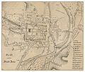
PLAN von der Stadt Jena.jpg 2,299 × 1,926; 2.6 MB
-
Jena-Lobeda, Johannisberg, Skizze Cartellieri 1912.png 1,881 × 2,295; 5.14 MB
-
Karte Jena von seinem Ursprunge 1858.jpg 2,480 × 2,153; 986 KB
-
Plan-Jena-1836-CTH.jpg 1,024 × 692; 733 KB
-
Schlacht bei Jena 14 10 1806 MK1888.png 727 × 481; 100 KB
-
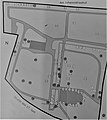
Übersicht Johannisfriedhof (Jena).jpg 1,553 × 1,737; 470 KB


