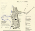
Category:Old maps of Helsingborg
Jump to navigation
Jump to search
Subcategories
This category has the following 3 subcategories, out of 3 total.
Media in category "Old maps of Helsingborg"
The following 26 files are in this category, out of 26 total.
-
VAUPELL(1870) p1.449 Plan der Schlacht von Helsingborg, März 1710.jpg 817 × 877; 519 KB
-
Admiralty Chart No 2115 Entrance to the Baltic The Sound, Published 1886.jpg 8,318 × 12,168; 16.29 MB
-
Karta över Helsingborg 1909.jpg 3,388 × 2,400; 1.25 MB
-
Charta huru dhe Danske lembnade Helsingborgh när dhe uthmarcherade effter Fredzsluthet.jpg 7,249 × 4,658; 2.65 MB
-
Charta öfwer Fälads Marken till Helsingborg, kopia 1786.jpg 7,391 × 9,259; 6.06 MB
-
Charta öfwer Helsingborg Stad (1787).jpg 5,627 × 8,475; 4.66 MB
-
Charta öfwer Helsingborg Stads In Ägor (1787 och 1788).jpg 5,600 × 11,652; 10.21 MB
-
Charta öfwer Röa, Troeds, Bagare, Hjelmshults, och Koppar Möllorna (1788).jpg 4,823 × 3,635; 2.18 MB
-
Charta öfwer Situationen Omkring Helsingborgs Stad.jpg 14,620 × 16,652; 11.67 MB
-
Cohrs Helsingborg 1928.jpg 1,891 × 2,932; 1.23 MB
-
Copy of plan of the fortifications of Helsingborg (01).jpg 6,900 × 5,442; 5.83 MB
-
Copy of plan of the fortifications of Helsingborg (02).jpg 6,900 × 5,295; 4.78 MB
-
Helsingborg 1645, förslag till befästningar.jpg 5,876 × 4,597; 2.89 MB
-
Helsingborg efter Skånska kriget 1679.png 1,707 × 1,319; 5.38 MB
-
Helsingborg med dess Situation aftagit uthi Augusti Månadh åhr 1666.jpg 8,699 × 6,009; 4.6 MB
-
Helsingborgs befästningar 1709-1710.jpg 6,900 × 4,843; 4.63 MB
-
Helsingborgs stad och fästning på 1600-talet.jpg 2,885 × 2,297; 2.09 MB
-
Karta över Helsingborg 1877, Robert Söderqvist.jpg 7,877 × 5,265; 4.01 MB
-
Karta över Stattena och Ringstorp 1788.jpg 7,276 × 4,330; 2.55 MB
-
Ljunggren Helsingborg detaljkarta (cropped).png 1,380 × 1,229; 1.76 MB
-
Ljunggren Helsingborg.png 4,510 × 3,600; 12.18 MB
-
Map Helsingborg Sweden.jpg 1,841 × 2,883; 5.53 MB


