Category:Old maps of Hancock County, Maine
Jump to navigation
Jump to search
Counties of Maine: Androscoggin · Aroostook · Cumberland · Franklin · Hancock · Kennebec · Knox · Lincoln · Oxford · Penobscot · Piscataquis · Sagadahoc · Somerset · Waldo · Washington · York
Subcategories
This category has the following 4 subcategories, out of 4 total.
Media in category "Old maps of Hancock County, Maine"
The following 11 files are in this category, out of 11 total.
-
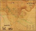
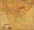
Map of the village of Bucksport, Hancock County, Maine LOC 2007626396.jpg 11,664 × 10,104; 10.34 MB
-
Map of the village of Bucksport, Hancock County, Maine LOC 2007626396.tif 11,664 × 10,104; 337.18 MB
-
Greens Landing, Me. (2675075381).jpg 2,000 × 1,663; 2.3 MB
-
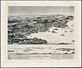
Blue Hill, Maine, 1896. LOC 97687303.jpg 7,152 × 4,312; 4.61 MB
-
Blue Hill, Maine, 1896. LOC 97687303.tif 7,152 × 4,312; 88.23 MB
-
Topographic Map, Acadia National Park, Hancock County, Maine. LOC 99446118.jpg 7,855 × 6,429; 11.81 MB
-
National Wetlands Inventory, (Maine). LOC 99446172.jpg 12,164 × 8,819; 21.8 MB
-
National Wetlands Inventory, (Maine). LOC 99446172.tif 12,164 × 8,819; 306.91 MB
-
Map of Mount Desert Island and the coast of Maine. LOC 98687176.jpg 6,959 × 4,534; 7.89 MB
-
Map of Mount Desert Island and the coast of Maine. LOC 98687176.tif 6,959 × 4,534; 90.27 MB


