Category:Old maps of Guayas Province
Jump to navigation
Jump to search
Media in category "Old maps of Guayas Province"
The following 9 files are in this category, out of 9 total.
-
 BOELEN(1835) T2 p446 KAARD VAN DE WESTKUST VAN COLUMBIA EN PERU.jpg 3,911 × 2,143; 4.2 MB
-
 231 of 'Die Culturländer des alten America' (11127338073).jpg 3,043 × 3,348; 2.35 MB
-
 Carta del Departamento de Guayaquil.jpg 2,474 × 3,936; 3.98 MB
-
 Mapa de la Gobernación de Guayaquil 1.III.1804 - AHG.jpg 3,367 × 2,224; 2.24 MB
-
 Mapa Del Ecuador.jpg 7,200 × 8,969; 22.2 MB
-
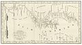
 Perfil Costanero Occidental de las Audiencias de Panamá, Nueva Granada, Quito y Lima - AHG.jpg 2,964 × 4,470; 14.16 MB
-
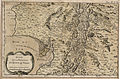 Suroccidente de la Audiencia de Quito - AHG.jpg 2,835 × 1,864; 7.93 MB
-
 The antiquities of Manabi, Ecuador; a preliminary report (1907) (14598291899).jpg 3,675 × 3,197; 878 KB
-
 The antiquities of Manabi, Ecuador; a preliminary report (1907) (14784953675).jpg 3,804 × 3,210; 998 KB
_T2_p446_KAARD_VAN_DE_WESTKUST_VAN_COLUMBIA_EN_PERU.jpg)
.jpg)


_(14598291899).jpg)
_(14784953675).jpg)