Category:Old maps of Grenada
Jump to navigation
Jump to search
Countries of North America: Antigua and Barbuda · The Bahamas · Barbados · Belize · Canada · Costa Rica · Cuba · Dominica · Dominican Republic · El Salvador · Grenada · Guatemala · Haiti · Honduras · Jamaica · Mexico · Nicaragua · Panama · Saint Kitts and Nevis · Saint Lucia · Saint Vincent and the Grenadines · Trinidad and Tobago‡ · United States of America‡
Other territories: Bermuda · Florida Keys · Greenland · Guadeloupe · Martinique · Montserrat · Puerto Rico · Saint Barthélemy · Saint-Martin · Saint Pierre and Miquelon
‡: partly located in North America
Other territories: Bermuda · Florida Keys · Greenland · Guadeloupe · Martinique · Montserrat · Puerto Rico · Saint Barthélemy · Saint-Martin · Saint Pierre and Miquelon
‡: partly located in North America
Subcategories
This category has the following 2 subcategories, out of 2 total.
Media in category "Old maps of Grenada"
The following 24 files are in this category, out of 24 total.
-
A plan of the parish of St. Patrick in the island of Grenada. LOC 2001622464.jpg 4,881 × 3,943; 1.38 MB
-
A plan of the parish of St. Patrick in the island of Grenada. LOC 2001622464.tif 4,881 × 3,943; 55.06 MB
-
Admiralty Chart No 2821 Grenada, Published 1962.jpg 13,619 × 16,429; 47.44 MB
-
Carte de l'isle de la Grenade, pour servir à l'Histoire générale des voyages. LOC 74691489.tif 2,158 × 2,870; 17.72 MB
-
Carte de l'isle de la Grenade. LOC 74691328.jpg 2,448 × 3,333; 1.08 MB
-
Carte de l'isle de la Grenade. LOC 74691328.tif 2,448 × 3,333; 23.34 MB
-
Grenada 1758-15474-01.jpg 1,276 × 1,690; 1.11 MB
-
Grenada 1758-15474-02.jpg 1,942 × 1,361; 393 KB
-
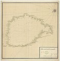
Isle de la Grenade - btv1b53121688m.jpg 6,074 × 3,970; 2.08 MB
-
Isle de la Grenade - btv1b53121898s.jpg 4,792 × 4,934; 2.16 MB
-
Isle de la Grenade - btv1b8494253m.jpg 5,025 × 6,236; 3.76 MB
-
L'Isle de la Grenade.jpg 1,408 × 1,054; 399 KB
-
Plan of the town and fort of Grenada. LOC 74692189.jpg 2,946 × 4,088; 1.71 MB
-
Plan of the town and fort of Grenada. LOC 74692189.tif 2,946 × 4,088; 34.46 MB
-
Port et Fort Royal de la Grenade. LOC 74691486.jpg 2,418 × 3,420; 1.14 MB
-
Port et Fort Royal de la Grenade. LOC 74691486.tif 2,418 × 3,420; 23.66 MB
-
Spherical Map of the Granada Island WDL376.png 1,583 × 1,024; 2.18 MB


