Category:Old maps of Fujian
Jump to navigation
Jump to search
Subcategories
This category has the following 3 subcategories, out of 3 total.
Media in category "Old maps of Fujian"
The following 78 files are in this category, out of 78 total.
-
Da Ming yu di tu LOC 2002626776-14.jpg 9,783 × 8,973; 11.9 MB
-
Da Ming yu di tu LOC 2002626776-14.tif 9,783 × 8,973; 251.15 MB
-
Guang yu tu - er juan LOC 2008623187-30.jpg 4,320 × 4,658; 4.54 MB
-
Guang yu tu - er juan LOC 2008623187-30.tif 4,320 × 4,658; 57.57 MB
-
Guang Yutu 1558 Vol 1 Pg 44 Fujian 1.jpg 4,380 × 4,658; 3.65 MB
-
Fen ye yu tu. LOC 2002626777-15.jpg 4,260 × 5,070; 1.81 MB
-
Fen ye yu tu. LOC 2002626777-15.tif 4,260 × 5,070; 61.79 MB
-
AMH-5187-NA Map of the Pescadores and the west coast of Formosa.jpg 2,400 × 1,875; 558 KB
-
Novvs atlas Sinensis. LOC 2002625249-5.jpg 7,376 × 6,366; 5.18 MB
-
Novvs atlas Sinensis. LOC 2002625249-5.tif 7,376 × 6,366; 134.34 MB
-
"Fokien Imperii Sinarum provincia undecima." (22066426729).jpg 3,503 × 2,972; 2.05 MB
-
169 of 'Behind the Great Wall ... With ... illustrations' (11239296074).jpg 1,357 × 1,977; 465 KB
-
Atlas Van der Hagen-KW1049B13 046-FOKIEN IMPERII SINARVM PROVINCIA VNDECIMA.jpeg 5,500 × 4,638; 4.5 MB
-
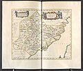
Fokien - Atlas Maior, vol 11, map 23 - Joan Blaeu, 1667 - BL 114.h(star).11.(23).jpg 4,000 × 3,422; 1.99 MB
-
Der Jesuiten-Atlas der Kanghsi-Zeit - China und die Aussenlaender LOC 74650033-30.jpg 6,125 × 7,111; 5.18 MB
-
Der Jesuiten-Atlas der Kanghsi-Zeit - China und die Aussenlaender LOC 74650033-30.tif 6,125 × 7,111; 124.61 MB
-
Fo-Kien Province de Fo-Kien - (par J.-B. d'Anville.) - btv1b8468746m.jpg 5,459 × 6,356; 5.69 MB
-
Province de Fo-kien - (d'Anville) ; Le Parmentier sculp - btv1b59730438.jpg 4,008 × 4,681; 1.81 MB
-
Province de Fo-kien - (tirée du P. Duhalde) - btv1b5963076c.jpg 4,432 × 5,080; 3.57 MB
-
Province de Fo-kien - (tirée du P. Duhalde) ; Le Parmentier Sculp. - btv1b5963075z.jpg 4,072 × 4,800; 2.86 MB
-
Anville Nouvel atlas de la Chine - Page26 Fo kien.jpg 2,848 × 3,368; 3.54 MB
-
Da Qing fen sheng yu tu LOC 2002626726-15.jpg 5,256 × 4,512; 2.38 MB
-
Da Qing fen sheng yu tu LOC 2002626726-15.tif 5,256 × 4,512; 67.85 MB
-
Zhi li ge sheng yu di quan tu - Zhang Zongjing - btv1b53103898v (32 of 69).jpg 5,137 × 4,460; 2.65 MB
-
Fujian quan tu LOC 96685903.jpg 9,358 × 8,560; 8.93 MB
-
Fujian quan tu LOC 96685903.tif 9,358 × 8,560; 229.18 MB
-
Nan yang fen tu. LOC gm71005139.jpg 5,100 × 7,186; 5.22 MB
-
Nan yang fen tu. LOC gm71005139.tif 5,100 × 7,186; 104.85 MB
-
Huang chao zhi sheng di yu quan tu - btv1b531099218 (12 of 38).jpg 6,209 × 4,538; 3.35 MB
-
Tian xia zong yu tu. LOC 2002626780-16.jpg 3,741 × 3,152; 1.17 MB
-
Tian xia zong yu tu. LOC 2002626780-16.tif 3,741 × 3,152; 33.74 MB
-
STANFORD(1917) p19 PLATE 2. FUKIEN (14803676033).jpg 2,336 × 3,612; 2 MB
-
Admiralty Chart No 1760 The Brothers to Ockseu Island, Published 1891.jpg 20,790 × 11,294; 67.52 MB
-
Admiralty Chart No 1957 Hao-Wang Chiao to Hsiung-Ti Tao, Published 1934, New Edition 1954.jpg 16,381 × 11,301; 45.62 MB
-
Admiralty Chart No 1959 Wei-T'ou Ao and Shen-Hu Wan, Published 1849, Large Corrections 1954.jpg 8,247 × 11,259; 17.84 MB
-
Admiralty Chart No 1962 Hongkong to the Brothers, Published 1890 webp.webp 15,719 × 4,094; 159.87 MB
-
AMH-5166-NA Map of China and Formosa.jpg 2,400 × 1,696; 495 KB
-
AMH-7974-KB Map of the bay of Hocsieu.jpg 2,400 × 1,905; 796 KB
-
Bay von Hocsieu.jpg 1,203 × 890; 487 KB
-
Carte des îles Formose (34167570590).jpg 1,200 × 1,028; 624 KB
-
China Wuyishan Tianyou Peak Scenic Spot Map.jpg 2,976 × 3,968; 2.81 MB
-
Du Halde - Description de la Chine - Villes de Kien ning fou et Tchang tai hien.jpg 2,600 × 3,744; 1.66 MB
-
Fokyen.jpg 1,127 × 1,032; 205 KB
-
Japanese Army GSO - 福建省全圖 (Complete Map of Fujian Province) (1882).jpg 7,569 × 8,999; 19.76 MB
-
Lienkianghien.JPG 683 × 619; 110 KB
-
Quantung,Fokien (Coronelli Map of Hong Kong, Formosa).jpg 2,015 × 1,428; 686 KB
-
Txu-oclc-10552568-nf50-2.jpg 5,000 × 3,792; 6.11 MB
-
Txu-oclc-10552568-nf50-3.jpg 5,000 × 3,783; 4.89 MB
-
Txu-oclc-10552568-ng50-12.jpg 5,000 × 3,795; 5.21 MB
-
Txu-oclc-10552568-ng50-15.jpg 5,000 × 3,808; 5.91 MB
-
Txu-oclc-10552568-ng50-16.jpg 5,000 × 3,789; 4.77 MB
-
Txu-oclc-10552568-ng50-3.jpg 5,000 × 3,800; 5.73 MB
-
Txu-oclc-10552568-ng50-4.jpg 5,000 × 3,731; 5.86 MB
-
Txu-oclc-10552568-ng50-7.jpg 5,000 × 3,816; 6.05 MB
-
Txu-oclc-10552568-ng50-8.jpg 5,000 × 3,823; 5.98 MB
-
Txu-oclc-10552568-ng51-1.jpg 5,000 × 3,802; 5.4 MB
-
Txu-oclc-10552568-ng51-5.jpg 5,000 × 3,809; 4.75 MB
-
Vincenzo Maria Coronelli - Quantung, e Fokien, Provincie della China (1696).jpg 7,520 × 5,740; 18.91 MB
-
亚新地学社1936年《袖珍中华全图》--14福建省.jpg 1,544 × 2,146; 789 KB
-
厦门海后滩全图.png 740 × 528; 281 KB
-
水吉县地图.jpg 4,168 × 3,077; 3.45 MB
-
海不揚波圖(廈門) (2).jpg 4,592 × 2,584; 6.52 MB
-
海不揚波圖(廈門) (3).jpg 4,592 × 3,448; 8.26 MB
-
海不揚波圖(廈門).jpg 4,592 × 3,064; 7.44 MB
-
海不揚波圖(漳浦).jpg 4,592 × 2,584; 6.62 MB
-
福建省海岸全图.jpg 65,500 × 3,797; 66.7 MB
-
閩省鹽場全圖.jpg 19,368 × 4,538; 22.86 MB
