Category:Old maps of Earth's hemispheres – orthographic
Jump to navigation
Jump to search
Subcategories
This category has only the following subcategory.
P
Media in category "Old maps of Earth's hemispheres – orthographic"
The following 18 files are in this category, out of 18 total.
-
Afrique spheroidale.jpg 2,128 × 2,433; 825 KB
-
Amerique du Nord spheroidale.jpg 2,141 × 2,461; 831 KB
-
Amerique du Sud spheroidale.jpg 2,120 × 2,484; 744 KB
-
Asie spheroidale.jpg 2,082 × 2,451; 966 KB
-
Durer Stabiussche Weltkarte 1515.jpg 4,223 × 3,306; 1.69 MB
-
Europe spheroidale.jpg 2,085 × 2,459; 946 KB
-
Hemispheres 1922.jpg 1,975 × 2,718; 1.48 MB
-
Mappemonde spheroidale.jpg 4,362 × 3,193; 2.61 MB
-
Maury Geography 026A Europe Asia.jpg 650 × 650; 61 KB
-
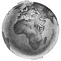
Maury Geography 026B Africa.jpg 650 × 650; 61 KB
-
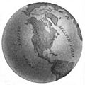
Maury Geography 027A North America.jpg 650 × 650; 54 KB
-
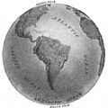
Maury Geography 027B South America.jpg 650 × 650; 49 KB
-
Oceanie spheroidale.jpg 2,149 × 2,424; 744 KB
-
2 photographies d'hémisphères - de M. Silbermann - btv1b550111517 (1 of 2).jpg 3,650 × 4,984; 1.92 MB
-
2 photographies d'hémisphères - de M. Silbermann - btv1b550111517 (2 of 2).jpg 3,947 × 5,074; 2.04 MB
-
Target Berlin (1943).jpg 4,020 × 5,343; 4.23 MB
-
Target Tokyo (1943).jpg 4,015 × 5,339; 4.04 MB
-
World Island, 1944.jpg 5,136 × 3,283; 2.52 MB


