Category:Old maps of Damascus
Jump to navigation
Jump to search
Subcategories
This category has the following 2 subcategories, out of 2 total.
Media in category "Old maps of Damascus"
The following 23 files are in this category, out of 23 total.
-
Opus transmarine peregrinationis (Travels to the Holy Land) (BM 1904,0206.2.8 5).jpg 1,996 × 2,500; 871 KB
-
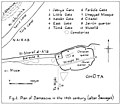
TIB V1 D146 Plan of Damascus in the 14th century.jpg 2,093 × 1,824; 260 KB
-
1752 Damascus detail map Turkish Empire by Moll BPL 17082.png 1,065 × 745; 1.47 MB
-
Heinrich Bünting, Die Stadt Damascus in Syrien (FL169298849 2768184).jpg 7,096 × 4,517; 27.51 MB
-
1855 Damascus map byPorter crop Old City.png 552 × 314; 237 KB
-
1855 Damascus map byPorter.png 1,210 × 732; 827 KB
-
MACCOUN(1899) p109 DAMASCUS.jpg 1,946 × 3,486; 2.71 MB
-
Map Damascus 1958 1-10000.jpg 4,038 × 6,177; 6.19 MB
-
Damascus, Pergamon World Atlas 1967.jpg 530 × 382; 55 KB
-
Sur les chevaux orientaux et provenants des races orientales. T. 3 (5596481).jpg 11,072 × 8,352; 19.88 MB


