Category:Old maps of Changhua
Jump to navigation
Jump to search
中文(臺灣):彰化縣的古地圖
Media in category "Old maps of Changhua"
The following 20 files are in this category, out of 20 total.
-
1684 台灣地理圖.jpg 1,466 × 1,161; 1.18 MB
-
1684 台灣地理圖2.jpg 1,582 × 930; 1.01 MB
-
ChanghuaYuanlinLugangXihuOldmap.jpg 6,328 × 4,494; 4.62 MB
-
Hokutokun Map.jpg 4,617 × 4,118; 1.11 MB
-
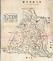
Hunensyou Map.jpg 3,133 × 3,889; 1.1 MB
-
Inrin District 1929.png 1,574 × 1,606; 1.39 MB
-
Old changhua city.jpg 800 × 626; 490 KB
-
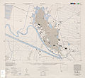
Rokko 1 6000 1944.jpg 4,362 × 3,982; 3.63 MB
-
Sensaisho Map.jpg 2,146 × 1,555; 254 KB
-
Shoka map in 1935.jpg 1,390 × 1,400; 314 KB
-
Shusuisou Map.jpg 1,162 × 1,870; 258 KB
-
Wanggong 1904.jpg 500 × 570; 113 KB
-
Yuanlin-old-map.jpg 613 × 528; 290 KB
-
YuanlinOldmap.jpg 1,276 × 1,879; 240 KB
-
彰化市區域圖 1946.jpg 577 × 396; 152 KB
-
彰化市區擴大計畫 1934.jpg 569 × 413; 210 KB
-
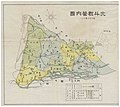
彰化廳管內圖.jpg 2,803 × 3,227; 1.65 MB
-
日據時期台中州圖.jpg 744 × 1,020; 82 KB
-
鹿港街全圖.jpg 3,746 × 3,225; 3.88 MB
-
鹿港街略圖.jpg 4,825 × 3,356; 5.86 MB


