Category:Old maps of Bordeaux
Jump to navigation
Jump to search
Subcategories
This category has only the following subcategory.
Media in category "Old maps of Bordeaux"
The following 72 files are in this category, out of 72 total.
-
Bordeaux dans l'Antiquité par Pierre Lacour.jpg 3,280 × 3,760; 1.43 MB
-
Bordeaux en 1229.jpg 7,304 × 5,944; 5.43 MB
-
Bordeaux en 1450 par Léo Drouyn.jpg 10,672 × 7,488; 12.5 MB
-
Bordeaux Detail 1 (1600).jpg 800 × 600; 162 KB
-
Bordeaux Detail 2 (1600).jpg 800 × 600; 167 KB
-
Bordeaux Detail 3 (1600).jpg 800 × 600; 153 KB
-
Old map of "Bourdeaux".jpg 4,109 × 3,387; 2.48 MB
-
Plan de Bordeaux et de ses environs, par Hippolyte Matis.jpg 3,705 × 4,000; 4.03 MB
-
Plans des ports de France (1777) - Bordeaux.jpg 6,352 × 4,560; 5.33 MB
-
1777-Bordeaux-Belcier.jpg 1,341 × 756; 338 KB
-
Ladors-02.jpg 1,816 × 2,912; 1.3 MB
-
1820-cadastreBordeaux-7A.jpg 1,211 × 596; 133 KB
-
1832 map of Bordeaux.jpg 9,528 × 7,773; 15.1 MB
-
1832 S.D.U.K. Map of Bordeaux, France - Geographicus - Bordeaux-SDUK-1832.jpg 4,000 × 3,313; 3.06 MB
-
Bordeaux 1840.jpg 674 × 551; 235 KB
-
Stadtplan-Bordeaux-1840.jpg 674 × 551; 89 KB
-
514 of 'Histoire politique, religieuse et littéraire des Landes, etc' (11025559935).jpg 1,474 × 2,486; 676 KB
-
Atlas général de la France - Plan de Bordeaux - E. Cortambert.jpg 1,051 × 1,378; 233 KB
-
31 of 'Histoire complète de Bordeaux ... 2e édition. (Supplément.)' (11065469984).jpg 2,224 × 1,526; 977 KB
-
366 of 'Elements of Geology' (11004327276).jpg 567 × 988; 139 KB
-
AM-P1040835.jpg 3,416 × 3,448; 3 MB
-
AM-P1040836.jpg 3,056 × 2,848; 2.19 MB
-
AM-P1040854.jpg 4,608 × 3,456; 4.71 MB
-
Atlante Veneto Volume 2 023.jpg 7,339 × 10,288; 8.32 MB
-
Belcier-P1040828.jpg 3,432 × 4,136; 3.89 MB
-
Belcier-P1040833.jpg 4,608 × 3,456; 4.27 MB
-
Bordeaux - Plan de Bordeaux Fayard-1894.jpg 978 × 742; 287 KB
-
BOrdeaux 1661 Zeiller 15215.jpg 4,197 × 1,694; 4.55 MB
-
Bordeaux ferroviaire XIXe siècle.jpg 1,005 × 729; 371 KB
-
Bordeaux vers 1470 Léo Drouyn encre sur papier, 1893.jpg 358 × 253; 34 KB
-
Cacault-Bordeaux-1756.JPG 3,036 × 2,332; 1.7 MB
-
Capitainerie Brouage Tassin 16920.jpg 4,037 × 2,783; 9.72 MB
-
Cassini 104-deveze.png 1,368 × 768; 1.84 MB
-
Château Trompette 1753.JPG 1,420 × 995; 205 KB
-
Diocèse de Bordeaux - Dressé et gravé par MM Charle ; et Dumortier - btv1b84455703.jpg 7,380 × 9,168; 10.16 MB
-
Frac033063 fi01 j 0001 r.jpg 1,000 × 799; 220 KB
-
HippolyteMathis-1717-Bordeaux-Bègles.jpg 1,346 × 755; 335 KB
-
Ladors-03.jpg 3,208 × 2,400; 2.03 MB
-
Lotissement du Palais Gallien.jpg 505 × 457; 81 KB
-
Plan du palais de l'Ombrière dans le quartier.jpg 964 × 729; 116 KB
-
Plan du palais de l'Ombrière.jpg 903 × 644; 100 KB
-
Plan Bx urb.jpg 777 × 888; 123 KB
-
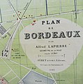
Plan de Bordeaux par Lapierre Alfred.jpg 1,178 × 978; 469 KB
-
Plan de Bordeaux vers 1450 - extrait centré sur la rue Juraïque.png 2,242 × 1,261; 4.35 MB
-
Plan de Bordeaux vers 1800 - extrait centré sur la rue Judaïque.png 746 × 757; 1.07 MB
-
Plan de Bordeaux vers 1835 - extrait centré sur la rue Juraïque.png 871 × 766; 1.19 MB
-
Plan de Bordeaux vers 1850 - extrait centré sur la rue Juraïque.png 1,276 × 1,227; 2.35 MB
-
Plan de Bordeaux vers 1888 - extrait centré sur la rue Juraïque.png 1,862 × 1,789; 4.88 MB
-
Plan de Bordeaux vers 1894 - extrait centré sur la rue Juraïque.png 902 × 874; 1.36 MB
-
Plan de la ville de Bordeaux 1754 - Jacques-Nicolas Bellin - Gallica BNF.jpg 1,456 × 1,054; 551 KB
-
Plan de la ville de Bordeaux, bâtie par les Romains l'an de J.C. 260.jpg 1,289 × 1,600; 797 KB
-
Plan de la ville de Bordeaux-Pierrugues 01.jpg 903 × 1,443; 554 KB
-
Plan de la ville de Bordeaux-Pierrugues 02.jpg 861 × 1,440; 428 KB
-
Plan géométral de la ville Bordeaux-Santin 1755.jpg 1,246 × 952; 466 KB
-
Plan observatoire Bordeaux.jpg 1,043 × 1,257; 230 KB


