Category:Old maps of Banten
Jump to navigation
Jump to search
| NO WIKIDATA ID FOUND! Search for Old maps of Banten on Wikidata | |
| Upload media |
Use the appropriate category for maps showing all or a large part of Category:Banten. See subcategories for smaller areas:
| If the map shows | Category to use |
|---|---|
| Category:Banten on a recently created map | Category:Maps of Banten or its subcategories |
| Category:Banten on a map created more than 70 years ago | Category:Old maps of Banten or its subcategories |
| the history of Category:Banten on a recently created map | Category:Maps of the history of Banten or its subcategories |
| the history of Category:Banten on a map created more than 70 years ago | Category:Old maps of the history of Banten or its subcategories |
Media in category "Old maps of Banten"
The following 31 files are in this category, out of 31 total.
-
Plattegrond van Bantam, 1596, RP-P-OB-80.245.jpg 6,440 × 4,598; 6.94 MB
-
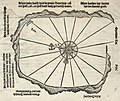
Scharmützel der Stadt Bantam mit den Holländern 1596.jpg 1,189 × 1,136; 417 KB
-
AMH-6630-KB Islands in the bay of Bantam.jpg 2,043 × 2,400; 1.01 MB
-
AMH-6642-KB Bird's eye view of the Bay of Bantam.jpg 2,400 × 1,688; 1.16 MB
-
AMH-6640-KB Views of the bay of Bantam.jpg 2,400 × 2,028; 1.11 MB
-
AMH-6643-KB De Houtman's fleet at anchor near Bantam.jpg 2,400 × 1,445; 1.02 MB
-
Bantam city.jpg 800 × 484; 227 KB
-
Bird’s-eye View of the City of Bantam de Bry.jpg 1,837 × 1,149; 1.12 MB
-
Bantam in 1602.jpg 1,443 × 1,184; 363 KB
-
B26056154G - View of the Bay of Bantam with Houtman's ships.jpg 3,210 × 2,010; 1.69 MB
-
AMH-6467-KB Bird's eye view of Bantam.jpg 2,400 × 1,464; 703 KB
-
AMH-4605-NA Map of the city of Bantam.jpg 2,400 × 1,722; 429 KB
-
AMH-2649-NA Map of part of the coast near Bantam.jpg 2,400 × 1,618; 504 KB
-
AMH-4604-NA Map of the city of Bantam.jpg 2,400 × 1,686; 780 KB
-
Gezicht op de stad Bantam, RP-P-1886-A-11180.jpg 5,578 × 5,150; 5.4 MB
-
AMH-4578-NA Map of the fort at Tangerang.jpg 1,605 × 2,400; 376 KB
-
1717 map of Bantam by Herman Moll.jpg 960 × 1,038; 484 KB
-
Map of Western Java (1718).jpg 1,280 × 1,098; 1.57 MB
-
AMH-7047-KB Map of the fort at Bantam.jpg 2,400 × 2,053; 1.56 MB
-
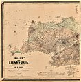
Junghuhn Kaart van het eiland Java - geologische Ausgabe -- Blatt 1.jpg 9,466 × 9,606; 12.69 MB
-
Junghuhns Java-Karte Erstes Blatt.jpg 6,084 × 6,204; 9.07 MB
-
Kaart-van-het-eiland-Java-Westblatt-Wikipedia.jpg 8,477 × 8,605; 11.84 MB
-
Residentie Bantam, KK 014-04-01015-05-07.pdf 2,797 × 2,195, 108 pages; 225.43 MB
-
1909 Atlas sekolah Hindia-Nederland map of Banten.jpg 967 × 725; 114 KB
-
1922-11-1(05)-69-Patilasan Banten.jpg 432 × 504; 58 KB
-
1928 map of Bantam Residency from Schoolatlas van Nederlandsch Indië.jpg 1,985 × 1,224; 389 KB
-
Banten java.jpg 1,549 × 1,140; 1.18 MB
-
Serang-indonesia.jpg 5,000 × 3,795; 4.79 MB


