Category:Old maps of Atlántico Department
Jump to navigation
Jump to search
Media in category "Old maps of Atlántico Department"
The following 6 files are in this category, out of 6 total.
-
 Carta Corografica Del Estado De Bolivar.jpg 6,620 × 8,165; 14.52 MB
-
 Carta Corográfica del Estado de Bolívar (1871).jpg 2,344 × 3,506; 3.57 MB
-
 Carta del Departamento del Magdalena.jpg 4,723 × 5,167; 7.42 MB
-
 Mapa de la Provincia de Cartagena (1787).jpg 3,455 × 5,355; 3.06 MB
-
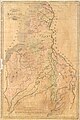
 Mapa del Estado de Bolívar (1864).jpg 236 × 295; 22 KB
-
 Mapa del Estado de Bolívar (1865).jpg 2,784 × 3,520; 2.06 MB

.jpg)

.jpg)
.jpg)
.jpg)