Category:Old maps of Anglo-Saxon England
Jump to navigation
Jump to search
Subcategories
This category has only the following subcategory.
Media in category "Old maps of Anglo-Saxon England"
The following 44 files are in this category, out of 44 total.
-
Map of Saxon England, 1685.jpg 630 × 900; 389 KB
-
Saxon England according to the Saxon Chronicle.jpg 685 × 985; 90 KB
-
George William Collen - Britannia Saxonica.jpg 1,317 × 1,939; 2.22 MB
-
103 of 'History of the English People ... With ... maps' (11118596044).jpg 2,016 × 1,447; 563 KB
-
DanelawEngland.jpg 3,940 × 5,165; 8.87 MB
-
OldMapKent.jpg 410 × 324; 90 KB
-
A short history of England (1904) (14777268112).jpg 1,504 × 2,356; 426 KB
-
Modern history; Europe (1904) (14579083699).jpg 1,716 × 2,892; 1.46 MB
-
Public Schools Historical Atlas - England 1065.jpg 1,307 × 1,732; 723 KB
-
Public Schools Historical Atlas - England 700.jpg 810 × 1,229; 313 KB
-
Public Schools Historical Atlas - England 878.jpg 801 × 1,194; 336 KB
-
Map of England Showing the Anglo-Saxon Kingdoms and Danish Districts.jpg 600 × 904; 136 KB
-
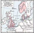
Cnut 1014 1035.jpg 765 × 731; 284 KB
-
Pupil's notebook and study outline in English history (1912) (14764401775).jpg 2,406 × 3,010; 708 KB
-
A history of mediaeval and modern Europe for secondary schools (1914) (14784094092).jpg 1,680 × 2,640; 379 KB
-
A short history of England and the British Empire (1915) (14763988301).jpg 1,832 × 1,816; 599 KB
-
A history of mediæval and modern Europe for secondary schools (1920) (14761214071).jpg 1,354 × 2,074; 244 KB
-
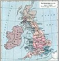
British isles 802.jpg 1,076 × 1,127; 1.29 MB
-
Jutishse.jpg 793 × 420; 97 KB
-
58 of 'History of the English People ... With ... maps' (11119920643).jpg 2,048 × 1,395; 495 KB
-
59 of 'History of the English People ... With ... maps' (11119573706).jpg 2,016 × 1,450; 588 KB
-
A short history of England and the British Empire (1915) (14763975821).jpg 1,824 × 1,304; 437 KB
-
A short history of England and the British Empire (1915) (14787026643).jpg 1,920 × 2,848; 988 KB
-
Angles, Saxons, Jutes in Britain year 600.jpg 1,126 × 810; 301 KB
-
Anglo-Saxon Heptarchy.jpg 1,816 × 3,058; 973 KB
-
Britain in AD500 - Project Gutenberg eText 16790.jpg 606 × 1,000; 102 KB
-
EB1911 - English History - England, 886.jpg 515 × 706; 189 KB
-
Großbritannien BV042518600.jpg 1,954 × 1,337; 302 KB
-
L'émigration bretonne en Armorique.jpg 888 × 1,160; 249 KB
-
MapGB Anglo-Saxon.gif 512 × 593; 41 KB
-
Public School History of England and Canada 005.jpg 6,160 × 4,416; 2.96 MB
-
Public School History of England and Canada 006.jpg 6,080 × 4,416; 2.96 MB
-
Saxonengland.jpg 681 × 877; 77 KB
-
ShepardMap802Northumbria.png 650 × 834; 359 KB
-
Tribal Hidage (1912 map by Brownbill).jpg 840 × 1,301; 166 KB


