
Category:Old county maps of Wales

Subcategories
This category has the following 14 subcategories, out of 14 total.
Media in category "Old county maps of Wales"
The following 6 files are in this category, out of 6 total.
-
 17 of 'Arnold's Geographical Handbooks' (11254154423).jpg 1,228 × 1,928; 623 KB
-
 18 of 'Arnold's Geographical Handbooks' (11252510634).jpg 1,224 × 1,889; 632 KB
-
 Bowes Ryther map playing cards.jpg 750 × 1,153; 317 KB
-
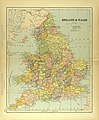 Map of England and Wales.jpg 2,931 × 3,542; 2.37 MB
-
 Wales Administration Map 1947.png 2,250 × 3,610; 1.79 MB
-
 Welsh Constituencies 1832-1868.svg 209 × 232; 290 KB
.jpg)
.jpg)


