Category:Old county maps of Cheshire
Jump to navigation
Jump to search
Ceremonial counties of England: Bedfordshire · Berkshire · Buckinghamshire · Cambridgeshire · Cheshire · Cornwall · Derbyshire · Devon · Dorset · Durham · East Riding of Yorkshire · Essex · Gloucestershire · Hampshire · Herefordshire · Hertfordshire · Kent · Lancashire · Leicestershire · Lincolnshire · Norfolk · Northamptonshire · Northumberland · Nottinghamshire · Oxfordshire · Rutland · Shropshire · Somerset · Staffordshire · Suffolk · Surrey · Warwickshire · Wiltshire · Worcestershire
City-counties:
Former historic counties: Cumberland · Huntingdonshire · Middlesex · North Riding of Yorkshire · Sussex · West Riding of Yorkshire · Westmorland · Yorkshire
Other former counties:
City-counties:
Former historic counties: Cumberland · Huntingdonshire · Middlesex · North Riding of Yorkshire · Sussex · West Riding of Yorkshire · Westmorland · Yorkshire
Other former counties:
Media in category "Old county maps of Cheshire"
The following 29 files are in this category, out of 29 total.
-
Cestria Atlas.jpg 9,211 × 7,118; 21.19 MB
-
William Smith Comitatus Palatinus Cestriae large.png 4,000 × 3,461; 20.33 MB
-
William Smith Comitatus Palatinus Cestriae.jpg 823 × 712; 250 KB
-
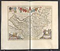
Bodleian Libraries, The Countie Palatine of Chester.jpg 864 × 668; 161 KB
-
Bodleian Libraries, Map- æThe Countie Palatine of ChesterÆ.jpg 1,000 × 770; 147 KB
-
John Speed - Map of Cheshire - 1610 - 001.jpg 3,000 × 2,246; 2.99 MB
-
17th Century map of Cheshire.JPG 3,456 × 2,592; 5.39 MB
-
Cestria Comitatus Palatinus. The County Palatine of Chester - btv1b53056342h (1 of 2).jpg 6,712 × 5,304; 5.22 MB
-
Atlas Van der Hagen-KW1049B11 030-CESTRIA COMITATVS PALATINVS.jpeg 5,500 × 4,208; 3.89 MB
-
Wenceslas Hollar - Cheshire (State 6).jpg 3,023 × 2,401; 2.39 MB
-
"Cestria Comitatus Palatinus" (22072118708).jpg 3,932 × 3,030; 2.19 MB
-
The Country Palatine of Chester with its Hundreds, (BM 1864,1114.34).jpg 2,500 × 1,921; 1.61 MB
-
Maps of England circa 1670, Chester 7 of 40 (13433710295).jpg 6,333 × 4,995; 4.17 MB
-
Cheshire-Morden-1695.jpg 2,977 × 2,508; 4.52 MB
-
Cestria comitatus palatinatus = The Countye Palatine of Chester - CBT 6596485.jpg 5,727 × 4,416; 6.94 MB
-
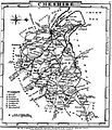
Aikin(1800) p114 - Cheshire.jpg 1,904 × 1,070; 373 KB
-
A topographical dictionary of the United Kingdom (1808) (14781955921).jpg 2,736 × 1,673; 943 KB
-
Gray1824.cheshire.jpg 804 × 936; 149 KB
-
Pigot and Co (1842) p2.018 - Map of Cheshire.jpg 2,144 × 1,310; 937 KB
-
Map of Cheshire 1923.jpg 6,501 × 4,946; 14.17 MB
-
BRITTON(1818) p7 - Cheshire.jpg 3,098 × 2,543; 1.68 MB


