Category:Oklahoma State Highway 51
Appearance
 | number: | (fifty-one) |
|---|---|---|
| State highways in Oklahoma: | 33 · 34 · 37 · 39 · 42 · 44 · 45 · 48 · 49 · 51 · 52 · 53 · 54 · 56 · 58 · 63 · 65 · 66 · 71 |
state highway in Oklahoma, United States | |||||
| Upload media | |||||
| Instance of | |||||
|---|---|---|---|---|---|
| Location | Oklahoma | ||||
| Transport network | |||||
| Owned by | |||||
| Maintained by | |||||
| Inception |
| ||||
| Length |
| ||||
| Terminus | |||||
| |||||
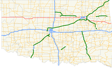
English: Media related to Oklahoma State Highway 51, a major 332.8-mile (535.6 km) east–west state highway in Oklahoma, United States, that runs from Texas to Arkansas and is the third-longest highway in the Oklahoma state highway system.
Subcategories
This category has only the following subcategory.
Pages in category "Oklahoma State Highway 51"
This category contains only the following page.
Media in category "Oklahoma State Highway 51"
The following 4 files are in this category, out of 4 total.
-
060us seiling.jpg 1,125 × 845; 143 KB
-
Oklahoma State Highway 51.svg 385 × 385; 9 KB
-
SH-51, SH-51A intersection Southard, OK.jpg 4,160 × 2,340; 312 KB
-
SH-51A and SH-8A intersection Blaine County, Oklahoma.jpg 4,160 × 2,340; 807 KB


