Category:Oireabhal
Jump to navigation
Jump to search

Oireabhal or Oreval is a 662m high mountain of the Isle of Harris. It is a Marilyn and a Graham.
Subcategories
This category has the following 2 subcategories, out of 2 total.
D
- Distant views of Oireabhal (3 F)
O
- Oireabhal summit (5 F)
Media in category "Oireabhal"
The following 19 files are in this category, out of 19 total.
-
 Above Gleann Mhiabhaig (geograph 5643890).jpg 3,648 × 2,736; 4.16 MB
-
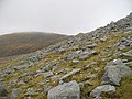 Bouldery slopes, Oireabhal - geograph.org.uk - 1259090.jpg 640 × 480; 102 KB
-
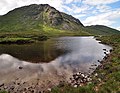 Cathadal Granda - geograph.org.uk - 1376910.jpg 640 × 497; 140 KB
-
 Chliostair power station - geograph.org.uk - 1258574.jpg 640 × 480; 80 KB
-
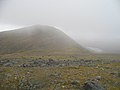
 East ridge of Oireabhal - geograph.org.uk - 1259054.jpg 640 × 359; 86 KB
-
 East ridge, Oireabhal - geograph.org.uk - 1259049.jpg 640 × 359; 79 KB
-
 Footbridge, Gleann Chliostair - geograph.org.uk - 1260263.jpg 640 × 480; 90 KB
-
 Gloraig Tharasaigh - geograph.org.uk - 1258689.jpg 640 × 258; 31 KB
-
 Gneiss slabs, Lag Garbh - geograph.org.uk - 1258671.jpg 640 × 359; 111 KB
-
 Lag Glas Oireabhal - geograph.org.uk - 562822.jpg 640 × 480; 153 KB
-
 Lochans - geograph.org.uk - 836476.jpg 640 × 480; 112 KB
-
 Looking south west from Oireabhal - geograph.org.uk - 1300263.jpg 640 × 480; 42 KB
-
 Outflow, Loch Aiseabhat - geograph.org.uk - 1260267.jpg 640 × 480; 108 KB
-
 Panorama from top of Oireabhal - geograph.org.uk - 1300296.jpg 640 × 121; 14 KB
-
 Penstock from Loch Chliostair dam - geograph.org.uk - 1428979.jpg 640 × 480; 111 KB
-
 Sòdhaigh Beag - geograph.org.uk - 1428998.jpg 640 × 480; 46 KB
-
 Ulabhal from Oireabhal - geograph.org.uk - 1429002.jpg 640 × 480; 61 KB
-
 Ullaval Oreval col - geograph.org.uk - 835770.jpg 640 × 480; 81 KB
-
 Western slopes of Oireabhal - geograph.org.uk - 924585.jpg 640 × 480; 108 KB
.jpg)


