Category:Ogmore Vale
Jump to navigation
Jump to search
village in Bridgend County Borough, Wales, UK  | |||||
| Upload media | |||||
| Instance of | |||||
|---|---|---|---|---|---|
| Location | Ogmore Valley, Bridgend County Borough, Wales | ||||
| Different from | |||||
 | |||||

Cymraeg: Tref a chymuned ym mwrdeistref sirol Pen-y-bont ar Ogwr yw Cwm Ogwr (Saesneg: Ogmore Vale). Saif i'r gogledd o dref Pen-y-bont ar Ogwr, ar Afon Ogwr Fawr. Heblaw Cwm Ogwr ei hun, mae'r gymuned yn cynnwys trefi Nant-y-moel a Price Town. Roedd poblogaeth y gymuned yn 2001 yn 7,800.
Subcategories
This category has the following 2 subcategories, out of 2 total.
Media in category "Ogmore Vale"
The following 33 files are in this category, out of 33 total.
-
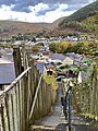 56 steps in Ogmore Vale (geograph 6645063).jpg 2,962 × 3,950; 4.87 MB
-
 A clearing and a view at Ogmore Forest - geograph.org.uk - 1353118.jpg 640 × 436; 103 KB
-

-

-

-
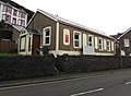 Calvary Baptist Church, High Street, Ogmore Vale - geograph.org.uk - 5884832.jpg 1,024 × 748; 158 KB
-
 Carwyn Jones open access launch.jpg 2,272 × 1,704; 802 KB
-
 Christchurch, Corbett Street, Ogmore Vale - geograph.org.uk - 5884905.jpg 1,024 × 1,007; 261 KB
-
 Classic Valleys terraces - with vehicles - geograph.org.uk - 475418.jpg 640 × 480; 108 KB
-
 Corbett Arms, Bridge Street, Ogmore Vale (geograph 5975139).jpg 1,024 × 758; 191 KB
-
 Cwm y Fuwch (2) - geograph.org.uk - 1291624.jpg 640 × 437; 105 KB
-

-
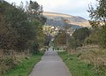 Cycle path in the Ogmore Valley (2) - geograph.org.uk - 3862326.jpg 800 × 571; 302 KB
-
 Cycle path in the Ogmore Valley - geograph.org.uk - 3793223.jpg 640 × 461; 162 KB
-
 Cycle path near Ogmore Vale (geograph 2755041).jpg 640 × 480; 77 KB
-
 Hillside above Ogmore Vale - geograph.org.uk - 475424.jpg 640 × 480; 101 KB
-
-
 In Ogmore Vale - geograph.org.uk - 1019414.jpg 640 × 488; 83 KB
-
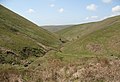
 Moorland valley - geograph.org.uk - 979829.jpg 640 × 480; 107 KB
-
 North along cycle route 883, Ogmore Vale (geograph 5975424).jpg 1,024 × 905; 244 KB
-
-
 Ogmore Vale Bowls Club bowling green (geograph 6194137).jpg 1,546 × 1,600; 590 KB
-
 Ogmore Vale Constitutional Club - geograph.org.uk - 5885432.jpg 1,006 × 1,024; 207 KB
-
 Ogmore Vale Convenience Store (geograph 5974792).jpg 1,024 × 755; 176 KB
-
 Ogmore Vale Fire Station - geograph.org.uk - 460869.jpg 640 × 427; 211 KB
-
 Ogmore Vale Non Political Club - geograph.org.uk - 5884827.jpg 1,024 × 688; 104 KB
-
 Recreation ground in Ogmore Vale - geograph.org.uk - 1019404.jpg 640 × 480; 91 KB
-
 Rugby ground, Ogmore Vale - geograph.org.uk - 4214444.jpg 640 × 476; 154 KB
-
 Standing at Caedu Box (geograph 3905896).jpg 1,600 × 1,052; 449 KB
-
 Terraced housing in Ogmore Vale - geograph.org.uk - 968254.jpg 640 × 480; 74 KB
-
 Terraced street, Ogmore Vale - geograph.org.uk - 1019411.jpg 640 × 480; 80 KB
-
 Wyndham From Cwm Ogwr Fawr - geograph.org.uk - 480446.jpg 640 × 480; 103 KB
-

.jpg)


.jpg)
_-_geograph.org.uk_-_1291624.jpg)

_-_geograph.org.uk_-_3862326.jpg)

.jpg)


.jpg)

.jpg)

.jpg)


.jpg)


