Category:Offord Cluny and Offord D'Arcy
Jump to navigation
Jump to search
civil parish and group of villages in Huntingdonshire, Cambridgeshire, England | |||||
| Upload media | |||||
| Instance of | |||||
|---|---|---|---|---|---|
| Named after | |||||
| Location | Huntingdonshire, Cambridgeshire, East of England, England | ||||
| Population |
| ||||
 | |||||
Subcategories
This category has the following 2 subcategories, out of 2 total.
O
Media in category "Offord Cluny and Offord D'Arcy"
The following 133 files are in this category, out of 133 total.
-
 A bend in the B1043 - geograph.org.uk - 4530692.jpg 640 × 480; 66 KB
-
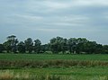
 A line of trees near Offord D'Arcy - geograph.org.uk - 2371803.jpg 640 × 395; 31 KB
-

-

-
 A14 link road - geograph.org.uk - 5555395.jpg 4,032 × 2,268; 1.45 MB
-
 A14 over East Coast Main Line - geograph.org.uk - 6295875.jpg 1,600 × 1,067; 187 KB
-
 Alison Lane, Offord D'Arcy - geograph.org.uk - 6245682.jpg 1,920 × 1,280; 1.22 MB
-
 All Saints' Church - geograph.org.uk - 5954770.jpg 2,000 × 1,334; 2.3 MB
-

-
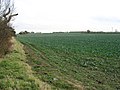
 Arable fields near Godmanchester - geograph.org.uk - 4001255.jpg 1,600 × 971; 137 KB
-
 Black bales near Offord - geograph.org.uk - 876334.jpg 640 × 562; 55 KB
-
 Bridge over Offord Weir 2 - geograph.org.uk - 4093563.jpg 1,600 × 1,200; 1,014 KB
-
 Bridleway past ripe wheat - geograph.org.uk - 4095039.jpg 1,600 × 1,200; 799 KB
-
 Cottage at Offord Hill - geograph.org.uk - 3094893.jpg 640 × 479; 35 KB
-
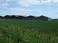 Cotton Farm - geograph.org.uk - 4511383.jpg 640 × 480; 81 KB
-
 Cotton Farm Wind Farm - geograph.org.uk - 5527297.jpg 1,024 × 768; 183 KB
-
 Cotton Farm, Graveley - geograph.org.uk - 2693881.jpg 2,592 × 1,944; 1.75 MB
-
 Crop field near Cotton Farm - geograph.org.uk - 4530708.jpg 640 × 480; 85 KB
-
 Crop field near Offord Cluny - geograph.org.uk - 4530872.jpg 640 × 480; 67 KB
-
 Crop field near Offord D'Arcy - geograph.org.uk - 4530702.jpg 640 × 480; 81 KB
-
 Crop field off Graveley Road - geograph.org.uk - 4511381.jpg 640 × 480; 105 KB
-
 Crop field off the B1043 - geograph.org.uk - 4530689.jpg 640 × 480; 117 KB
-
 Crop field, Great Parlow Close - geograph.org.uk - 4511385.jpg 640 × 480; 94 KB
-
 Dead tree near Offord D'Arcy - geograph.org.uk - 2395814.jpg 640 × 347; 23 KB
-
 Ditch and field boundary - geograph.org.uk - 4196918.jpg 640 × 430; 52 KB
-
 Ditch north of Offord Cluny - geograph.org.uk - 2395817.jpg 640 × 430; 29 KB
-
 East Coast Main Line from A14 - geograph.org.uk - 6295538.jpg 1,600 × 1,079; 311 KB
-

-

-
 Entering Offord Cluny - geograph.org.uk - 4530870.jpg 640 × 480; 49 KB
-
 Entering Offord D'Arcy - geograph.org.uk - 4530694.jpg 640 × 480; 99 KB
-
 Farm land near to Offord D'Arcy - geograph.org.uk - 3481733.jpg 4,320 × 3,240; 3.34 MB
-
 Farm track at Cotton Lane - geograph.org.uk - 2693880.jpg 2,592 × 1,944; 1.3 MB
-
 Farm track off Graveley Road - geograph.org.uk - 1655720.jpg 640 × 480; 102 KB
-
 Farm track off Graveley Road - geograph.org.uk - 4530706.jpg 640 × 480; 72 KB
-
 Farm Track to Level Crossing - geograph.org.uk - 1655669.jpg 640 × 480; 74 KB
-
 Farmland near Offord Cluny - geograph.org.uk - 3102068.jpg 800 × 592; 66 KB
-
 Farmland near Whitwell Farm - geograph.org.uk - 3102069.jpg 640 × 457; 54 KB
-
 Farmland north of Offord Cluny - geograph.org.uk - 4576264.jpg 1,600 × 1,064; 263 KB
-
 Fields near Offord D'Arcy - geograph.org.uk - 2693877.jpg 2,592 × 1,944; 1.91 MB
-
 Flat farmland - geograph.org.uk - 4196916.jpg 640 × 430; 39 KB
-

-
 Foot crossing over East Coast Main Line - geograph.org.uk - 2580776.jpg 3,000 × 4,000; 4.4 MB
-
 Footpath to Offord Cluny - geograph.org.uk - 4093596.jpg 1,600 × 1,200; 1,014 KB
-
 Graveley Airfield commemorative plaque - geograph.org.uk - 2693884.jpg 2,592 × 1,944; 1.58 MB
-
 Graveley airfield memorial - geograph.org.uk - 3181588.jpg 1,024 × 685; 275 KB
-
 Graveley Road - geograph.org.uk - 1655700.jpg 640 × 480; 81 KB
-
 Graveley Road - geograph.org.uk - 1655823.jpg 640 × 480; 82 KB
-
 Graveley Road - geograph.org.uk - 4530705.jpg 640 × 480; 82 KB
-
 Graveley Road - geograph.org.uk - 4530709.jpg 640 × 480; 84 KB
-
 Graveley Road, Offord D'Arcy - geograph.org.uk - 4530700.jpg 640 × 480; 69 KB
-
 Graveley wartime airfield memorial - geograph.org.uk - 6420080.jpg 4,608 × 3,072; 5.97 MB
-
 Graveley wartime airfield memorial - geograph.org.uk - 6420081.jpg 4,608 × 3,072; 4.19 MB
-
 Great Ouse Viaduct - geograph.org.uk - 6295907.jpg 1,600 × 1,067; 235 KB
-
 High Street (B1043), Offord D'Arcy - geograph.org.uk - 4530699.jpg 640 × 480; 68 KB
-
 High Street, Offord D'Arcy - geograph.org.uk - 3482355.jpg 4,320 × 3,240; 2.87 MB
-
 High Street, Offord D'Arcy - geograph.org.uk - 6245681.jpg 1,868 × 1,198; 1.22 MB
-

-
 Houses in Offord D'Arcy, from the railway - geograph.org.uk - 4716959.jpg 1,600 × 582; 142 KB
-

-
 Houses, Offord Cluny - geograph.org.uk - 4196919.jpg 640 × 321; 34 KB
-
 Land near the River Great Ouse - geograph.org.uk - 3102072.jpg 640 × 385; 46 KB
-
 Land towards the River Great Ouse - geograph.org.uk - 3102073.jpg 640 × 423; 49 KB
-
 Leaving Offord D'Arcy - geograph.org.uk - 2693874.jpg 2,592 × 1,944; 1.16 MB
-
 Leaving Offord D'Arcy - geograph.org.uk - 4530701.jpg 640 × 480; 73 KB
-

-
-
 Level crossing, Offord Cluny - geograph.org.uk - 3102071.jpg 640 × 457; 54 KB
-
 Lineside at Offord Cluny - geograph.org.uk - 2586869.jpg 4,000 × 3,000; 4.04 MB
-
 Lineside at Offord Cluny - geograph.org.uk - 2586870.jpg 4,000 × 3,000; 4.46 MB
-
 Looking across the B1043 - geograph.org.uk - 4119828.jpg 4,000 × 3,000; 4.11 MB
-
 Looking towards Offord D'Arcy - geograph.org.uk - 4121115.jpg 4,000 × 3,000; 4.12 MB
-
 Manor House, Offord Cluny - geograph.org.uk - 3341179.jpg 640 × 415; 157 KB
-
 Mobile phone mast - geograph.org.uk - 4095091.jpg 1,200 × 1,600; 636 KB
-
 Mobile phone mast by the bridleway - geograph.org.uk - 4095096.jpg 1,600 × 1,200; 788 KB
-
 Offord D'Arcy - geograph.org.uk - 4196924.jpg 640 × 322; 32 KB
-
 Offord D'Arcy Cemetery - geograph.org.uk - 4511380.jpg 640 × 480; 102 KB
-
 Offord Weir 2 - geograph.org.uk - 4093581.jpg 1,600 × 1,200; 1.01 MB
-
 Old house in Offord D'Arcy - geograph.org.uk - 4530697.jpg 640 × 480; 79 KB
-
 Park Way, Offord Cluny - geograph.org.uk - 4093612.jpg 1,600 × 1,200; 690 KB
-
 Pathfinder Long Distance Walk - geograph.org.uk - 4095034.jpg 1,600 × 1,200; 826 KB
-
 Pathfinder Memorial - geograph.org.uk - 1467664.jpg 640 × 480; 284 KB
-
 Pathfinder path towards Godmanchester - geograph.org.uk - 4095028.jpg 1,600 × 1,200; 787 KB
-
 Paxton Road - geograph.org.uk - 4119822.jpg 4,000 × 3,000; 3.98 MB
-
 Paxton Road, Offord D'Arcy - geograph.org.uk - 6252707.jpg 1,920 × 1,280; 1.09 MB
-
 Pippin Close, Offord D'Arcy - geograph.org.uk - 6245680.jpg 1,890 × 1,234; 1.28 MB
-
 Powerlines - geograph.org.uk - 2042254.jpg 640 × 480; 39 KB
-
 Prairie like landscape - geograph.org.uk - 4196914.jpg 640 × 430; 40 KB
-
 Ripe wheat field - geograph.org.uk - 4095042.jpg 1,600 × 1,200; 915 KB
-
 River Great Ouse - geograph.org.uk - 4093628.jpg 1,600 × 1,200; 630 KB
-
 River Great Ouse - geograph.org.uk - 4093753.jpg 1,600 × 1,200; 802 KB
-
 River Great Ouse - geograph.org.uk - 4093788.jpg 1,600 × 1,200; 672 KB
-
 River Great Ouse near Offord Cluny - geograph.org.uk - 4093589.jpg 1,600 × 1,200; 766 KB
-
 River Great Ouse, Offord Cluny - geograph.org.uk - 4530904.jpg 640 × 480; 71 KB
-
 Road bridge near Offord - geograph.org.uk - 2098531.jpg 3,648 × 2,736; 2.21 MB
-
 Road bridge over the River Great Ouse at Offord Cluny - geograph.org.uk - 2693860.jpg 2,592 × 1,944; 2.66 MB
-
 Runoff pond by new A14 - geograph.org.uk - 6295883.jpg 1,600 × 1,067; 359 KB
-

-
-
 Station Lane, crossing branch of River Great Ouse - geograph.org.uk - 4093621.jpg 1,600 × 1,200; 701 KB
-
 Thatched cottage, Offord Cluny - geograph.org.uk - 4530875.jpg 640 × 480; 56 KB
-
-
 The harvest is nearly ready - geograph.org.uk - 2513192.jpg 1,024 × 768; 112 KB
-
 The Horseshoe Inn, Offord D'Arcy - geograph.org.uk - 3482359.jpg 4,320 × 3,240; 2.89 MB
-
 The Old Flour Mills - geograph.org.uk - 4019055.jpg 1,600 × 1,200; 397 KB
-
 The Pathfinder Long Distance Walk - geograph.org.uk - 4511386.jpg 640 × 480; 72 KB
-
 The River Ouse - Offord Cluny - geograph.org.uk - 1890877.jpg 1,500 × 996; 1.31 MB
-
 The River Ouse - Offord Cluny - geograph.org.uk - 1890878.jpg 1,500 × 996; 1.63 MB
-
 The road to Graveley - geograph.org.uk - 4121063.jpg 4,000 × 3,000; 4.32 MB
-
 The road to Offord D'Arcy - geograph.org.uk - 4121060.jpg 4,000 × 3,000; 4.25 MB
-
 The road to Offord D'Arcy - geograph.org.uk - 4121068.jpg 4,000 × 3,000; 3.85 MB
-
 The Swan, Offord Cluny - geograph.org.uk - 4513001.jpg 640 × 404; 42 KB
-

-
 Track off Paxton Road - geograph.org.uk - 1655933.jpg 640 × 480; 108 KB
-
 Tree by Great Ouse - geograph.org.uk - 4093771.jpg 1,600 × 1,200; 602 KB
-
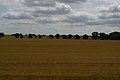
 Treeline near Offord D'Arcy - geograph.org.uk - 4121086.jpg 4,000 × 3,000; 4.18 MB
-

-
 Up mineral at Offord ^ Buckden, ECML 1955 - geograph.org.uk - 4857402.jpg 2,399 × 1,315; 2.02 MB
-
 Very large and very flat - geograph.org.uk - 4196915.jpg 640 × 430; 38 KB
-

-

-

-

-
 View from the road to Offord D'Arcy - geograph.org.uk - 4121075.jpg 4,000 × 3,000; 4.04 MB
-

-
 View up Offord Hill from the railway - geograph.org.uk - 4576268.jpg 1,600 × 1,064; 257 KB
-

-
 Wall surrounding cricket ground, Offord D'Arcy - geograph.org.uk - 3481749.jpg 4,320 × 3,240; 2.87 MB
-
 Waterloo Farm near the Offords - geograph.org.uk - 1923462.jpg 3,648 × 2,736; 2.12 MB
-
 Which way - geograph.org.uk - 1965753.jpg 3,648 × 2,736; 2.12 MB
-
 Whitwell House - geograph.org.uk - 4019051.jpg 1,600 × 1,200; 391 KB
-
 Wind farm near Graveley - geograph.org.uk - 3481705.jpg 4,320 × 3,240; 3.01 MB
-
 Wind turbines, near Graveley - geograph.org.uk - 5504269.jpg 1,600 × 1,067; 620 KB


,_Offord_D%27Arcy_-_geograph.org.uk_-_4530699.jpg)


