Category:Oeno Atoll
Jump to navigation
Jump to search
atoll in the Pitcairn Islands, British Overseas Territories | |||||
| Upload media | |||||
| Instance of | |||||
|---|---|---|---|---|---|
| Part of | |||||
| Location | Pitcairn Islands, British overseas territories, Britain | ||||
| Located in or next to body of water | |||||
| Time of discovery or invention |
| ||||
| Area |
| ||||
| Elevation above sea level |
| ||||
 | |||||
Media in category "Oeno Atoll"
The following 10 files are in this category, out of 10 total.
-
Admiralty Chart No 987 Plans of Islands in the South Pacific, Published 1873.jpg 8,458 × 11,138; 24.75 MB
-
LocationOeno.PNG 250 × 158; 5 KB
-
Murphy's petrel, Ducie island2.jpg 5,000 × 3,200; 1,007 KB
-
Oeno Atoll Island Map mk.svg 1,241 × 902; 1.36 MB
-
Oeno Atoll Island Map.jpg 1,240 × 902; 193 KB
-
Oeno Atoll Island Map.svg 1,241 × 902; 1.36 MB
-
Oeno Atoll ISS002.jpg 1,500 × 1,000; 176 KB
-
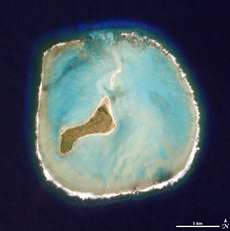
Oenosatellite.jpg 530 × 532; 41 KB
-
Oenosatellite.png 530 × 532; 298 KB
-
W W oeno island atol.png 1,024 × 677; 418 KB


