Category:October 2008 in Lincolnshire
Jump to navigation
Jump to search
Ok
Deutsch: Bilder, die im Oktober 2008 in Lincolnshire aufgenommen worden sind. Bitte beachten Sie, dass dies weder das Datum des Uploads noch das Datum des Scannens eines Fotos ist.
English: Images/pictures taken in Lincolnshire during October 2008. Note this is not the date of the upload, nor the date a photo was scanned.
Español: Fotografías o imágenes tomadas en Lincolnshire durante octubre 2008. No es la fecha de subida ni escaneo, sino la fecha en que las fotografías o imágenes se crearon.
Esperanto: Bildoj faritaj en Lincolnshire en oktobro 2008. Tio ne estas la dato, kiam la bildoj estis alŝutitaj aŭ skanitaj.
Français : Photographies ou images prises en Lincolnshire durant octobre 2008. Ce n'est pas la date du téléchargement ou du scan.
Galego: Fotografías ou imaxes tomadas en Lincolnshire durante outubro 2008. Non é a data de subida nin escaneamento, senón a data na que se crearon as fotografías ou imaxes.
Italiano: Fotografie o immagini scattate a Lincolnshire nel ottobre 2008. Nota bene: la data non si riferisce né a quella di upload né a quella in cui la foto è stata digitalizzata.
Norsk bokmål: Bilder tatt i Lincolnshire i løpet av oktober 2008. Merk at dette ikke er datoen for opplasting, eller når et bilde har blitt skannet.
Norsk nynorsk: Bilete teke i Lincolnshire i løpet av oktober 2008. Merk at dette ikkje er datoen for opplasting, eller når eit bilete har vorte skanna.
Русский: Изображения, сделанные в Lincolnshire в течение октябрь 2008 (не дата загрузки изображения).
Українська: Зображення, зроблені в Lincolnshire протягом жовтень 2008. Зауважте, що це не дата завантаження чи дата сканування фотографії.
| October 2007 | ← | October 2008 | → | October 2009 | |||||||
| Jan | Feb | Mar | Apr | May | Jun | Jul | Aug | Sep | Oct | Nov | Dec |
| 154 | 48 | 36 | 59 | 41 | 98 | 99 | 120 | 81 | 146 | 141 | 22 |
|---|---|---|---|---|---|---|---|---|---|---|---|
Subcategories
This category has the following 10 subcategories, out of 10 total.
0
1
2
Media in category "October 2008 in Lincolnshire"
The following 136 files are in this category, out of 136 total.
-
 'Private' road in West Lincolnshire - geograph.org.uk - 1031307.jpg 640 × 425; 43 KB
-
 A strange epitaph..... - geograph.org.uk - 1030814.jpg 481 × 640; 127 KB
-
 Rauceby railway station house in 2008.jpg 640 × 480; 74 KB
-
 Rauceby railway station signal box in 2008.jpg 640 × 480; 60 KB
-
 Train at Rauceby railway station in 2008.jpg 640 × 480; 96 KB
-
 Waiting for the Train - geograph.org.uk - 992845.jpg 640 × 480; 98 KB
-
 Water ski club lake, near Barrow Haven - geograph.org.uk - 993832.jpg 624 × 640; 199 KB
-
 The Corn is as High as an Elephant's Eye - geograph.org.uk - 997841.jpg 640 × 425; 122 KB
-
 Blackfriars Arts Centre plaque - geograph.org.uk - 997509.jpg 640 × 620; 164 KB
-
 Blackfriars Theatre - geograph.org.uk - 997345.jpg 640 × 427; 74 KB
-
 Little Peacock Inn - geograph.org.uk - 997717.jpg 640 × 427; 71 KB
-
 Old Schoolmasters House - geograph.org.uk - 997339.jpg 640 × 427; 80 KB
-
 Wormgate - geograph.org.uk - 997725.jpg 640 × 427; 75 KB
-
 Harts Grounds - geograph.org.uk - 997908.jpg 640 × 427; 60 KB
-
 North Forty Foot Bank - geograph.org.uk - 997915.jpg 640 × 427; 87 KB
-
 Lay-by, West Deeping - geograph.org.uk - 997287.jpg 640 × 480; 66 KB
-
 Water Mill - geograph.org.uk - 997288.jpg 640 × 480; 82 KB
-
 Booth Nooking Lane - geograph.org.uk - 1006558.jpg 640 × 426; 180 KB
-
 Copse or Fox Covert on Elsham Wold - geograph.org.uk - 1004796.jpg 640 × 471; 113 KB
-
 Hanging Dales - geograph.org.uk - 1004825.jpg 640 × 427; 50 KB
-
 Approaching Burnham Crossroads - geograph.org.uk - 1005006.jpg 640 × 481; 129 KB
-
 Farmland near Two Mile Bank Drain - geograph.org.uk - 1010223.jpg 640 × 457; 146 KB
-
 Barton Haven - geograph.org.uk - 1011289.jpg 640 × 480; 81 KB
-
 Holydyke - A1077 - geograph.org.uk - 1011261.jpg 640 × 480; 100 KB
-
 Holydyke - A1077 - geograph.org.uk - 1011270.jpg 640 × 480; 99 KB
-
 Humber Foreshore Reedbed - geograph.org.uk - 1011298.jpg 480 × 640; 97 KB
-
 Bridge at Route 64 - geograph.org.uk - 1011077.jpg 640 × 480; 88 KB
-
 Bridge over Route 64 - geograph.org.uk - 1011069.jpg 640 × 475; 109 KB
-
 Crowle village sign - geograph.org.uk - 1013892.jpg 640 × 480; 93 KB
-
 Ealand Gate Restaurant - geograph.org.uk - 1013901.jpg 640 × 480; 73 KB
-
 The New Trent - geograph.org.uk - 1013873.jpg 640 × 332; 56 KB
-

-
 Cultivating on the Wolds - geograph.org.uk - 1014264.jpg 640 × 427; 74 KB
-
 Cultivating on the Wolds - geograph.org.uk - 1014276.jpg 640 × 427; 78 KB
-
 The Joseph Bentley Site - geograph.org.uk - 990145.jpg 640 × 380; 90 KB
-
 Thornton Abbey, Level Crossing - geograph.org.uk - 990153.jpg 640 × 480; 88 KB
-

-
 The Road to Barton Upon Humber - geograph.org.uk - 993668.jpg 640 × 428; 92 KB
-
 The Road to Saxby All Saints - geograph.org.uk - 994246.jpg 640 × 480; 97 KB
-
 Lane, near Barrow - geograph.org.uk - 994345.jpg 480 × 640; 209 KB
-
 Power Lines crossing Horkstow Wolds - geograph.org.uk - 994258.jpg 640 × 425; 87 KB
-
 Barrow Blow Wells Nature Reserve - geograph.org.uk - 996452.jpg 640 × 425; 92 KB
-
 The Bridge over the Beck - geograph.org.uk - 996439.jpg 640 × 425; 99 KB
-
-
 The Beck flowing towards Barrow Haven - geograph.org.uk - 996477.jpg 640 × 425; 71 KB
-
 West Hann Lane - geograph.org.uk - 997857.jpg 640 × 425; 95 KB
-
 Stowe Road- King Street Crossroads - geograph.org.uk - 997279.jpg 640 × 480; 81 KB
-
 Remains of Hudson's Mill - geograph.org.uk - 997254.jpg 640 × 480; 55 KB
-
 Barrow Beck - geograph.org.uk - 1006510.jpg 640 × 425; 85 KB
-
 Ploughing near Down Hall - geograph.org.uk - 998615.jpg 640 × 425; 111 KB
-
 Swans on Barrow Beck - geograph.org.uk - 1006490.jpg 640 × 417; 108 KB
-
 The Footbridge over Barrow Beck - geograph.org.uk - 1006477.jpg 640 × 425; 122 KB
-

-
-
 West Hann Farm - geograph.org.uk - 1006456.jpg 640 × 425; 100 KB
-

-
 Haven Road, North Killingholme - geograph.org.uk - 1003447.jpg 640 × 387; 69 KB
-

-
 Humber Bank Public Footpath - geograph.org.uk - 1001608.jpg 640 × 425; 87 KB
-
 Humber Foreshore and Dredger - geograph.org.uk - 1007853.jpg 640 × 425; 67 KB
-

-
 Great Eau Footbridge - geograph.org.uk - 1003508.jpg 640 × 480; 88 KB
-
 Walking to Gayton le Marsh - geograph.org.uk - 1003530.jpg 640 × 480; 70 KB
-
 Drain and Field near Gayton le Marsh - geograph.org.uk - 1003383.jpg 480 × 640; 56 KB
-
 Bulrush Lake - geograph.org.uk - 1005905.jpg 640 × 480; 90 KB
-
 Nature Park - geograph.org.uk - 1005892.jpg 640 × 480; 80 KB
-
 Footbridge Over Great Eau - geograph.org.uk - 1003477.jpg 640 × 480; 82 KB
-

-
 Two Bridges - geograph.org.uk - 1003517.jpg 640 × 480; 95 KB
-

-
 Wooded Gatekeepers - geograph.org.uk - 1003536.jpg 640 × 480; 82 KB
-
 Harston Road - geograph.org.uk - 1030072.jpg 640 × 427; 63 KB
-
 John Blyth tomb - geograph.org.uk - 1028745.jpg 427 × 640; 92 KB
-
 Leys House - geograph.org.uk - 1028707.jpg 640 × 427; 110 KB
-
 Perpendicular capital - geograph.org.uk - 1028832.jpg 640 × 427; 53 KB
-
 Richard Welby memorial - geograph.org.uk - 1028851.jpg 427 × 640; 85 KB
-
 South doorway - geograph.org.uk - 1028861.jpg 427 × 640; 56 KB
-
 South doorway - geograph.org.uk - 1028865.jpg 427 × 640; 53 KB
-
 St.Andrew's chancel - geograph.org.uk - 1028752.jpg 640 × 427; 74 KB
-
 St.Andrew's church - geograph.org.uk - 1015897.jpg 640 × 427; 53 KB
-
 St.Andrew's font - geograph.org.uk - 1028762.jpg 427 × 640; 75 KB
-
 St.Andrew's nave - geograph.org.uk - 1028827.jpg 640 × 427; 94 KB
-
 St.Andrew's reredos - geograph.org.uk - 1028840.jpg 640 × 427; 103 KB
-
 Welby putto - geograph.org.uk - 1028854.jpg 427 × 640; 66 KB
-
 Welby putto - geograph.org.uk - 1028858.jpg 427 × 640; 69 KB
-
 Middlegate Lane near Horkstow - geograph.org.uk - 1013184.jpg 640 × 427; 65 KB
-
-
 Two Mile Bank Drain - geograph.org.uk - 1010206.jpg 457 × 640; 143 KB
-
 Two Mile Bank Drain - geograph.org.uk - 1010276.jpg 640 × 457; 149 KB
-
 Autumn cultivations Gayton Le Marsh - geograph.org.uk - 1010266.jpg 640 × 457; 136 KB
-

-
 Farmland near Two Mile Bank Drain - geograph.org.uk - 1010213.jpg 640 × 457; 154 KB
-
 Farmland near Walk Farm. - geograph.org.uk - 1010290.jpg 640 × 457; 142 KB
-
 Saltfleetby National Nature Reserve - geograph.org.uk - 1038298.jpg 640 × 457; 142 KB
-
 Saltfleetby National Nature Reserve - geograph.org.uk - 1038303.jpg 640 × 458; 133 KB
-
 Saltfleetby National Nature Reserve - geograph.org.uk - 1038309.jpg 640 × 457; 158 KB
-
 Protected Roadside Verge - geograph.org.uk - 1012672.jpg 640 × 480; 127 KB
-
 Julian's Bower - geograph.org.uk - 1019903.jpg 640 × 427; 74 KB
-
 St.John the Baptist's tower - geograph.org.uk - 1019868.jpg 427 × 640; 94 KB
-
 The Royal Hotel - geograph.org.uk - 1017898.jpg 640 × 427; 67 KB
-
 Footpath to Alkborough - geograph.org.uk - 1018356.jpg 640 × 427; 72 KB
-
 St.Ethelreda's church - geograph.org.uk - 1019919.jpg 640 × 427; 81 KB
-
 St.Ethelreda's church - geograph.org.uk - 1019926.jpg 640 × 427; 71 KB
-
 South Holland Main Drain 2 - geograph.org.uk - 1024418.jpg 640 × 480; 78 KB
-
 New fingerpost - geograph.org.uk - 1018228.jpg 640 × 427; 72 KB
-
 Laughton Forest - geograph.org.uk - 1028370.jpg 640 × 427; 87 KB
-
 Laughton Forest - geograph.org.uk - 1024195.jpg 640 × 427; 138 KB
-
 Laughton Forest - geograph.org.uk - 1024199.jpg 640 × 427; 128 KB
-
 Laughton Forest - geograph.org.uk - 1024203.jpg 640 × 427; 116 KB
-
 Disused pigsties - geograph.org.uk - 1028377.jpg 640 × 427; 101 KB
-
 Barrow Haven Railway Bridge - geograph.org.uk - 1027531.jpg 640 × 480; 113 KB
-
 The Beck at Barrow Haven - geograph.org.uk - 1028536.jpg 640 × 480; 99 KB
-
 Wainfleet Haven - geograph.org.uk - 1025780.jpg 640 × 475; 21 KB
-

-
 The Car Park at Chowder Ness - geograph.org.uk - 1023877.jpg 640 × 480; 95 KB
-
 TV and Computer Monitor Recycling Pen - geograph.org.uk - 1025508.jpg 640 × 480; 105 KB
-
 ASDA Grantham - geograph.org.uk - 1008953.jpg 640 × 463; 53 KB
-
 Carline Road - geograph.org.uk - 1026639.jpg 640 × 427; 86 KB
-
 Chain Home Transmitter Mast - geograph.org.uk - 1469559.jpg 480 × 640; 31 KB
-
 Haven Hulks - geograph.org.uk - 997627.jpg 427 × 640; 96 KB
-
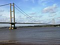 Humber Bridge - geograph.org.uk - 1028625.jpg 640 × 480; 55 KB
-
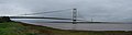 Humber Bridge Panorama October 2008.jpg 11,129 × 2,972; 12.51 MB
-
 Randall Bank - geograph.org.uk - 1024421.jpg 640 × 480; 82 KB
-
 Randall Bank, near Bridge Farm - geograph.org.uk - 1017710.jpg 640 × 480; 91 KB
-
 River Witham and The Junxion - geograph.org.uk - 1000930.jpg 640 × 427; 91 KB
-
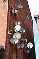 Satellite dishes - geograph.org.uk - 997536.jpg 427 × 640; 82 KB
-
 South Bank Petrol Station - geograph.org.uk - 1005065.jpg 640 × 458; 69 KB
-
 South Holland Main Drain 1 - geograph.org.uk - 1024415.jpg 640 × 480; 79 KB
-
 Station House - geograph.org.uk - 994913.jpg 640 × 427; 79 KB
-
 Sunflowers along the Sewstern Drift - geograph.org.uk - 1031642.jpg 640 × 480; 102 KB
-
 Swans in the Two Mile Bank Drain - geograph.org.uk - 1010314.jpg 457 × 640; 152 KB
-
 The Railway - geograph.org.uk - 1005850.jpg 640 × 480; 80 KB
-
 The Ship Inn - geograph.org.uk - 1017370.jpg 640 × 427; 57 KB
-
 The Welland Wash - geograph.org.uk - 998486.jpg 640 × 480; 65 KB
-
 West Glen river in spate-geograph-1955347-by-Bob-Harvey.jpg 3,072 × 2,304; 3.94 MB
-
 Farmland near Syston and Barkston - geograph.org.uk - 268069.jpg 640 × 427; 71 KB


_-_geograph.org.uk_-_1001732.jpg)


