Category:OGL-C
Jump to navigation
Jump to search
copyright licence for Crown Copyright works published by the Canadian government | |||||
| Upload media | |||||
| Instance of |
| ||||
|---|---|---|---|---|---|
| Author | |||||
| Operator |
| ||||
| Software version identifier |
| ||||
| official website | |||||
| |||||
This category is for media licensed under the Open Government License-Canada: http://data.gc.ca/eng/open-government-licence-canada. The majority of works produced by the Government of Canada and by provincial/territorial governments is protected by default under the relevant Crown copyright unless the work is explicitly licensed under OGL-C or the work has entered into the public domain.
Media in category "OGL-C"
The following 145 files are in this category, out of 145 total.
-
1915 Canada railway map page39 40.pdf 3,600 × 2,562; 1.41 MB
-
1957 Railway Map of Canada 083.pdf 3,947 × 2,970; 1.27 MB
-
1968-Canada-Election-Results.jpg 6,276 × 4,032; 3.43 MB
-
1972-Canada-Election-Results.jpg 4,965 × 4,527; 3.25 MB
-
1974-Canada-Election-Results.jpg 6,312 × 5,371; 5.27 MB
-
1979-Canada-31st-Parliament.jpg 6,831 × 5,271; 5.92 MB
-
1980-Canada-32nd-Parliament.jpg 6,872 × 5,311; 5.88 MB
-
1980-Canada-Election-Results.jpg 5,859 × 5,328; 5.3 MB
-
1983-Canada-Topographic-Map.jpg 7,874 × 7,016; 13.31 MB
-
1984-Canada-33rd-Parliament.jpg 6,940 × 5,370; 13.2 MB
-
1984-Canada-Election-Results.jpg 5,331 × 5,340; 3.87 MB
-
1988-Canada-34th-Parliament.jpg 7,678 × 4,730; 12.62 MB
-
1988-Canada-Election-Results.jpg 5,987 × 4,674; 3.76 MB
-
1993-Canada-35th-Parliament.jpg 8,615 × 4,461; 5.79 MB
-
1993-Canada-Election-Results.jpg 6,677 × 4,555; 5.42 MB
-
1997-Canada-36th-Parliament.jpg 8,606 × 4,443; 6.44 MB
-
2000-Canada-37th-Parliament.jpg 8,630 × 4,451; 6.28 MB
-
Alice Wilson.jpg 697 × 882; 102 KB
-
Arviat.ogg 4.5 s; 36 KB
-
Blank Map of New Brunswick.svg 4,096 × 2,731; 5.81 MB
-
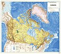
Canada 2014.jpg 6,368 × 5,350; 4.81 MB
-
Canada Be prepared for COVID-19 Infographic English.jpg 1,700 × 2,200; 416 KB
-
Canada Covid-19 be prepared infographic English.jpg 1,700 × 2,800; 540 KB
-
Canada Going out safely during the COVID-19 pandemic risk assessment English.jpg 2,200 × 8,000; 1.15 MB
-
Canada marine transportation infrastructure 2006 harbours map.png 6,879 × 6,165; 15.15 MB
-
Canada mosaic lcc 1000m 2.jpg 5,700 × 4,800; 4.38 MB
-
Canada mosaic lcc 1000m.tif 5,700 × 4,800; 26.13 MB
-
Canada Topo MGRS1.jpg 640 × 478; 29 KB
-
Canada Topo MGRS2.jpg 478 × 640; 45 KB
-
Canada Topo MGRS3.jpg 478 × 640; 63 KB
-
Canadian Charter of Rights and Freedoms (English).jpg 4,050 × 3,300; 3.33 MB
-
Canadian Charter of Rights and Freedoms (French).jpg 4,050 × 3,300; 3.5 MB
-
Canadian Drought Monitor.jpg 3,300 × 2,550; 3.67 MB
-
Canadian National Parks.png 2,750 × 2,300; 989 KB
-
Carleton Electoral District, 2015.svg 1,052 × 744; 119 KB
-
Census Divisions Newfoundland and Labrador.svg 762 × 1,102; 3.06 MB
-
Charles Camsell (cropped).jpg 298 × 305; 31 KB
-
Charles Camsell.jpg 383 × 464; 52 KB
-
Charlottetown Accord referendum results map (Referendum 1992, MCR 0122).jpg 7,877 × 6,939; 7.79 MB
-
Chemin de fer de la Rivière Romaine map.png 912 × 632; 303 KB
-
Crombies Station map.png 946 × 583; 1.19 MB
-
Eastern Canada electrical generating stations map, 1968.jpg 3,030 × 2,130; 2.02 MB
-
Educational institutions in Canada map, 1957.jpg 4,124 × 3,071; 1.22 MB
-
Eriocampa ovata wings Rice 1968 Fig1 A.png 781 × 517; 141 KB
-
Eriocampa scudderi wings Rice 1968 Fig1 C.png 649 × 323; 77 KB
-
Eriocampa tulameenensis antenna Rice 1968 Fig3 A.png 270 × 154; 12 KB
-
Eriocampa tulameenensis holotype Rice 1968 Pl1 Fig1 cropped.png 529 × 508; 277 KB
-
Eriocampa tulameenensis holotype Rice 1968 Pl1 Fig1.png 673 × 741; 322 KB
-
Eriocampa tulameenensis left forewing Rice 1968 Fig3 C.png 765 × 326; 102 KB
-
Eriocampa tulameenensis left hindwing Rice 1968 Fig3 E.png 586 × 306; 52 KB
-
Eriocampa tulameenensis right forewing Rice 1968 Fig3 B.png 736 × 327; 109 KB
-
Françoise Boivin (NRCAN-4151).jpg 500 × 361; 18 KB
-
Fritz 1992 Mummaspis oblisooculatus.png 1,516 × 2,408; 502 KB
-
Fury and Hecla Strait.jpg 1,598 × 609; 148 KB
-
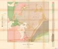
Geological map of the vicinity of Copper Cliff Sudbury mining district.pdf 5,920 × 4,972; 15.37 MB
-
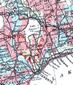
Grand Trunk lines along Lake Simcoe.png 544 × 628; 764 KB
-
GTR Lake Simcoe Sutton 1915 map.png 343 × 352; 298 KB
-
Hawthorne park.jpg 351 × 430; 23 KB
-
Ile de St-Pierre, Newfoundland - France RGS.png 2,380 × 1,708; 3.43 MB
-
Immuk.ogg 4.3 s; 31 KB
-
Income Per Capita Map 1986 Census.jpg 5,350 × 4,700; 9.66 MB
-
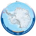
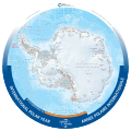
IPY Antarctica 2012 150.pdf 4,987 × 4,987; 2.8 MB
-
IPY Antarctica 2012 150.svg 3,192 × 3,192; 7.48 MB
-
Irniq.ogg 3.6 s; 29 KB
-
Iu-illu.ogg 4.7 s; 36 KB
-
Kanata-Carleton Federal Riding 2015.svg 1,052 × 744; 107 KB
-
Lambeosaurus clavinitialis.png 1,016 × 838; 216 KB
-
Lambeosaurus magnicristatus.png 1,194 × 1,335; 410 KB
-
Map of New Brunswick highlighting Madawaska County.svg 4,096 × 2,731; 5.81 MB
-
Map of New Brunswick highlighting Northumberland County.svg 4,096 × 2,731; 5.81 MB
-
Map of New Brunswick highlighting Queens County.svg 4,096 × 2,731; 5.81 MB
-
Map of New Brunswick highlighting Restigouche County.svg 4,096 × 2,731; 5.81 MB
-
Map of New Brunswick highlighting Saint John County.svg 4,096 × 2,731; 5.81 MB
-
Map of New Brunswick highlighting Sunbury County.svg 4,096 × 2,731; 5.81 MB
-
Map of New Brunswick highlighting Victoria County.svg 4,096 × 2,731; 5.81 MB
-
Map of New Brunswick highlighting Westmorland County.svg 4,096 × 2,731; 5.81 MB
-
Marine Bioregions of Canada, 2018.jpg 1,600 × 1,280; 234 KB
-
Nepean.svg 1,052 × 744; 104 KB
-
Nepisiguit Bay Borders.png 653 × 522; 345 KB
-
Nepisiguit Bay coastline.png 1,230 × 972; 1.07 MB
-
Non-Ferrous Metals - Eastern Canada map.pdf 3,975 × 2,975; 1.31 MB
-
North America 2005.jpg 5,381 × 6,105; 7.62 MB
-
NP-Natural-Regions-EN-11x17-04Feb2020-High-Res-FINAL-DIR.jpg 5,100 × 3,300; 6.23 MB
-
NTR geological map gscmap-a 12a e 1910 mn01.pdf 8,150 × 3,510; 7.63 MB
-
Olympic sites map 2010.jpg 8,259 × 8,862; 24.85 MB
-
Ontario and Quebec Railway Territories 1915 map.pdf 3,577 × 2,568; 2.13 MB
-
Orthophotographie 2009 de Oujé-Bougoumou 02.jpg 10,626 × 8,595; 47 MB
-
Orthophotographie 2009 de Oujé-Bougoumou.jpg 14,767 × 13,733; 71.49 MB
-
Ottawa Satellite 1990.png 3,094 × 2,248; 15.26 MB
-
Pacific Rim National Park map, 1989 - 1 70,000.jpg 6,193 × 6,469; 8.15 MB
-
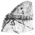
Penthetria (?) fryi holotype Rice 1959 pl1 fig2.png 742 × 416; 242 KB
-
Penthetria whipsawensis holotype Rice 1959 pl1 fig1.png 338 × 194; 52 KB
-
Plecia angustipennis hypotype Rice 1959 pl1 fig5.png 440 × 196; 68 KB
-
Plecia avus holotype Rice 1959 pl3 fig6.png 409 × 198; 71 KB
-
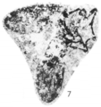
Plecia avus hypotype Rice 1959 pl3 fig7.png 531 × 538; 231 KB
-
Plecia cairnesi holotype Rice 1959 pl2 fig7.png 433 × 458; 179 KB
-
Plecia cairnesi paratype Rice 1959 pl2 fig3.png 348 × 217; 63 KB
-
Plecia canadensis holotype Rice 1959 pl2 fig10.png 876 × 294; 240 KB
-
Plecia canadensis hypotype Rice 1959 pl2 fig8.png 625 × 401; 239 KB
-
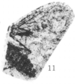
Plecia curtula (syn Penthetria avunculus cotype) Rice 1959 pl1 fig11.png 385 × 419; 128 KB
-
Plecia curtula holotype Rice 1959 pl1 fig9.png 352 × 180; 63 KB
-
Plecia curtula hypotype Rice 1959 pl1 fig10.png 688 × 556; 309 KB
-
Plecia dilatata holotype Rice 1959 pl3 fig9.png 442 × 228; 97 KB
-
Plecia elatior holotype Rice 1959 pl4 fig5.png 718 × 556; 298 KB
-
Plecia kelownaensis holotype Rice 1959 pl1 fig4.png 630 × 263; 139 KB
-
Plecia minutula holotype Rice 1959 pl1 fig3a.png 345 × 293; 84 KB
-
Plecia minutula holotype Rice 1959 pl1 fig3b.png 338 × 237; 64 KB
-
Plecia nana holotype Rice 1959 pl1 fig8.png 494 × 464; 175 KB
-
Plecia pictipennis hypotype Rice 1959 pl4 fig6.png 744 × 783; 409 KB
-
Plecia pictipennis lectotype Rice 1959 pl3 fig2.png 511 × 329; 133 KB
-
Plecia platyptera holotype Rice 1959 pl4 fig1.png 497 × 544; 258 KB
-
Plecia pulchra holotype Rice 1959 pl4 fig2.png 624 × 314; 183 KB
-
Plecia pulla holotype Rice 1959 pl1 fig6.png 456 × 293; 126 KB
-
Plecia reducta holotype Rice 1959 pl2 fig2.png 357 × 166; 57 KB
-
Plecia reducta hypotype Rice 1959 pl2 fig6.png 319 × 178; 47 KB
-
Plecia similkameena hypotype Rice 1959 pl2 fig9.png 734 × 448; 251 KB
-
Plecia similkameena lectotype Rice 1959 pl2 fig5.png 554 × 394; 181 KB
-
Plecia transitoria holotype Rice 1959 pl3 fig3.png 681 × 579; 270 KB
-
Plecia transitoria hypotype Rice 1959 pl3 fig4.png 526 × 525; 211 KB
-
Plecia tulameenensis holotype Rice 1959 pl2 fig1a.png 428 × 285; 99 KB
-
Plecia tulameenensis holotype Rice 1959 pl2 fig1b.png 316 × 152; 51 KB
-
Plecia tulameenensis paratype Rice 1959 pl2 fig4.png 477 × 259; 97 KB
-
Population LRH GRH.png 874 × 506; 112 KB
-
Pseudosiobla campbelli dorsal of thorax Rice 1968 Fig4 B.png 381 × 367; 46 KB
-
Pseudosiobla campbelli dorsal Rice 1968 Fig4 A.png 446 × 463; 51 KB
-
Pseudosiobla campbelli holotype Rice 1968 Pl1 Fig1b cropped.png 688 × 474; 346 KB
-
Pseudosiobla campbelli holotype Rice 1968 Pl1 Fig1b.png 745 × 603; 381 KB
-
Pseudosiobla campbelli left forewing Rice 1968 Fig4 D.png 827 × 339; 81 KB
-
Pseudosiobla campbelli left hindwing Rice 1968 Fig4 E.png 580 × 228; 29 KB
-
Pseudosiobla campbelli right forewing Rice 1968 Fig4 C.png 853 × 330; 96 KB
-
Pseudosiobla campbelli right hindwing Rice 1968 Fig4 F.png 494 × 332; 43 KB
-
Pseudosiobla excavata wings Rice 1968 Fig1 B.png 775 × 482; 133 KB
-
Schomberg and Aurora Railway map.png 942 × 644; 1,017 KB
-
Siqiniq.ogg 4.6 s; 35 KB
-
Sudbury Basin Non-Ferrous Metals - Eastern Canada map.png 1,018 × 1,013; 1.11 MB
-
The World, 2021.jpg 6,900 × 4,500; 4.87 MB
-
Ulluq.ogg 4.3 s; 34 KB
-
World map 2005.jpg 7,090 × 4,788; 7.89 MB
-
Yellowhead Pass gscmcm 0748 e 1901 mn01.pdf 7,050 × 1,295; 2.93 MB


