Category:November 2008 in Hampshire
Jump to navigation
Jump to search
Ceremonial counties of England: Bedfordshire · Berkshire · Buckinghamshire · Cambridgeshire · Cheshire · Cornwall · Cumbria · Derbyshire · Devon · Dorset · Durham · East Riding of Yorkshire · East Sussex · Essex · Gloucestershire · Greater London · Greater Manchester · Hampshire · Herefordshire · Hertfordshire · Kent · Lancashire · Leicestershire · Lincolnshire · Merseyside · Norfolk · North Yorkshire · Northamptonshire · Northumberland · Nottinghamshire · Oxfordshire · Rutland · Shropshire · Somerset · South Yorkshire · Staffordshire · Suffolk · Surrey · Tyne and Wear · Warwickshire · West Midlands · West Sussex · West Yorkshire · Wiltshire · Worcestershire
City-counties: Bristol ·
Former historic counties:
Other former counties:
City-counties: Bristol ·
Former historic counties:
Other former counties:
Deutsch: Bilder, die im November 2008 in Hampshire aufgenommen worden sind. Bitte beachten Sie, dass dies weder das Datum des Uploads noch das Datum des Scannens eines Fotos ist.
English: Images/pictures taken in Hampshire during November 2008. Note this is not the date of the upload, nor the date a photo was scanned.
Español: Fotografías o imágenes tomadas en Hampshire durante noviembre 2008. No es la fecha de subida ni escaneo, sino la fecha en que las fotografías o imágenes se crearon.
Esperanto: Bildoj faritaj en Hampshire en novembro 2008. Tio ne estas la dato, kiam la bildoj estis alŝutitaj aŭ skanitaj.
Français : Photographies ou images prises en Hampshire durant novembre 2008. Ce n'est pas la date du téléchargement ou du scan.
Galego: Fotografías ou imaxes tomadas en Hampshire durante novembro 2008. Non é a data de subida nin escaneamento, senón a data na que se crearon as fotografías ou imaxes.
Italiano: Fotografie o immagini scattate a Hampshire nel novembre 2008. Nota bene: la data non si riferisce né a quella di upload né a quella in cui la foto è stata digitalizzata.
Norsk bokmål: Bilder tatt i Hampshire i løpet av november 2008. Merk at dette ikke er datoen for opplasting, eller når et bilde har blitt skannet.
Norsk nynorsk: Bilete teke i Hampshire i løpet av november 2008. Merk at dette ikkje er datoen for opplasting, eller når eit bilete har vorte skanna.
Русский: Изображения, сделанные в Hampshire в течение ноябрь 2008 (не дата загрузки изображения).
Українська: Зображення, зроблені в Hampshire протягом листопад 2008. Зауважте, що це не дата завантаження чи дата сканування фотографії.
| November 2007 | ← | November 2008 | → | November 2009 | |||||||
| Jan | Feb | Mar | Apr | May | Jun | Jul | Aug | Sep | Oct | Nov | Dec |
| 151 | 174 | 239 | 378 | 401 | 298 | 186 | 131 | 241 | 453 | 100 | 178 |
|---|---|---|---|---|---|---|---|---|---|---|---|
Subcategories
This category has only the following subcategory.
B
Media in category "November 2008 in Hampshire"
The following 99 files are in this category, out of 99 total.
-
'Semi' on Norn Hill - geograph.org.uk - 1047456.jpg 640 × 472; 60 KB
-
A neat hedge for winter - geograph.org.uk - 1053093.jpg 640 × 477; 72 KB
-
A new footpath - cyclepath into town - geograph.org.uk - 1060520.jpg 640 × 480; 91 KB
-
An imposing block - Regent Court - geograph.org.uk - 1047485.jpg 640 × 478; 78 KB
-
Andover - Adelaide Road - geograph.org.uk - 1059074.jpg 640 × 480; 87 KB
-
Andover - Bridge Street - geograph.org.uk - 1039650.jpg 640 × 480; 86 KB
-
Andover - Car Park - geograph.org.uk - 1056201.jpg 640 × 480; 87 KB
-
Andover - Chantry Centre - geograph.org.uk - 1056675.jpg 640 × 480; 72 KB
-
Andover - Marlborough Street - geograph.org.uk - 1056687.jpg 480 × 640; 79 KB
-
Andover - St Marys Church - geograph.org.uk - 1039161.jpg 640 × 480; 110 KB
-
Andover - St Marys Church - geograph.org.uk - 1039252.jpg 640 × 461; 59 KB
-
Andover - St Marys Church - geograph.org.uk - 1056206.jpg 640 × 480; 96 KB
-
Andover - St Marys Church Graveyard - geograph.org.uk - 1039209.jpg 640 × 480; 165 KB
-
Barn at Ibthorpe - geograph.org.uk - 1067359.jpg 640 × 427; 207 KB
-
Bluestar 1034.JPG 2,336 × 1,518; 640 KB
-
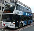
Bluestar 1125 2.JPG 2,584 × 1,496; 844 KB
-
Bluestar 1125 3.JPG 2,184 × 1,608; 748 KB
-
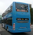
Bluestar 1125 rear.JPG 2,349 × 1,457; 577 KB
-
Bluestar 1301 rear.JPG 1,741 × 1,872; 474 KB
-
Bluestar 1301.JPG 3,328 × 1,872; 1.89 MB
-
Bluestar 1302.JPG 1,807 × 1,658; 522 KB
-
Bluestar 1305.JPG 1,812 × 1,444; 505 KB
-
Bluestar 1309.JPG 1,392 × 1,416; 373 KB
-
Bluestar 180.JPG 1,546 × 1,246; 378 KB
-
Bluestar 766.JPG 2,076 × 1,775; 629 KB
-
Bluestar 773 2.JPG 2,364 × 1,823; 848 KB
-
Bluestar 782.JPG 1,534 × 1,245; 412 KB
-
Bungalows in Carlisle Close - geograph.org.uk - 1054002.jpg 640 × 472; 50 KB
-
Chapel Hill roundabout - geograph.org.uk - 1059411.jpg 640 × 473; 66 KB
-
Corner House - Soper Grove - geograph.org.uk - 1057080.jpg 640 × 478; 78 KB
-
Cottages at Bighton - geograph.org.uk - 1041293.jpg 640 × 360; 61 KB
-
Cycle racks - Elmwood Parade - geograph.org.uk - 1058395.jpg 640 × 476; 71 KB
-
Cycleway under roundabout - geograph.org.uk - 1060586.jpg 640 × 470; 91 KB
-
Field and woodland west of Tollbar Way - geograph.org.uk - 1036614.jpg 640 × 427; 148 KB
-
Field gate on Bighton Dean Lane - geograph.org.uk - 1041410.jpg 360 × 640; 110 KB
-
Field off Staplewood Lane - geograph.org.uk - 1064836.jpg 640 × 480; 65 KB
-
Fields NW of Tollbar Way - geograph.org.uk - 1039554.jpg 640 × 427; 122 KB
-
First Hampshire & Dorset 46366.JPG 1,639 × 1,336; 427 KB
-
First Hampshire & Dorset 66122.JPG 1,624 × 1,301; 399 KB
-
Footbridge at Hedge End Station - geograph.org.uk - 1036436.jpg 640 × 427; 131 KB
-
Footpath across field - geograph.org.uk - 1041246.jpg 640 × 360; 53 KB
-
Footpath across field - geograph.org.uk - 1041251.jpg 640 × 360; 57 KB
-
Footpath across field - geograph.org.uk - 1041255.jpg 640 × 360; 69 KB
-
Footpath crossing field to railway line - geograph.org.uk - 1041204.jpg 640 × 360; 100 KB
-
Footpath west of Charterhouse Way - geograph.org.uk - 1036548.jpg 640 × 427; 193 KB
-
George V postbox near Minstead - geograph.org.uk - 1037005.jpg 480 × 640; 140 KB
-
George V postbox, Hurstbourne Tarrant - geograph.org.uk - 1061770.jpg 480 × 640; 111 KB
-
George VI postbox, Outwick - geograph.org.uk - 1039328.jpg 480 × 640; 151 KB
-
Gresley Road - Norn Hill junction - geograph.org.uk - 1063833.jpg 640 × 466; 60 KB
-
Hants & Dorset 1540 2.JPG 1,652 × 1,431; 448 KB
-
Hants & Dorset 1540.JPG 1,271 × 1,293; 344 KB
-
Hants & Dorset 3377 2.JPG 1,329 × 1,475; 377 KB
-
Hedge End railway station - geograph.org.uk - 1041495.jpg 640 × 427; 135 KB
-
Hornhill pond - geograph.org.uk - 1052658.jpg 640 × 427; 185 KB
-
Houses in Hawthron Way - geograph.org.uk - 1059116.jpg 640 × 477; 64 KB
-
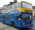
King Alfred 595 LCG.JPG 1,438 × 1,267; 370 KB
-
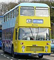
King Alfred OU 9286.JPG 1,413 × 1,069; 370 KB
-
Lemon car - lemon flats - geograph.org.uk - 1046874.jpg 640 × 460; 92 KB
-
Modern detached houses - geograph.org.uk - 1059094.jpg 640 × 472; 66 KB
-
More new homes are squezed in - geograph.org.uk - 1046851.jpg 640 × 473; 52 KB
-
Church interior, St Andrew's Church - geograph.org.uk - 1044191.jpg 640 × 480; 61 KB
-
North Warnborough, The Jolly Miller - geograph.org.uk - 1055364.jpg 640 × 480; 71 KB
-
Not sure about the motto - geograph.org.uk - 1046835.jpg 489 × 640; 84 KB
-
Platform at Hedge End Railway Station - geograph.org.uk - 1036432.jpg 640 × 427; 120 KB
-
River Mude near Waterditch - geograph.org.uk - 1030830.jpg 640 × 480; 101 KB
-
Skyline Plaza - geograph.org.uk - 1056063.jpg 640 × 500; 64 KB
-
Slip road and ring road - geograph.org.uk - 1056666.jpg 484 × 640; 71 KB
-
Slip road off the ring way - geograph.org.uk - 1063604.jpg 640 × 480; 93 KB
-
Slip road to Daneshill - geograph.org.uk - 1063599.jpg 480 × 640; 95 KB
-
Solent Blue Line 37 2.JPG 1,955 × 1,478; 497 KB
-
Solent Blue Line 37.JPG 1,571 × 1,735; 533 KB
-
St Andrew's Church, Nether Wallop - geograph.org.uk - 1041898.jpg 640 × 431; 79 KB
-
St Andrew's Church, Nether Wallop - geograph.org.uk - 1043228.jpg 640 × 454; 94 KB
-
St Georges Street towards Jewry Street - panoramio.jpg 1,024 × 677; 695 KB
-
The TV Workshop, off Lower Northam Road - geograph.org.uk - 1041979.jpg 640 × 389; 144 KB
-
The Way Inn - geograph.org.uk - 1059415.jpg 640 × 475; 45 KB
-
Tomb, St Andrew's Church - geograph.org.uk - 1043248.jpg 640 × 480; 100 KB
-
Unusual estate house - geograph.org.uk - 1047339.jpg 640 × 471; 64 KB
-
Victorian houses - Soper Grove - geograph.org.uk - 1057086.jpg 640 × 468; 54 KB
-
Viewing platform in the Spinnaker Tower - geograph.org.uk - 1049649.jpg 640 × 480; 105 KB
-
Village Green, Minstead - geograph.org.uk - 1035917.jpg 640 × 480; 107 KB
-
Wall painting, St Andrew's Church - geograph.org.uk - 1044258.jpg 640 × 480; 60 KB
-
Wall painting, St Andrew's Church - geograph.org.uk - 1044262.jpg 480 × 640; 83 KB
-
Warnborough Green, Mill Lane Ford - geograph.org.uk - 1055462.jpg 640 × 480; 101 KB


