Category:Northenden
Jump to navigation
Jump to search
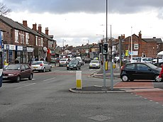
English: Northenden is situated in the Manchester City Council ward of Northenden in Wythenshawe, in the City of Manchester
suburban area in the city of Manchester, England | |||||
| Upload media | |||||
| Instance of | |||||
|---|---|---|---|---|---|
| Location | Manchester, Greater Manchester, North West England, England | ||||
| Different from | |||||
 | |||||
Subcategories
This category has the following 4 subcategories, out of 4 total.
B
P
R
S
Media in category "Northenden"
The following 23 files are in this category, out of 23 total.
-
Alpha Point - geograph.org.uk - 5692293.jpg 1,280 × 937; 738 KB
-
Bradnor Road - geograph.org.uk - 5692280.jpg 1,280 × 1,038; 807 KB
-
Bridge over A5103 at M60 junction 5 - geograph.org.uk - 6311028.jpg 1,600 × 937; 556 KB
-
Fallen Birch tree - geograph.org.uk - 362887.jpg 640 × 480; 148 KB
-
Footbridge over A5103 south of M60 junction 5 - geograph.org.uk - 6311030.jpg 1,600 × 726; 439 KB
-
Gas governor - geograph.org.uk - 4231680.jpg 640 × 480; 115 KB
-
Heron sculpture - geograph.org.uk - 5486985.jpg 1,280 × 1,280; 1.29 MB
-
Longley Lane, Northenden - geograph.org.uk - 3989146.jpg 1,000 × 750; 365 KB
-
M60 - geograph.org.uk - 6506141.jpg 4,032 × 2,901; 1.98 MB
-
Northenden (Manchester City Council ward) 2018.png 2,043 × 3,776; 630 KB
-
Northenden Junction - geograph.org.uk - 2622894.jpg 640 × 480; 211 KB
-
Northenden Junction - geograph.org.uk - 5064346.jpg 4,568 × 3,123; 1.76 MB
-
Princess Parkway bridge over the River Mersey - geograph.org.uk - 6795596.jpg 4,160 × 3,120; 1.06 MB
-
River Mersey - geograph.org.uk - 6503029.jpg 4,032 × 3,024; 1.79 MB
-
Rth Rly Northenden Junction 30.07.2016.jpg 1,400 × 992; 862 KB
-
Sign gantry over A5103 north of M56 junction 3A - geograph.org.uk - 6311033.jpg 1,600 × 1,200; 700 KB
-
Simon's Bridge, River Mersey, Didsbury - geograph.org.uk - 6795619.jpg 3,120 × 4,160; 726 KB
-
Spire on Bradnor Road - geograph.org.uk - 1010126.jpg 640 × 391; 38 KB
-
The farm - panoramio (1).jpg 4,000 × 3,000; 5.28 MB
-
Under the M60 - geograph.org.uk - 6198049.jpg 1,280 × 960; 1.05 MB


