Category:North Branford, Connecticut
Jump to navigation
Jump to search
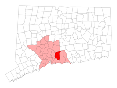
English: Media pertaining to North Branford, Connecticut in east central New Haven County
human settlement in Connecticut, United States of America | |||||
| Upload media | |||||
| Instance of | |||||
|---|---|---|---|---|---|
| Location |
| ||||
| Inception |
| ||||
| Population |
| ||||
| Area |
| ||||
| Elevation above sea level |
| ||||
| official website | |||||
 | |||||
Subcategories
This category has the following 5 subcategories, out of 5 total.
Media in category "North Branford, Connecticut"
The following 14 files are in this category, out of 14 total.
-
Aerial view of Tilcon Connecticut quarry and Lake Gaillard, July 2019.JPG 5,184 × 3,888; 3.45 MB
-
Branford Steam over CT 80 085.JPG 2,048 × 1,536; 638 KB
-
Lebia solea Hentz.jpg 449 × 600; 162 KB
-
N Branford CT lg.PNG 1,824 × 1,374; 110 KB
-
NBranfordCtLocatorMap.png 936 × 695; 79 KB
-
North Branford Town Hall 099.JPG 2,048 × 1,536; 652 KB
-
NorthBranfordCT AtwaterMemorialLibrary.jpg 750 × 562; 225 KB
-
NorthBranfordCT HowdLinsleyHouse.jpg 1,024 × 680; 293 KB
-
NorthBranfordCT MaltbyStevensFactorySite.jpg 1,024 × 680; 268 KB
-
Sec Perez 052815 0767 (18206401516).jpg 3,721 × 2,363; 1.43 MB
-
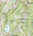
Totoket Mountain.gif 543 × 592; 183 KB
-
Utility access road on SLERy ROW in North Branford (1), December 2013.JPG 3,309 × 2,479; 2.77 MB
-
Utility access road on SLERy ROW in North Branford (2), December 2013.JPG 4,320 × 3,240; 4.59 MB
-
Utility access road on SLERy ROW in North Branford (3), December 2013.JPG 4,320 × 3,240; 4.84 MB


