Category:Normanton-on-Cliffe
Jump to navigation
Jump to search
village in South Kesteven, Lincolnshire, England  | |||||
| Upload media | |||||
| Instance of | |||||
|---|---|---|---|---|---|
| Location | Normanton, South Kesteven, Lincolnshire, East Midlands, England | ||||
 | |||||
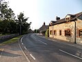
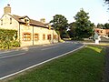
Normanton-on-Cliffe is a village (and a civil parish as just Normanton) in South Kesteven, Lincolnshire, England, and lies on the Lincoln Cliffe (an escarpment between Lincoln and Grantham) at its southern edge.
Subcategories
This category has the following 2 subcategories, out of 2 total.
N
Media in category "Normanton-on-Cliffe"
The following 14 files are in this category, out of 14 total.
-
 A607, Main Street, Normanton-on-Cliffe - geograph.org.uk - 4208508.jpg 640 × 480; 293 KB
-
 A607, Normanton-on-Cliffe - geograph.org.uk - 4208499.jpg 640 × 480; 323 KB
-
 Cedar tree overhanging A607, Normanton-on-Cliffe - geograph.org.uk - 5989403.jpg 1,600 × 1,067; 849 KB
-
 Farmland, Normanton on Cliffe - geograph.org.uk - 3076245.jpg 640 × 480; 94 KB
-
 Heath Barn, Normanton on Cliffe - geograph.org.uk - 6193356.jpg 1,024 × 768; 178 KB
-
 Main Street - geograph.org.uk - 1742934.jpg 640 × 426; 105 KB
-
 Main Street, Normanton-on-Cliffe - geograph.org.uk - 4208507.jpg 640 × 480; 286 KB
-
 Normanton village looking north.jpg 4,608 × 3,456; 7.65 MB
-
 Normanton village looking south.jpg 4,608 × 3,456; 6.93 MB
-
 Normanton-on-Cliffe - geograph.org.uk - 4208503.jpg 640 × 480; 293 KB
-
 Normanton-on-Cliffe - geograph.org.uk - 5261636.jpg 1,024 × 683; 372 KB
-
 Normanton-on-Cliffe - geograph.org.uk - 6266414.jpg 6,240 × 4,160; 5.58 MB
-
 Rain battered field, Normanton on Cliffe - geograph.org.uk - 6193358.jpg 1,024 × 768; 216 KB
-
 Corner House - geograph.org.uk - 327304.jpg 640 × 427; 59 KB


