Category:Nickerie District
Jump to navigation
Jump to search
Dansk: Nickerie er et distrikt i Surinam beliggende på nordvestkysten grænsende mod Atlanterhavet og Guyana. Nickeries hovedstad er Nieuw-Nickerie, som er den anden største by i landet. Andre byer inkluderer Washoda og Wageningen.
Deutsch: Nickerie ist ein Distrikt im äußersten Nordwesten von Suriname, er grenzt im Osten an den Distrikt Coronie, im Süden an den Distrikt Sipaliwini und im Westen an Guyana, Grenzfluss ist der Corantijn. Der Distrikt hat eine Fläche von 5.353 km² und besitzt 36.639 Einwohner. Hauptort ist Nieuw-Nickerie, die zweitgrößte Stadt des Landes nach Paramaribo. Im Parlament (De Nationale Assemblée) ist der Distrikt Nickerie mit 5 Abgeordneten vertreten.
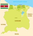
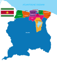
English: Nickerie is a district of Suriname, on the north-west coast. Nickerie's capital city is Nieuw-Nickerie, the second largest city in the country. Other towns include Washoda and Wageningen. The district borders the Atlantic Ocean to the north, the Surinamese district of Coronie to the east, the Surinamese district of Sipaliwini to the south and Guyana to the west.
Español: Nickerie es un distrito situado en el noroeste de Surinam emplazado en la desembocadura del río Corantijn, río que hace de frontera entre este país y Guyana. Al norte delimita con el Océano Atlántico, al este con Coronie y al sur con el extenso distrito de Sipaliwini.
Bahasa Indonesia: Distrik Nickerie merupakan sebuah distrik di Suriname yang memiliki luas wilayah 5.353 km² dan populasi 41.080 jiwa (2005). Ibu kotanya ialah Nieuw-Nickerie.
Italiano: Nickerie è uno dei 10 distretti del Suriname. Situato all'estremo occidentale del paese confina a est con il distretto di Coronie, a sud con quello di Sipaliwini e a ovest con la Guyana dalla quale lo separa il fiume Corentyne.
Lietuvių: Nikerio apygarda yra šiaurės vakarų Suriname, Atlanto vandenyno pakrantėje, Gajanos pasienyje. Sostinė - Naujasis Nikeris. Kiti miestai: Vašoda, Vageningenas.
Nederlands: Nickerie is een district in het noordwesten van Suriname en ligt aan de monding van de rivier de Corantijn, grensrivier tussen Suriname en Guyana. Het district beslaat 5.353 km² en heeft 36.639 inwoners (2004). De hoofdplaats is Nieuw-Nickerie, gelegen aan de rivier de Nickerie. Een andere bekende plaats is Wageningen.
Norsk bokmål: Nickerie er et av ti distrikter i Surinam. Det ligger nord-vest i landet, langs kysten og grenser til Guyana i vest. Administrasjonssenteret Nieuw-Nickerie er også Surinams nest største by. Pågrunn av grensekonflikt mellom Guyana og Surinam er det få åpene grenseoverganger. I Nickerie er det kun en fergeavgang over elva til Guyana.
Polski: Nickerie to dystrykt w północno-zachodnim Surinamie, nad Oceanem Atlantyckim, przy granicy z Gujaną. Stolicą dystryktu jest Nieuw Nickerie, drugie pod względem wielkości miasto w Surinamie. Inne ważne miasta to Washoda i Wageningen. Ludność Nickerie wynosi 41 080 mieszkańców, a powierzchnia 5 353 km². Na terenie dystryktu uprawia się głównie banany i ryż.
Română: Districtul Nickerie este una dintre cele 10 unităţi administrativ-teritoriale de gradul I ale statului Surinam.
Русский: Никкери — округ Суринама, расположенный на северо-западном побережье. Столица — город Ньив-Никкери, второй по размеру город в стране. Другие города — Вашода и Вагенинген.
district of Suriname | |||||
| Upload media | |||||
| Instance of | |||||
|---|---|---|---|---|---|
| Location | Suriname | ||||
| Located in or next to body of water | |||||
| Capital | |||||
| Area |
| ||||
 | |||||
Subcategories
This category has the following 13 subcategories, out of 13 total.
B
- Backtrack, Nickerie (12 F)
- Bigi-Pan (55 F)
J
- Jamaer Canal (10 F)
M
- Manglie's Rijstbedrijf (8 F)
N
- Nickerie River (4 F)
S
- Schools in Nickerie (6 F)
W
Media in category "Nickerie District"
The following 70 files are in this category, out of 70 total.
-
114 Wageningen.ogg 1.0 s; 20 KB
-
African drum "DJEMBE".jpg 1,200 × 1,600; 199 KB
-
Arbeiders bij de rijstpelmolen in Nickerie, Bestanddeelnr 252-5599.jpg 2,646 × 2,551; 833 KB
-
Arbeiders bij een sluis in de polder van Nickerie, Bestanddeelnr 252-5560.jpg 2,628 × 2,581; 994 KB
-
Arbeiders bij een sluis in de polder van Nickerie, Bestanddeelnr 252-5564.jpg 2,655 × 2,560; 899 KB
-
Arbeiders bij een sluis in de polder van Nickerie, Bestanddeelnr 252-5565.jpg 2,631 × 2,575; 859 KB
-
Bigi-pan kaaiman.jpg 1,920 × 1,080; 1.02 MB
-
Boats ready for Guyana (31095616622).jpg 4,802 × 2,699; 1.25 MB
-
Vooraanzicht gevel met omgeving - Boonackerpolder - 20418035 - RCE.jpg 2,046 × 3,120; 1.2 MB
-
Coragyps atratus, Nickerie, Suriname (31095607052).jpg 4,896 × 2,752; 1.58 MB
-
Courantyne shore (30871840430).jpg 4,805 × 2,701; 825 KB
-
De zeewering bij Nickerie, Bestanddeelnr 252-5569.jpg 2,634 × 2,578; 769 KB
-
District Nickerie - Suriname- Location Map.png 7,920 × 6,120; 891 KB
-
Districten kaart van Suriname.svg 842 × 1,108; 1.42 MB
-
Districts of Suriname with Capital Cities.svg 1,074 × 1,252; 203 KB
-
Een boer met koeien in een sloot in Nickerie, Bestanddeelnr 252-5516.jpg 2,628 × 2,548; 995 KB
-
Flag of Nickerie District.svg 900 × 600; 12 KB
-
Great egrets (31095581462).jpg 4,896 × 2,752; 1.24 MB
-
Heavy industry in the jungle (17544896624).jpg 4,046 × 2,276; 1.71 MB
-
Hindoe flags in Nickerie (31125304871).jpg 4,429 × 2,490; 931 KB
-
Karbouwen aan het ploegen, Bestanddeelnr 252-5589.jpg 2,631 × 2,563; 1,011 KB
-
Landschap in Nickerie, Bestanddeelnr 252-5513.jpg 2,625 × 2,572; 1.07 MB
-
Locator Map Groot Henar - Nickerie Suriname.png 7,940 × 7,941; 1.11 MB
-
Locator Map Nieuw Nickerie - Nickerie Suriname.png 7,941 × 7,940; 1.1 MB
-
Locator Map Oostelijke Polders - Nickerie Suriname.png 7,941 × 7,940; 1.1 MB
-
Locator Map Wageningen - Nickerie Suriname.png 7,941 × 7,941; 1.1 MB
-
Locator Map Westelijke Polders - Nickerie Suriname.png 7,940 × 7,940; 1.1 MB
-
Map of Suriname - Nickerie Highlight.png 2,310 × 2,593; 214 KB
-
Map of Suriname showing Districts and the capital cities.svg 1,448 × 1,572; 330 KB
-
New Horizons Suriname 2011 110717-F-UL435-044.jpg 3,872 × 2,592; 4.51 MB
-
Nickerie (1).png 2,000 × 2,047; 233 KB
-
Nickerie (2).png 1,184 × 878; 154 KB
-
Nickerie (titel op object), NG-2015-4-1-56.jpg 1,874 × 1,445; 510 KB
-
Nickerie - Suriname.png 5,952 × 6,123; 689 KB
-
Nickerie polder banner.jpg 1,999 × 301; 252 KB
-
Nickerie Resorts Suriname Neutral.png 8,419 × 5,953; 798 KB
-
Nickerie resorts.png 1,056 × 816; 23 KB
-
Nickerie Resorts.svg 842 × 595; 374 KB
-
Nickerie rijstveld.jpg 640 × 427; 66 KB
-
Nickerie Suriname América do Sul (1).png 2,000 × 2,047; 225 KB
-
Nickerie Suriname América do Sul.png 959 × 657; 49 KB
-
Nickerie.jpg 3,456 × 2,304; 3.56 MB
-
Nickerie.png 2,000 × 2,047; 292 KB
-
Nickerie4.jpg 3,456 × 2,304; 2.54 MB
-
Nickerie5.jpg 3,456 × 2,304; 2.4 MB
-
Nickerie6.jpg 3,456 × 2,304; 5.02 MB
-
Nickerie7.jpg 2,304 × 3,456; 3.78 MB
-
Nickerie8.jpg 2,304 × 3,456; 2.89 MB
-
Nickerie9.jpg 3,456 × 2,304; 4.65 MB
-
On our way to Nickerie (24365450707).jpg 3,264 × 2,448; 1.81 MB
-
On our way to Nickerie (25361099818).jpg 3,264 × 2,448; 1.68 MB
-
Out of place (17979762870).jpg 4,308 × 2,423; 2.69 MB
-
Paramaribo 36.jpg 5,363 × 3,017; 12.57 MB
-
Port Scheveningen in Suriname (31125307031).jpg 4,862 × 2,733; 1.11 MB
-
Red ibises (30418323484).jpg 4,033 × 2,267; 412 KB
-
Red ibises (31095579932).jpg 4,463 × 2,509; 236 KB
-
Stephanie's Ecolodge (30418320074).jpg 4,896 × 2,752; 1.06 MB
-
Stephanie's Ecolodge (31095574802).jpg 4,896 × 2,752; 781 KB
-
Stephanie's Ecolodge (31125286601).jpg 4,858 × 2,731; 1.14 MB
-
Stephanie's Ecolodge (31203652436).jpg 4,800 × 2,698; 1.06 MB
-
Stephanie's Ecolodge guide (31203655506).jpg 2,464 × 4,384; 771 KB
-
Suriname (NICKERIE).png 2,000 × 2,047; 226 KB
-
Suriname Map of Regions and Provinces.svg 876 × 950; 305 KB
-
Suriname Nickerie district.png 588 × 600; 98 KB
-
Suriname-Nickerie.png 200 × 205; 4 KB
-
Suriname-Nickerie.svg 595 × 558; 154 KB
-
Suriname-Oppervlakte per district - Area per district in km2.svg 842 × 972; 441 KB
-
The 10 Districts of Suriname - De 10 districten van Suriname.svg 595 × 612; 304 KB
-
Tilapia (30871820820).jpg 4,896 × 2,752; 813 KB


