Category:Newtyle (civil parish)
Jump to navigation
Jump to search
Scottish parish in Angus, Scotland, UK | |||||
| Upload media | |||||
| Instance of | |||||
|---|---|---|---|---|---|
| Named after | |||||
| Location |
| ||||
| Population |
| ||||
| Area |
| ||||
 | |||||
Subcategories
This category has the following 3 subcategories, out of 3 total.
Media in category "Newtyle (civil parish)"
The following 140 files are in this category, out of 140 total.
-
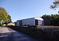 A new steading - geograph.org.uk - 4721408.jpg 1,600 × 1,103; 256 KB
-
 Approach to Kinpurnie Tower - geograph.org.uk - 3189169.jpg 640 × 480; 84 KB
-
 B954 at Millhole above Newtyle - geograph.org.uk - 3932711.jpg 1,024 × 680; 222 KB
-
 Belmont Arms - geograph.org.uk - 4408036.jpg 800 × 533; 158 KB
-
 Belmont Arms Hotel - geograph.org.uk - 5317536.jpg 640 × 480; 47 KB
-
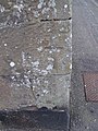 Bench Mark, Church Street - geograph.org.uk - 1857932.jpg 480 × 640; 134 KB
-
 Bonnyton Road - geograph.org.uk - 1874178.jpg 640 × 480; 87 KB
-

-
 Bulb Park houses - geograph.org.uk - 2461554.jpg 2,000 × 1,500; 525 KB
-
 Burnmouth farm road - geograph.org.uk - 2461557.jpg 2,000 × 1,500; 742 KB
-

-
 C14 (Angus) road at East Keillor - geograph.org.uk - 6790080.jpg 5,184 × 3,888; 5.44 MB
-
 Cairn near Auchtertyre - geograph.org.uk - 2633139.jpg 640 × 480; 108 KB
-
 Cairn, Kinpurnie - geograph.org.uk - 3779352.jpg 640 × 480; 254 KB
-
 Corner of Kirkton Road and Smiddy Road, Newtyle - geograph.org.uk - 4721328.jpg 4,027 × 2,715; 2.44 MB
-
 Cottage near Bonnyton Bridge - geograph.org.uk - 4717156.jpg 4,027 × 2,570; 1.88 MB
-
 Cottages by the minor road - geograph.org.uk - 4721464.jpg 4,608 × 3,456; 2.94 MB
-

-
 Crop under netting - geograph.org.uk - 3781888.jpg 640 × 480; 257 KB
-
 Damp trees - geograph.org.uk - 2006593.jpg 2,816 × 2,112; 1.14 MB
-

-
 Denend Farm sign - geograph.org.uk - 5728735.jpg 5,184 × 3,888; 4.88 MB
-
 Denend Farm, Newtyle - geograph.org.uk - 4105368.jpg 1,024 × 680; 197 KB
-
 Denend Farm, Newtyle - geograph.org.uk - 4721400.jpg 4,268 × 3,072; 2.48 MB
-
 Dry stane dyke near Henderston Farm - geograph.org.uk - 1083556.jpg 427 × 640; 144 KB
-
 Dry stane dyke near Henderston Farm - geograph.org.uk - 1083558.jpg 640 × 427; 192 KB
-

-
 East Keillor - geograph.org.uk - 5728803.jpg 5,184 × 3,888; 5.62 MB
-
 Edge of the wood - geograph.org.uk - 2006296.jpg 640 × 480; 81 KB
-
 Entering Newtyle from the Kettins Road - geograph.org.uk - 1192307.jpg 640 × 427; 110 KB
-
 Face of a quarry - geograph.org.uk - 2461609.jpg 2,000 × 1,500; 801 KB
-
 Farm building with clock, Auchtertyre - geograph.org.uk - 2498108.jpg 533 × 800; 153 KB
-
 Farm track, Auchtertyre - geograph.org.uk - 2498119.jpg 800 × 533; 105 KB
-
 Felled plantation, Kinpurney Hill - geograph.org.uk - 3780989.jpg 640 × 480; 272 KB
-
 Field at Kinpurney - geograph.org.uk - 5728740.jpg 5,184 × 3,888; 6.34 MB
-
 Field at Millhole, near Newtyle - geograph.org.uk - 3715327.jpg 1,024 × 684; 169 KB
-
 Field edge, Auchtertyre - geograph.org.uk - 2498118.jpg 800 × 533; 138 KB
-
 Field of barley, Auchtertyre - geograph.org.uk - 2498116.jpg 800 × 533; 154 KB
-

-
 Field, Newbigging - geograph.org.uk - 4408015.jpg 800 × 533; 180 KB
-

-

-
 Fields at Auchtertyre - geograph.org.uk - 2498111.jpg 800 × 533; 156 KB
-
 Fields at Kinpurney, Newtyle - geograph.org.uk - 4105438.jpg 1,024 × 680; 127 KB
-
 Fields between Kinpurney and Templeton, Newtyle - geograph.org.uk - 4105447.jpg 1,024 × 680; 225 KB
-
 Firebreak with path - geograph.org.uk - 2576145.jpg 640 × 480; 113 KB
-
 Footbridge in the Den - geograph.org.uk - 2461562.jpg 2,000 × 1,500; 1.1 MB
-
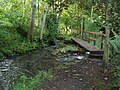 Footbridge over Den Burn - geograph.org.uk - 3185848.jpg 640 × 480; 134 KB
-
 Footpath to Water Backie, Newtyle - geograph.org.uk - 1192320.jpg 640 × 427; 99 KB
-
 Former railway bridge, B954 - geograph.org.uk - 4408021.jpg 800 × 533; 289 KB
-
 Former railway bridge, B954 - geograph.org.uk - 4408027.jpg 800 × 533; 317 KB
-

-
 Furrows at right-angles - geograph.org.uk - 2461571.jpg 2,000 × 1,500; 655 KB
-
 Gate of sewage works - geograph.org.uk - 2461547.jpg 2,000 × 1,500; 512 KB
-
 Gate on Newtyle Path Network - geograph.org.uk - 3185846.jpg 640 × 480; 115 KB
-
 Gated access to Kirkton Cemetery - geograph.org.uk - 4721342.jpg 4,608 × 3,456; 3.18 MB
-
 Glack of Newtyle - geograph.org.uk - 1088441.jpg 640 × 426; 34 KB
-
 Hall, Newtyle - geograph.org.uk - 1857934.jpg 640 × 480; 87 KB
-
 Hillside cattle - geograph.org.uk - 2461614.jpg 2,000 × 1,500; 755 KB
-
 Junction near Davidston - geograph.org.uk - 4717130.jpg 4,608 × 3,456; 3.27 MB
-
 Keillor Path from Kinpurnie Road - geograph.org.uk - 1192271.jpg 640 × 426; 51 KB
-
 Kinpurney Farm - geograph.org.uk - 2461575.jpg 2,000 × 1,500; 442 KB
-
 Kinpurney Hill - geograph.org.uk - 4369171.jpg 1,600 × 1,060; 256 KB
-
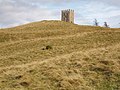
 Kinpurney Hill Tower - geograph.org.uk - 3977600.jpg 640 × 429; 55 KB
-
 Kinpurney Hill triangulation pillar - geograph.org.uk - 5203128.jpg 5,184 × 3,888; 4.38 MB
-
 Kinpurney Tower - geograph.org.uk - 5203164.jpg 5,184 × 3,888; 5.44 MB
-
 Kinpurnie Castle, Newtyle - geograph.org.uk - 3930952.jpg 1,024 × 681; 221 KB
-
 Kinpurnie Hill from Newtyle - geograph.org.uk - 893606.jpg 640 × 512; 113 KB
-
 Kinpurnie Hill Trig Point and Tower - geograph.org.uk - 6773834.jpg 1,024 × 1,374; 874 KB
-
 Kirk at Newtyle - geograph.org.uk - 2563008.jpg 640 × 427; 65 KB
-
 Kirkton farm - geograph.org.uk - 2006597.jpg 640 × 480; 59 KB
-
 Larch tree near Privy's Prap - geograph.org.uk - 6241474.jpg 5,152 × 3,864; 5.07 MB
-
 Mackenzie Meridian (Privy's Prap) - geograph.org.uk - 5415384.jpg 5,184 × 3,888; 5.14 MB
-
 Mackenzie Meridian from the south-west - geograph.org.uk - 5415387.jpg 5,184 × 3,888; 4.75 MB
-
 Newtyle and Coupar Angus Railway - geograph.org.uk - 4406639.jpg 800 × 533; 277 KB
-
 Newtyle and Coupar Angus Railway - geograph.org.uk - 4406642.jpg 800 × 533; 319 KB
-
 Newtyle and Coupar Angus Railway - geograph.org.uk - 4408013.jpg 800 × 533; 204 KB
-

-
-
 Newtyle church - geograph.org.uk - 2006604.jpg 640 × 480; 57 KB
-
 Newtyle Parish Church - geograph.org.uk - 1857926.jpg 480 × 640; 93 KB
-
 Newtyle parish church - geograph.org.uk - 4721305.jpg 3,235 × 4,313; 2.81 MB
-
 Newtyle Parish Church - geograph.org.uk - 5317530.jpg 640 × 480; 79 KB
-
 Newtyle Parish Church - geograph.org.uk - 5728823.jpg 5,184 × 3,888; 4.82 MB
-
 Newtyle Post Office - geograph.org.uk - 5728832.jpg 5,184 × 3,888; 6.2 MB
-
 Newtyle War Memorial - geograph.org.uk - 5728828.jpg 5,184 × 3,888; 6.67 MB
-
 Newtyle-Drive Safely - geograph.org.uk - 4721233.jpg 3,967 × 2,612; 2.52 MB
-
 North Street, Newtyle - geograph.org.uk - 3779367.jpg 640 × 480; 304 KB
-
 Old observatory, Kinpurney Hill - geograph.org.uk - 5203149.jpg 5,184 × 3,888; 4.63 MB
-
 Old railway track around Newtyle - geograph.org.uk - 2413850.jpg 1,600 × 1,200; 784 KB
-
 Once a bridge - geograph.org.uk - 2006315.jpg 2,816 × 2,112; 2.35 MB
-
 Parkland at Hatton, Newtyle - geograph.org.uk - 2498103.jpg 800 × 533; 114 KB
-
 Path to East Keillor - geograph.org.uk - 2633126.jpg 640 × 480; 94 KB
-
 Ploughed fields near Couston - geograph.org.uk - 1859169.jpg 640 × 480; 151 KB
-
 Post office, Newtyle - geograph.org.uk - 3780981.jpg 480 × 640; 288 KB
-
 Postbox, Newtyle - geograph.org.uk - 1858633.jpg 480 × 640; 153 KB
-
 Private Road to Burnmouth Farm - geograph.org.uk - 4721370.jpg 4,608 × 3,456; 3.09 MB
-
 Privy's Prap (the MacKenzie Meridian) - geograph.org.uk - 6241466.jpg 3,864 × 5,152; 4.81 MB
-
 Puddles on the track - geograph.org.uk - 2461585.jpg 2,000 × 1,500; 765 KB
-
 Rainclouds over Strathmore - geograph.org.uk - 2461618.jpg 2,000 × 1,500; 718 KB
-
 Remains of a railway junction - geograph.org.uk - 4408254.jpg 800 × 533; 196 KB
-
 Remains of OS Cut Mark, Kinpurney Hill, Old Observatory - geograph.org.uk - 6773883.jpg 2,448 × 3,264; 4.24 MB
-
 Road fork - geograph.org.uk - 2006322.jpg 640 × 480; 91 KB
-
 Road junction by old Pitnappie Quarry - geograph.org.uk - 4717182.jpg 4,266 × 3,041; 2.37 MB
-
 Road near Newtyle - geograph.org.uk - 3780986.jpg 640 × 480; 301 KB
-
 Road to Kinpurnie Castle, near Newtyle - geograph.org.uk - 1992326.jpg 800 × 533; 151 KB
-
 Roadside cottages - geograph.org.uk - 2461622.jpg 2,000 × 1,500; 777 KB
-
 Rocky cutting - geograph.org.uk - 2006583.jpg 2,816 × 2,112; 2.83 MB
-
 Signpost Depicting walks in Newtyle - geograph.org.uk - 1192353.jpg 640 × 427; 74 KB
-
 Sluice near Denburn Farm - geograph.org.uk - 3185850.jpg 640 × 480; 129 KB
-
 Small fall - geograph.org.uk - 2461582.jpg 1,500 × 2,000; 758 KB
-
 South Street, Newtyle - geograph.org.uk - 2498097.jpg 800 × 533; 110 KB
-
 Spring cereal crops - geograph.org.uk - 1874145.jpg 640 × 480; 115 KB
-
 Spring crops, Davidston - geograph.org.uk - 1874164.jpg 640 × 480; 120 KB
-
 Steading at Kinpurney - geograph.org.uk - 4721441.jpg 4,608 × 3,456; 3.14 MB
-
 Strathmore stubble - geograph.org.uk - 3781891.jpg 640 × 480; 257 KB
-
 Stubble, Keillor - geograph.org.uk - 3779348.jpg 640 × 480; 256 KB
-
 Stubble, Kinpurney - geograph.org.uk - 3781895.jpg 640 × 480; 263 KB
-
 Stubble, Newtyle - geograph.org.uk - 3780994.jpg 640 × 480; 291 KB
-
 Telephone box, Newtyle - geograph.org.uk - 1858643.jpg 480 × 640; 93 KB
-
 The old railway embankment - geograph.org.uk - 6675584.jpg 5,184 × 3,888; 5.46 MB
-
 The post boy's bike - geograph.org.uk - 2006615.jpg 2,816 × 2,112; 1.64 MB
-
 The Railway Walk - geograph.org.uk - 6664160.jpg 5,184 × 3,888; 3.63 MB
-
 Track to Burnside Quarry - geograph.org.uk - 2413840.jpg 1,600 × 1,200; 518 KB
-
 Track to Millhole, near Newtyle - geograph.org.uk - 3715332.jpg 1,024 × 681; 342 KB
-
 Track towards Burnside Quarry - geograph.org.uk - 2413808.jpg 1,600 × 1,200; 492 KB
-
 Tree and potatoes, Auchtertyre - geograph.org.uk - 2498114.jpg 800 × 533; 101 KB
-
 Tree lined road, Kinpurney - geograph.org.uk - 3781904.jpg 640 × 480; 357 KB
-
 Trig point on Kinpurnie Hill - geograph.org.uk - 3192307.jpg 640 × 480; 101 KB
-
 Unnamed lochan - geograph.org.uk - 3189185.jpg 640 × 480; 70 KB
-

-
 View of Keillor area near Newtyle - geograph.org.uk - 1182061.jpg 640 × 427; 56 KB
-
 View of the tower on Kinpurney Hill - geograph.org.uk - 4721431.jpg 4,608 × 3,456; 3.12 MB
-

-
 View to houses on Coupar Road, Newtyle - geograph.org.uk - 4721352.jpg 4,608 × 3,456; 3.15 MB
-
 Viewfinder, Kinpurney Hill - geograph.org.uk - 5203136.jpg 5,184 × 3,888; 6.22 MB
-
 Wall of Kirkton Cemetery - geograph.org.uk - 4721360.jpg 4,608 × 3,456; 3.55 MB
-
 West side of Kinpurney Hill in the mist - geograph.org.uk - 4105382.jpg 1,024 × 680; 68 KB
-
 Wood on the Newtyle-Glamis road - geograph.org.uk - 5728745.jpg 5,184 × 3,888; 6.33 MB
-
 Young woodland - geograph.org.uk - 1874155.jpg 640 × 480; 124 KB


,_Auchtertyre_-_geograph.org.uk_-_2498110.jpg)


_road_at_East_Keillor_-_geograph.org.uk_-_6790080.jpg)


_-_geograph.org.uk_-_5415384.jpg)


_-_geograph.org.uk_-_6241466.jpg)


