Category:New Road Side
Jump to navigation
Jump to search
New Road Side is an area of and a street in Horsforth, Leeds.
Subcategories
This category has the following 3 subcategories, out of 3 total.
B
F
- The Fleece, Horsforth (4 F)
Media in category "New Road Side"
The following 49 files are in this category, out of 49 total.
-
 2SEETV - New Road Side - geograph.org.uk - 1600464.jpg 459 × 640; 71 KB
-
-
 Amo's and White Lightning, New Road Side - geograph.org.uk - 152510.jpg 640 × 480; 277 KB
-
 Canyon Ranch Summit.jpg 8,192 × 4,096; 5.6 MB
-
 Coral - New Road Side - geograph.org.uk - 1600764.jpg 418 × 640; 60 KB
-
 Costa - New Road Side - geograph.org.uk - 1601440.jpg 640 × 516; 63 KB
-
-
 Damaged milestone, New Road Side (geograph 6771752).jpg 1,024 × 768; 227 KB
-
 Emerald city - New Road Side - geograph.org.uk - 1600770.jpg 462 × 640; 70 KB
-

-
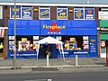 Fireplace World, New Road Side - geograph.org.uk - 152511.jpg 640 × 480; 280 KB
-

-
 Greggs - New Road Side - geograph.org.uk - 1601438.jpg 407 × 640; 69 KB
-

-
 Hayward Commercial - New Road Side - geograph.org.uk - 1600551.jpg 640 × 494; 85 KB
-
 Horsforth Club Ltd - New Road Side - geograph.org.uk - 694681.jpg 640 × 480; 55 KB
-
 Horsforth roundabout on Leeds outer ring road (geograph 3443617).jpg 640 × 480; 64 KB
-
 Leeds Womens Aid and Co-Op Funeralcare (geograph 6771845).jpg 1,024 × 768; 153 KB
-
 Low Fold.jpg 4,019 × 3,013; 1.99 MB
-
 Milestone on New Road Side, Horsforth, Leeds (geograph 6583953).jpg 2,731 × 4,026; 2.7 MB
-
 Milestone on New Road Side, Horsforth, Leeds (geograph 6583963).jpg 4,608 × 3,072; 7.18 MB
-
 Milestone on New Road Side, Horsforth, Leeds (geograph 6583966).jpg 4,608 × 3,072; 7.29 MB
-
 Milestone on New Road Side, Horsforth, Leeds (geograph 6583968).jpg 1,600 × 1,067; 580 KB
-
 NatWest - New Road Side - geograph.org.uk - 1600613.jpg 640 × 544; 76 KB
-
 New Road Side and Clarence Road - geograph.org.uk - 149535.jpg 640 × 445; 192 KB
-
 New Road Side, Horsforth - geograph.org.uk - 100638.jpg 640 × 480; 87 KB
-
 New Road Side, Horsforth - geograph.org.uk - 100640.jpg 640 × 480; 90 KB
-
 New Road Side, Horsforth with First Steps Nursery (geograph 6583972).jpg 1,600 × 1,132; 377 KB
-
 New Road Side, Horsforth, New Years Day 2015 (geograph 4296968).jpg 1,024 × 576; 120 KB
-
 New Road Side, Horsforth.jpg 2,848 × 2,136; 3.23 MB
-
 Oil Mill Beck upstream of the A65, Horsforth - geograph.org.uk - 6084644.jpg 2,000 × 1,500; 1.25 MB
-
 Ordnance Survey Cut Mark with Rivet (geograph 3529322).jpg 1,920 × 2,560; 1.99 MB
-
 OS Rivet Benchmark, New Road Side (geograph 5634570).jpg 1,600 × 1,200; 836 KB
-
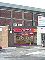 Pizza Hut - New Road Side - geograph.org.uk - 1601450.jpg 480 × 640; 76 KB
-
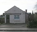
 Trinity Church Hall - New Road Side - geograph.org.uk - 686846.jpg 640 × 444; 54 KB
-

-
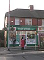
 Rawdon Surgery - New Road Side - geograph.org.uk - 686834.jpg 640 × 393; 44 KB
-
 Sophie's Choice - New Road Side - geograph.org.uk - 1600556.jpg 430 × 640; 60 KB
-
 Suburban Style Bar - New Road Side - geograph.org.uk - 1600570.jpg 640 × 540; 96 KB
-
 The Airport Flyer on New Road Side (geograph 6753228).jpg 1,024 × 768; 228 KB
-

-
 New Road Side by the Horsforth Club - geograph.org.uk - 152514.jpg 640 × 480; 218 KB
-
 New Road Side, Horsforth - geograph.org.uk - 100642.jpg 640 × 480; 78 KB
-
 New Road Side, Horsforth - geograph.org.uk - 130082.jpg 640 × 480; 96 KB
-
 New Road Side, Horsforth - geograph.org.uk - 130098.jpg 480 × 640; 74 KB
-
 New Road Side, Horsforth - geograph.org.uk - 152516.jpg 640 × 480; 250 KB
-
 New Road Side, Horsforth - geograph.org.uk - 152519.jpg 640 × 480; 273 KB
-
 New Road Side, Horsforth - geograph.org.uk - 310046.jpg 640 × 480; 90 KB
-
 New Road Side, Horsforth Leeds - geograph.org.uk - 100637.jpg 640 × 480; 90 KB


.jpg)


.jpg)
.jpg)

.jpg)
.jpg)
.jpg)
.jpg)


.jpg)
.jpg)


.jpg)
.jpg)


.jpg)


