Category:New River (London)
Jump to navigation
Jump to search
artificial waterway built to supply water to London, England | |||||
| Upload media | |||||
| Instance of | |||||
|---|---|---|---|---|---|
| Location |
| ||||
| Commissioned by |
| ||||
| Operator |
| ||||
 | |||||
The New River is an artificial waterway in England, opened in 1613 to supply London with fresh drinking water taken from the River Lea and and other springs and wells along its course. It starts between Ware and Hertford in Hertfordshire and today travels 20 miles (32 km) to Stoke Newington in London.
Subcategories
This category has the following 4 subcategories, out of 4 total.
Media in category "New River (London)"
The following 17 files are in this category, out of 17 total.
-
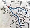
Flash-Lane-aqueduct--info-board--1.jpg 342 × 341; 77 KB
-
Flash-Lane-aqueduct--info-board--2.jpg 367 × 335; 99 KB
-
GOC Ally Pally to Kings Cross 034 New River (39026202185).jpg 4,608 × 3,456; 4.97 MB
-
GOC Ally Pally to Kings Cross 038 New River (39026206805).jpg 4,608 × 3,456; 5.08 MB
-
GOC Ally Pally to Kings Cross 042 New River (39231791234).jpg 4,608 × 3,456; 4.71 MB
-
GOC Ally Pally to Kings Cross 044 New River (39231794204).jpg 4,608 × 3,456; 5.41 MB
-
GOC Ally Pally to Kings Cross 077 New River (39273113684).jpg 4,608 × 3,456; 5.19 MB
-
GOC Ally Pally to Kings Cross 096 New River Walk (40083901941).jpg 4,608 × 3,456; 5.37 MB
-
GOC Ally Pally to Kings Cross 099 Touch the rainbow (39307735625).jpg 4,229 × 3,178; 3.88 MB
-
New River Loop 01.jpg 4,160 × 3,120; 3.65 MB
-
New River Loop 02.jpg 2,400 × 1,800; 2.36 MB
-
New River Loop 03.jpg 2,400 × 1,800; 2.89 MB
-
New River Loop 04.jpg 4,288 × 3,216; 3.6 MB
-
New River Water.jpg 600 × 901; 552 KB
-
New River, London N21 - geograph.org.uk - 302421.jpg 640 × 479; 136 KB
-
New River, London N21 - geograph.org.uk - 302429.jpg 640 × 475; 132 KB
-
Survey of the Roads and Foot paths in the Parish of Islington.jpg 3,666 × 5,702; 3.28 MB


