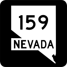
Category:Nevada State Route 159
Jump to navigation
Jump to search
 | number: | (one hundred fifty-nine) |
|---|---|---|
| State highways in Nevada: | 140 · 146 · 147 · 156 · 157 · 158 · 159 · 160 · 161 · 163 · 164 · 165 · 168 · 169 · 170 · 171 · 172 · 173 |
state highway in Clark County, Nevada, United States | |||||
| Upload media | |||||
| Instance of | |||||
|---|---|---|---|---|---|
| Location | Clark County, Nevada | ||||
| Transport network | |||||
| Owned by | |||||
| Maintained by | |||||
| Start time |
| ||||
| Inception |
| ||||
| Length |
| ||||
| Terminus | |||||
| |||||
English: Media related to Nevada State Route 159, a 31.204-mile (50.218 km) state highway in Clark County, Nevada, United States, that connects Nevate State Route 160 on the eastern edge of Blue Diamond with Nevada State Route 612 (Nellis Boulevard on the border of Las Vegas and Sunrise Manor.
Subcategories
This category has only the following subcategory.
Media in category "Nevada State Route 159"
The following 15 files are in this category, out of 15 total.
-
Blue Diamond Nevada 2.jpg 2,400 × 1,600; 765 KB
-
Las Vegas Charleston Blvd 1.jpg 1,800 × 2,400; 803 KB
-
Nevada 159 map.svg 1,011 × 395; 577 KB
-
Nevada 159.svg 600 × 600; 12 KB
-
Red Rock Canyon and clouds 1.jpg 2,000 × 1,333; 429 KB
-
Red Rock Canyon from Turtlehead 1.jpg 2,400 × 1,600; 888 KB
-
Red Rock Canyon National Conservation Area, Near Las Vegas, Nevada (17577798643).jpg 4,000 × 3,000; 2.93 MB
-
Red Rock Canyon National Conservation Area, Near Las Vegas, Nevada (17577814693).jpg 4,000 × 3,000; 2.98 MB
-
Red Rock Canyon road sign.jpg 4,173 × 2,475; 8.09 MB
-
Red Rock Canyon Scenic Fire 1.jpg 2,400 × 1,600; 751 KB
-
Red Rock Canyon Scenic Fire 2.jpg 2,400 × 1,713; 1.09 MB
-
Red Rock Canyon Scenic Fire 3.jpg 2,400 × 1,800; 1.1 MB
-
Red Rock NCA.jpg 2,048 × 1,536; 716 KB


